Download
Preview
Add to list
More
7.1 km
~1 hrs 52 min
281 m
Loop
“Embark on a scenic 7 km loop from Weiler im Allgäu, blending natural beauty and historical intrigue.”
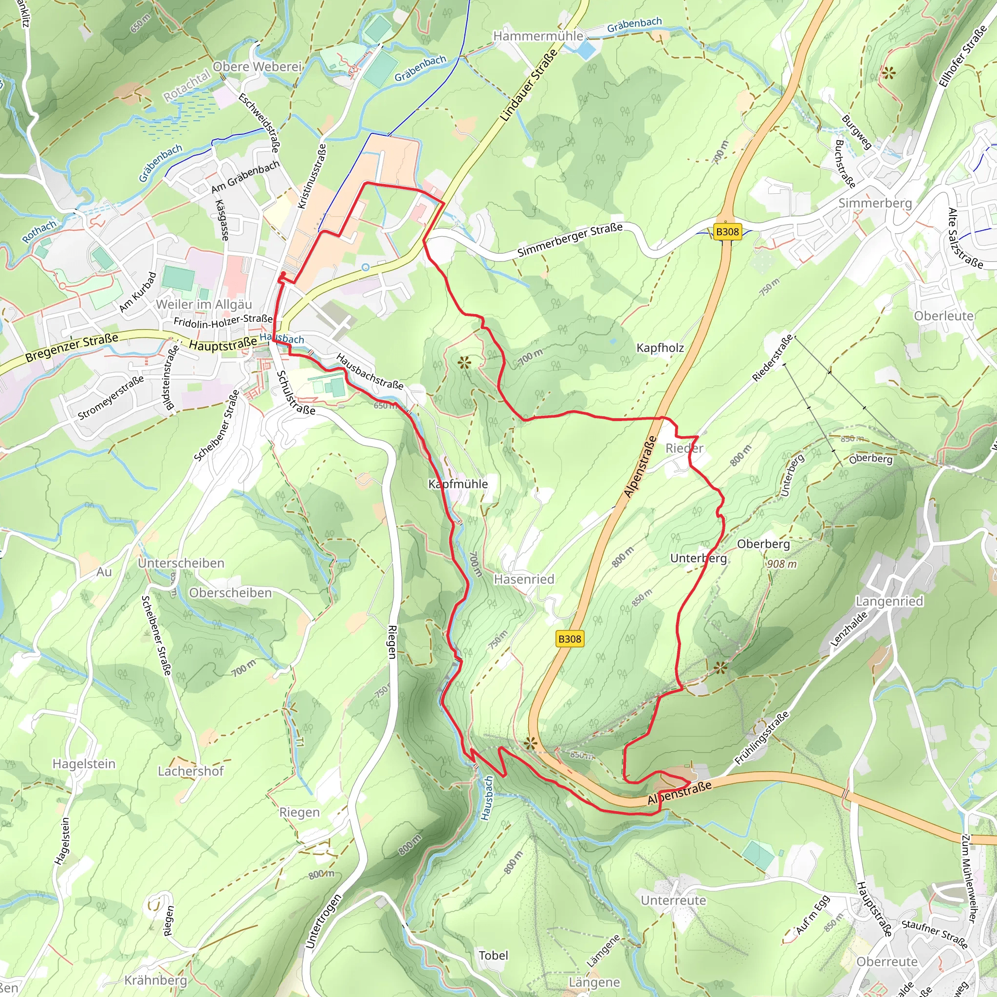
Starting near Lindau, Germany, the Weiler im Allgäu to Hasenried Loop via Hausbachklamm is a picturesque 7 km (4.3 miles) loop trail with an elevation gain of approximately 200 meters (656 feet). This medium-difficulty trail offers a blend of natural beauty, historical significance, and a touch of adventure, making it a rewarding experience for hikers.### Getting There To reach the trailhead, you can either drive or use public transport. If driving, head towards Weiler im Allgäu, which is easily accessible from Lindau. Parking is available near the trailhead. For those using public transport, take a train to Lindau and then a local bus to Weiler im Allgäu. The nearest significant landmark to the trailhead is the Weiler im Allgäu town center.### Trail Overview The trail begins in the charming town of Weiler im Allgäu, known for its traditional Bavarian architecture and friendly locals. As you set off, you'll quickly find yourself immersed in the lush greenery of the Allgäu region.### Hausbachklamm Gorge One of the trail's highlights is the Hausbachklamm Gorge, located approximately 2 km (1.2 miles) from the start. This section features wooden walkways and bridges that allow you to traverse the gorge safely while enjoying the stunning views of cascading waterfalls and rugged rock formations. The sound of rushing water and the cool, misty air provide a refreshing break from the hike.### Flora and Fauna As you continue, the trail meanders through dense forests and open meadows, offering a diverse range of flora and fauna. Keep an eye out for native wildlife such as deer, foxes, and various bird species. The wildflowers in spring and summer add a splash of color to the landscape, making it a photographer's paradise.### Historical Significance The region around Weiler im Allgäu has a rich history dating back to medieval times. Along the trail, you'll come across several historical markers and ruins, including remnants of old farmhouses and mills. These sites offer a glimpse into the area's past and are perfect spots for a brief rest and some exploration.### Hasenried Around the 5 km (3.1 miles) mark, you'll reach Hasenried, a small hamlet that serves as a peaceful midpoint of the loop. Here, you can take a break and enjoy the serene countryside views. The elevation gain is more noticeable in this section, but the well-maintained path ensures a manageable ascent.### Navigation For navigation, it's highly recommended to use the HiiKER app, which provides detailed maps and real-time updates to keep you on track. The trail is well-marked, but having a reliable navigation tool can enhance your hiking experience.### Return to Weiler im Allgäu The final stretch of the trail leads you back to Weiler im Allgäu, completing the loop. This section is relatively flat and offers a gentle descent, allowing you to relax and reflect on the journey. As you approach the town, you'll be greeted by the sight of traditional Bavarian houses and the welcoming atmosphere of Weiler im Allgäu.This trail offers a perfect blend of natural beauty, historical intrigue, and moderate physical challenge, making it an ideal choice for hikers looking to explore the Allgäu region.
What to expect?
Activity types
Comments and Reviews
User comments, reviews and discussions about the Weiler im Allgäu to Hasenried Loop via Hausbachklamm, Germany.
4.57
average rating out of 5
7 rating(s)

