Download
Preview
Add to list
More
14.0 km
~3 hrs 4 min
161 m
Loop
“Embark on a captivating 14 km loop from Lichtenfels, blending Bavarian beauty, history, and moderate challenge.”
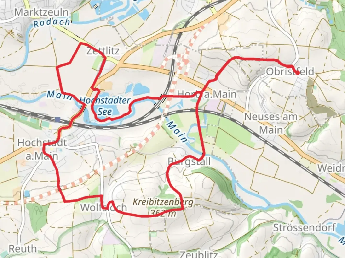
Starting near the picturesque town of Lichtenfels, Germany, the Hochstadter See via Hochstadter Rundweg is a delightful 14 km (8.7 miles) loop trail that offers a moderate challenge with an elevation gain of around 100 meters (328 feet). This trail is perfect for those looking to immerse themselves in the serene beauty of the Bavarian countryside.
Getting There To reach the trailhead, you can either drive or use public transport. If driving, set your GPS to Lichtenfels, and you will find ample parking near the town center. For those using public transport, take a train to Lichtenfels Bahnhof (Lichtenfels Train Station), which is well-connected to major cities like Bamberg and Coburg. From the station, it's a short walk to the trailhead.
Trail Overview The trail begins near the town center of Lichtenfels, leading you through a mix of forested areas, open meadows, and charming rural landscapes. The initial part of the trail is relatively flat, making it an excellent warm-up as you head towards the first significant landmark, the Hochstadter See.
Hochstadter See Approximately 5 km (3.1 miles) into the hike, you will reach Hochstadter See, a tranquil lake surrounded by lush greenery. This is a great spot to take a break, enjoy a picnic, or simply soak in the natural beauty. The lake is home to various bird species, so keep your binoculars handy for some birdwatching.
Historical Significance As you continue along the trail, you will pass through areas rich in history. The region around Lichtenfels has been inhabited since the Middle Ages, and you may come across remnants of old farmhouses and stone walls that tell the story of its agricultural past. The town of Lichtenfels itself is known for its basket-weaving tradition, which dates back several centuries.
Flora and Fauna The trail offers a diverse range of flora and fauna. In the spring and summer months, the meadows are adorned with wildflowers, while the forested sections provide a cool, shaded respite. Wildlife enthusiasts might spot deer, foxes, and a variety of bird species along the way.
Navigation While the trail is well-marked, it's always a good idea to have a reliable navigation tool. The HiiKER app is highly recommended for this trail, offering detailed maps and real-time updates to ensure you stay on the right path.
Final Stretch The last few kilometers of the trail take you through more open fields and gently rolling hills before looping back towards Lichtenfels. The elevation gain is gradual, making it manageable for most hikers. As you approach the end of the trail, you'll have stunning views of the surrounding countryside, providing a perfect end to your hike.
This trail offers a wonderful blend of natural beauty, historical intrigue, and moderate physical challenge, making it a must-visit for any hiking enthusiast exploring the Bavarian region.

Comments and Reviews
User comments, reviews and discussions about the Hochstadter See via Hochstadter Rundweg, Germany.
4.0
average rating out of 5
1 rating(s)