Download
Preview
Add to list
More
9.0 km
~1 hrs 57 min
93 m
Point-to-Point
“Explore lush fields and historic landmarks on this accessible 9 km trail near Lichtenfels, Germany.”
Starting near the picturesque town of Lichtenfels in Germany, this 9 km (approximately 5.6 miles) point-to-point trail offers a delightful hiking experience with virtually no elevation gain, making it accessible for a wide range of hikers. The trail is estimated to be of medium difficulty, primarily due to its length rather than any challenging terrain.
Getting There To reach the trailhead, you can either drive or use public transport. If driving, head towards Lichtenfels, where ample parking is available near the starting point. For those using public transport, Lichtenfels is well-connected by train, and from the Lichtenfels Bahnhof (train station), you can take a local bus or taxi to the trailhead.
Trail Overview The trail begins near Lichtenfels and meanders through the serene Franconian countryside. As you set off, you'll be greeted by lush green fields and gentle rolling hills. The path is well-marked and maintained, making navigation straightforward. For those who prefer digital navigation, the HiiKER app is an excellent tool to ensure you stay on track.
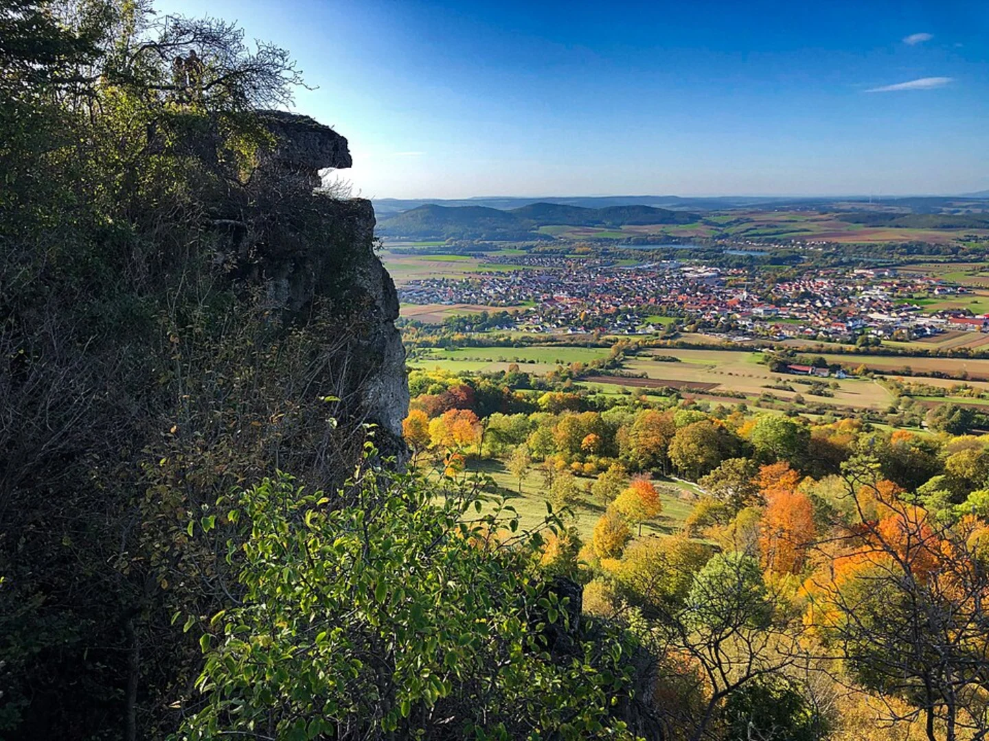
Landmarks and Points of Interest Around the 2 km (1.2 miles) mark, you'll come across the charming village of Bad Staffelstein. This area is known for its historical significance, particularly the Staffelberg, a prominent hill that has been a site of human settlement since prehistoric times. Although the trail itself does not ascend the Staffelberg, the hill is visible from various points along the route, offering a scenic backdrop.
Continuing on, the trail passes through a mix of open fields and wooded areas. The diversity in landscape provides ample opportunities for wildlife spotting. Keep an eye out for local bird species and small mammals that inhabit the region.
Historical Significance The region around Lichtenfels and Bad Staffelstein is steeped in history. The town of Bad Staffelstein is home to the Basilica of the Fourteen Holy Helpers (Basilika Vierzehnheiligen), a stunning example of Baroque architecture. While the basilica is not directly on the trail, it is worth a short detour if time permits.
Flora and Fauna The trail is rich in natural beauty, with a variety of flora and fauna. Depending on the season, you may encounter wildflowers, dense forests, and agricultural fields. The area is also known for its biodiversity, so be prepared to see a range of plant species and possibly some local wildlife.
Final Stretch As you approach the end of the trail, the landscape opens up, offering expansive views of the surrounding countryside. The trail concludes near the town of End, where you can find local amenities such as cafes and rest areas to relax after your hike.
Practical Tips - **Footwear:** Given the relatively flat terrain, comfortable walking shoes or light hiking boots are recommended. - **Weather:** Check the weather forecast before you set out, as conditions can change rapidly. - **Supplies:** Carry enough water and snacks, especially if you plan to take your time and enjoy the scenery. - **Navigation:** Use the HiiKER app for real-time navigation and updates on the trail.
This trail offers a blend of natural beauty, historical landmarks, and a peaceful hiking experience, making it a rewarding journey for those who embark on it.

What to expect?
Activity types
Comments and Reviews
User comments, reviews and discussions about the Bad Staffelstein to End Walk, Germany.
4.5
average rating out of 5
8 rating(s)