Brochterbeck and Bismarckturm Loop via Teutoschleife Tecklenburger Bergpfad
Download
Preview
Add to list
More
10.3 km
~2 hrs 26 min
225 m
Loop
“The Brochterbeck and Bismarckturm Loop offers a scenic, moderately challenging 10 km hike through lush forests and historic landmarks.”
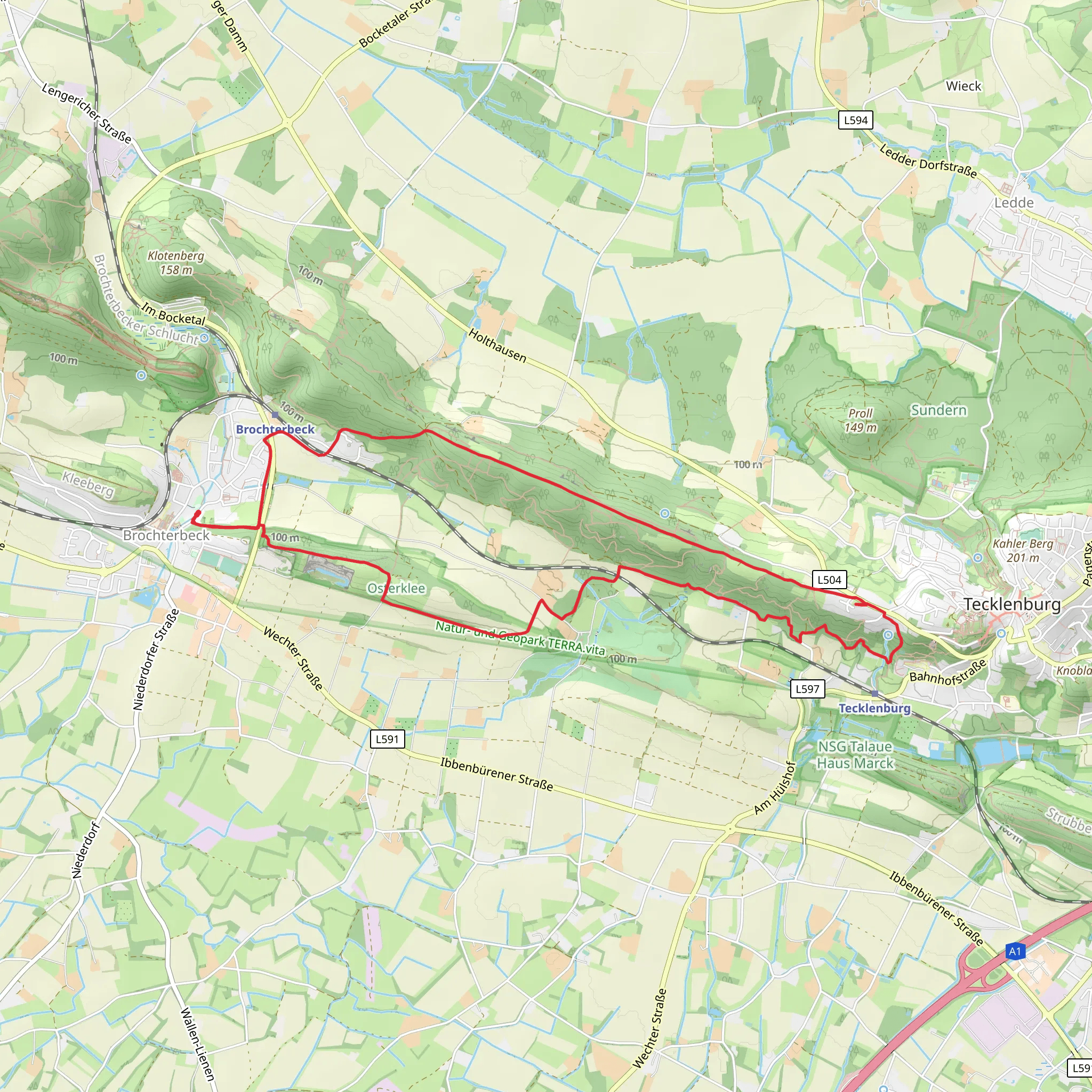
Starting near Kreis Steinfurt in Germany, the Brochterbeck and Bismarckturm Loop via Teutoschleife Tecklenburger Bergpfad offers a scenic and moderately challenging hike. This 10 km (approximately 6.2 miles) loop trail features an elevation gain of around 200 meters (656 feet), making it suitable for hikers with a moderate level of fitness.
Getting There To reach the trailhead, you can either drive or use public transport. If driving, set your GPS to Kreis Steinfurt, Germany, and look for parking options near the trailhead. For those using public transport, take a train or bus to the nearest station in Tecklenburg, and from there, you can either walk or take a local bus to the starting point.
Trail Highlights The trail begins with a gentle ascent through lush forests, offering a serene start to your hike. As you progress, you'll encounter a mix of deciduous and coniferous trees, providing a rich tapestry of greenery. Keep an eye out for local wildlife, including deer and various bird species.
#### Brochterbeck Around the 3 km (1.9 miles) mark, you'll reach the charming village of Brochterbeck. This quaint settlement is known for its traditional German architecture and offers a perfect spot for a short break. You can explore the local church and enjoy the peaceful ambiance before continuing your hike.
#### Teutoschleife Tecklenburger Bergpfad As you leave Brochterbeck, the trail begins to climb more steeply. This section, known as the Teutoschleife Tecklenburger Bergpfad, is the most challenging part of the hike. The path winds through dense forest and rocky outcrops, offering stunning views of the surrounding landscape. The elevation gain here is about 100 meters (328 feet) over a distance of 2 km (1.2 miles).
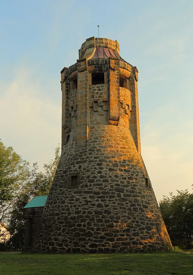
#### Bismarckturm At approximately 7 km (4.3 miles), you'll reach the Bismarckturm, a historic tower built in honor of Otto von Bismarck. The tower stands at 18 meters (59 feet) tall and offers panoramic views of the Teutoburg Forest and the Münsterland region. It's a great spot for photos and a well-deserved rest.
Final Stretch The final 3 km (1.9 miles) of the trail take you through rolling hills and open meadows, gradually descending back towards the starting point. This section is less strenuous and allows you to enjoy the natural beauty of the area at a more relaxed pace.
Navigation and Safety For navigation, it's recommended to use the HiiKER app, which provides detailed maps and real-time updates. The trail is well-marked, but having a reliable navigation tool ensures you stay on track. Be sure to wear sturdy hiking boots, carry enough water, and pack a small first-aid kit.
Historical Significance The region around Kreis Steinfurt has a rich history, with the Bismarckturm being a notable landmark. Built in the early 20th century, the tower commemorates Otto von Bismarck, the first Chancellor of the German Empire. The surrounding Teutoburg Forest is also historically significant, known for the Battle of the Teutoburg Forest in 9 AD, where Germanic tribes ambushed and defeated Roman legions.
This hike offers a blend of natural beauty, moderate physical challenge, and historical intrigue, making it a rewarding experience for any outdoor enthusiast.
What to expect?
Activity types
Comments and Reviews
User comments, reviews and discussions about the Brochterbeck and Bismarckturm Loop via Teutoschleife Tecklenburger Bergpfad, Germany.
4.5
average rating out of 5
6 rating(s)
