Download
Preview
Add to list
More
13.7 km
~2 hrs 51 min
71 m
Loop
“Discover the scenic and accessible 14 km Gillrath Loop, rich in natural beauty and historical landmarks.”
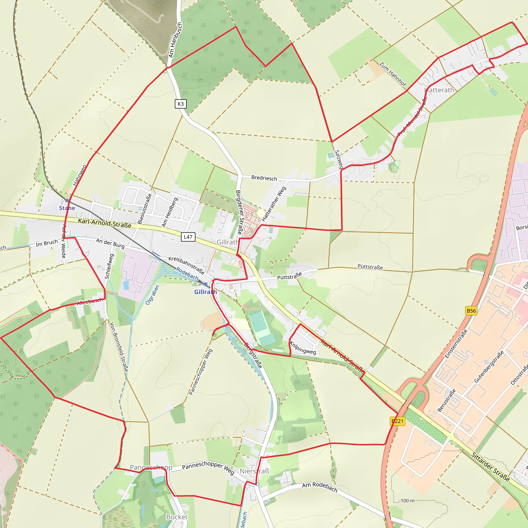
Starting near Kreis Heinsberg, Germany, the Gillrath Loop is a delightful 14 km (approximately 8.7 miles) trail with virtually no elevation gain, making it an accessible yet engaging hike for those looking to explore the region. The trailhead is conveniently located near the town of Gillrath, which can be reached by car or public transport. If you're driving, you can park near the Gillrath Church, a notable landmark in the area. For those using public transport, the nearest train station is in Geilenkirchen, from where you can take a local bus to Gillrath.### Trail OverviewThe Gillrath Loop is a medium-difficulty trail that offers a mix of natural beauty and cultural landmarks. The flat terrain makes it suitable for hikers of various skill levels, though the distance requires a moderate level of fitness. The trail is well-marked, but it's always a good idea to have a navigation tool like HiiKER to ensure you stay on track.### Key Landmarks and Points of Interest#### Gillrath Church Starting your hike near the Gillrath Church, you'll immediately notice the historical significance of this area. The church itself is a beautiful example of local architecture and serves as a great starting point for your journey.#### Nature and Wildlife As you venture further, you'll traverse through a variety of landscapes, including open fields, dense woodlands, and serene riversides. The area is home to a diverse range of wildlife, including deer, foxes, and numerous bird species. Keep your eyes peeled for the European Goldfinch, a colorful bird often spotted in this region.#### Historical Significance The region around Kreis Heinsberg has a rich history dating back to Roman times. While the trail itself doesn't pass through any major historical ruins, the surrounding area is steeped in history. The nearby town of Geilenkirchen, for instance, has several historical buildings and museums that are worth a visit if you have extra time.### Trail Navigation and SafetyThe Gillrath Loop is well-marked with signs at regular intervals, but it's always wise to have a reliable navigation tool like HiiKER. The trail is mostly flat, with an elevation gain of around 0 meters, making it easy to navigate. However, the distance of 14 km (8.7 miles) means you'll need to be prepared with enough water and snacks to keep your energy levels up.### Getting ThereBy Car: If you're driving, set your GPS to Gillrath Church, Kreis Heinsberg. There is ample parking available near the church, making it a convenient starting point.By Public Transport: For those relying on public transport, take a train to Geilenkirchen Station. From there, local buses can take you to Gillrath. The bus ride is short and offers a glimpse of the beautiful countryside you'll soon be exploring on foot.### Final Tips- Weather: Check the weather forecast before you set out. The trail can be muddy after rain, so waterproof footwear is recommended. - Supplies: Bring enough water and snacks for the journey. There are no facilities along the trail, so you'll need to be self-sufficient. - Wildlife: While the wildlife is generally harmless, it's always a good idea to keep a respectful distance from any animals you encounter.The Gillrath Loop offers a wonderful blend of natural beauty and cultural history, making it a rewarding hike for anyone looking to explore the scenic landscapes of Kreis Heinsberg.
What to expect?
Activity types
Comments and Reviews
User comments, reviews and discussions about the Gillrath Loop, Germany.
4.0
average rating out of 5
2 rating(s)

