Download
Preview
Add to list
More
7.3 km
~2 hrs 2 min
357 m
Loop
“This 7 km loop in Kreis Bergstraße blends stunning nature, historical intrigue, and moderate hiking challenge.”
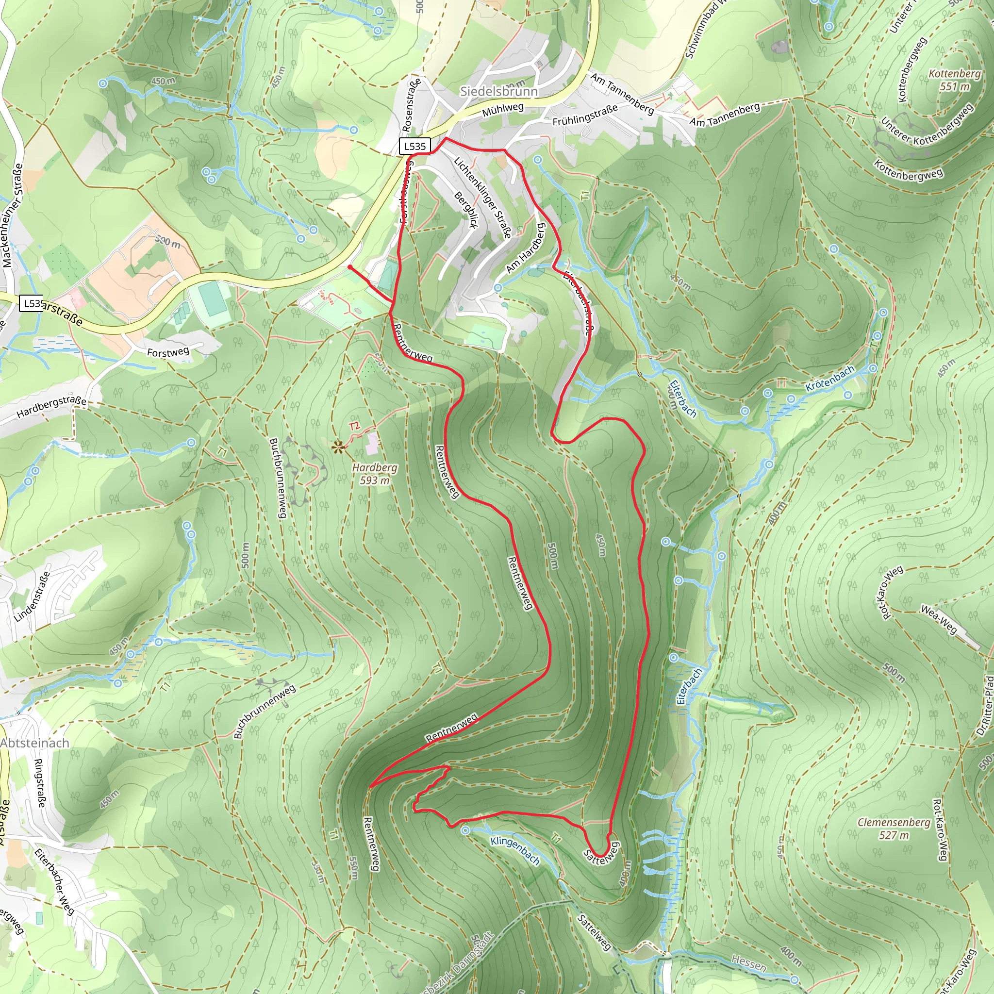
Starting near Kreis Bergstraße in Germany, this 7 km (4.35 miles) loop trail offers a delightful mix of natural beauty and historical intrigue. With an elevation gain of approximately 300 meters (984 feet), the trail is rated as medium difficulty, making it suitable for moderately experienced hikers.### Getting There To reach the trailhead, you can either drive or use public transport. If driving, set your GPS to the nearest known address: "Kreis Bergstraße, Germany." For those using public transport, take a train to the Heppenheim (Bergstraße) station. From there, you can catch a local bus or taxi to the trailhead.### Trail Overview The trail begins with a gentle ascent through a lush forest, where you'll be greeted by the sounds of chirping birds and rustling leaves. The initial 1 km (0.62 miles) is relatively easy, allowing you to warm up before the more challenging sections.### Significant Landmarks Around the 2 km (1.24 miles) mark, you'll come across the Stiefelhütten, a charming hut that offers a perfect spot for a short break. This area is rich in history, with the hut originally serving as a shelter for local shepherds. Take a moment to appreciate the rustic architecture and perhaps snap a few photos.Continuing on, you'll encounter the Lichtenklinger Weg, a path that winds through a picturesque valley. This section is particularly scenic, with wildflowers dotting the landscape and occasional glimpses of local wildlife such as deer and foxes. The trail here is well-marked, but it's always a good idea to have the HiiKER app handy for navigation.### Elevation and Terrain As you approach the 4 km (2.48 miles) point, the trail begins to climb more steeply, gaining about 150 meters (492 feet) in elevation over the next kilometer. This section can be a bit strenuous, so take your time and enjoy the panoramic views of the surrounding hills and valleys.### Historical Significance The region around Kreis Bergstraße is steeped in history, dating back to Roman times. As you hike, you'll notice remnants of ancient stone walls and possibly even some old Roman roads. These historical markers add a layer of depth to your hike, making it not just a physical journey but a walk through time.### Wildlife and Flora The trail is home to a diverse range of flora and fauna. Depending on the season, you might see wildflowers like bluebells and daisies, or even spot some rare bird species. Keep an eye out for signs of wildlife, such as deer tracks or the occasional fox darting through the underbrush.### Final Stretch The last 2 km (1.24 miles) of the trail are a gentle descent back to the starting point. This section is relatively easy, allowing you to cool down and reflect on the hike. The path here is wide and well-maintained, making for a pleasant end to your journey.### Practical Tips - Wear sturdy hiking boots, as some sections can be rocky and uneven. - Bring plenty of water and snacks, especially if you plan to take breaks at the Stiefelhütten or along the Lichtenklinger Weg. - Check the weather forecast before you go, as the trail can be slippery after rain. - Use the HiiKER app for real-time navigation and updates on trail conditions.This 7 km loop offers a rewarding mix of natural beauty, historical landmarks, and moderate physical challenge, making it a must-visit for any hiking enthusiast.
Comments and Reviews
User comments, reviews and discussions about the Stiefelhuetten Weg and Lichtenklinger Weg, Germany.
4.0
average rating out of 5
3 rating(s)
