Download
Preview
Add to list
More
14.8 km
~3 hrs 52 min
556 m
Loop
“Embark on a scenic 15 km loop through diverse landscapes and rich history near Ober-Ramstadt, Germany.”
Starting near Kreis Bergstraße in Germany, this 15 km (approximately 9.3 miles) loop trail offers a medium difficulty hike with an elevation gain of around 500 meters (approximately 1,640 feet). The trailhead is easily accessible by car or public transport. If you're driving, you can park near the town of Ober-Ramstadt. For those using public transport, take a train to the Ober-Ramstadt station and then a local bus or taxi to the trailhead.
Trail Overview
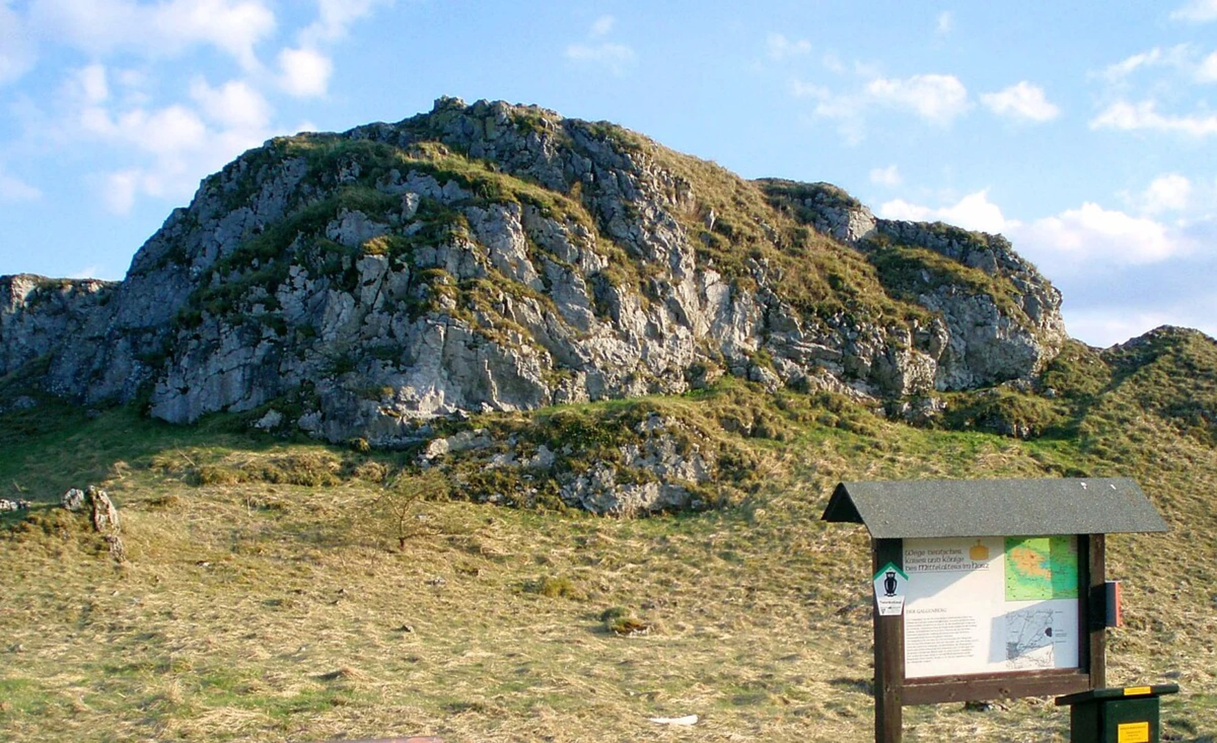
The trail begins with a gentle ascent through mixed forests, providing a serene start to your hike. As you progress, you'll encounter a variety of landscapes, including open meadows and dense woodlands. The first significant landmark is the Galgenberg, a hill that offers panoramic views of the surrounding countryside. This is a great spot for a short break and some photography.
Flora and Fauna
The trail is rich in biodiversity. In the spring and summer months, you'll find a plethora of wildflowers, including orchids and lilies. The forests are home to deer, foxes, and a variety of bird species, making it a great trail for wildlife enthusiasts. Keep an eye out for red kites and buzzards soaring overhead.
Historical Significance
The region has a rich history dating back to medieval times. The name "Galgenberg" translates to "Gallows Hill," hinting at its historical use as a site for public executions. While this may sound grim, it adds a layer of historical intrigue to your hike. The trail also passes by several old farmhouses and mills, some of which date back to the 18th century.
Key Sections
#### Galgenberg Ascent
The ascent to Galgenberg is one of the more challenging parts of the trail, with a steep incline that gains about 200 meters (656 feet) in elevation over a distance of 2 km (1.2 miles). The effort is well worth it for the views at the top.
#### Ober Ramstadt Wiesenbach
After descending from Galgenberg, the trail leads you through the picturesque Wiesenbach valley. This section is relatively flat and offers a peaceful walk along the Wiesenbach stream. The valley is particularly beautiful in the autumn when the leaves change color.
Navigation and Safety
For navigation, it's highly recommended to use the HiiKER app, which provides detailed maps and real-time GPS tracking. The trail is well-marked, but having a reliable navigation tool will ensure you stay on track.
Getting There
To reach the trailhead, you can drive to Ober-Ramstadt and park near the town center. If you're using public transport, take a train to the Ober-Ramstadt station. From there, local buses or taxis can take you to the starting point of the trail. The nearest significant landmark to the trailhead is the Ober-Ramstadt Town Hall, located at Nieder-Ramstädter Str. 2, 64372 Ober-Ramstadt, Germany.
Final Tips
Wear sturdy hiking boots, as some sections of the trail can be rocky and uneven. Bring plenty of water and snacks, especially if you plan to take your time exploring the various landmarks and natural features. The trail can be hiked year-round, but the best times to visit are in the spring and autumn when the weather is mild and the scenery is at its most vibrant.

What to expect?
Activity types
Comments and Reviews
User comments, reviews and discussions about the Galgenberg Weg and Ober Ramstadt Wiesenbach, Germany.
4.67
average rating out of 5
3 rating(s)