Download
Preview
Add to list
More
8.9 km
~2 hrs 12 min
262 m
Loop
“The Rundweg Essing 25 is a picturesque 9 km loop trail rich in natural beauty and historical significance.”
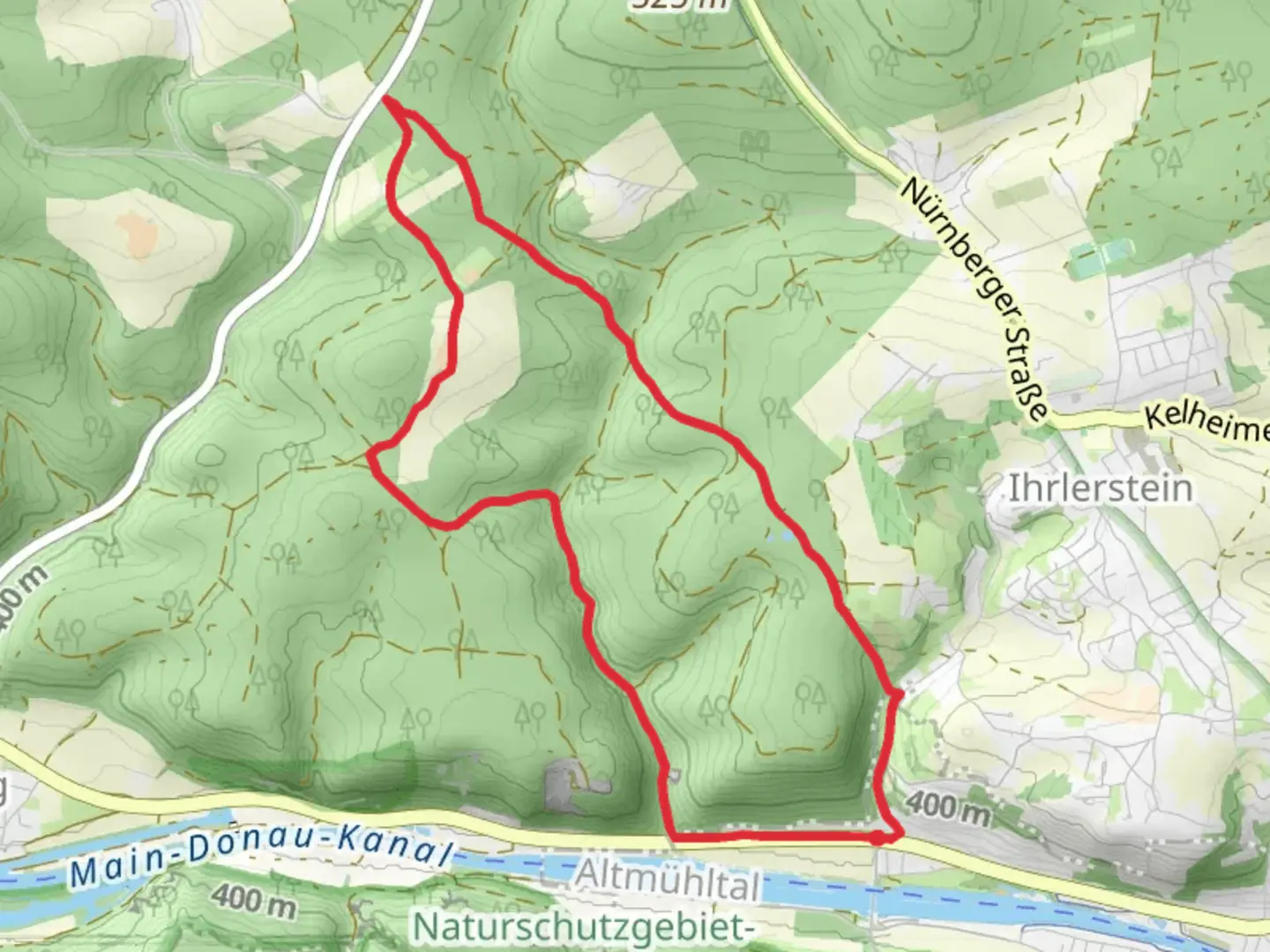
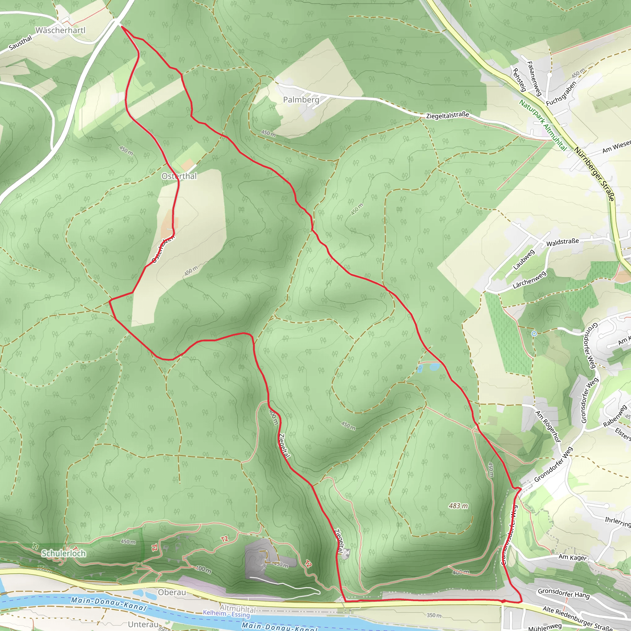
Starting near the charming town of Kelheim, Germany, the Rundweg Essing 25 is a delightful 9 km (5.6 miles) loop trail that offers a moderate challenge with an elevation gain of around 200 meters (656 feet). This trail is perfect for those looking to immerse themselves in the natural beauty and historical richness of the Bavarian region.
Getting There To reach the trailhead, you can either drive or use public transportation. If driving, head towards Kelheim and look for parking near the town center or at designated trailhead parking areas. For those using public transport, take a train to Kelheim and then a local bus to Essing. The nearest significant landmark to the trailhead is the Essing Bridge, a picturesque wooden bridge that spans the Altmühl River.
Trail Overview The Rundweg Essing 25 begins near the Essing Bridge, a perfect spot to start your adventure. As you set off, you'll immediately notice the lush greenery and the serene ambiance of the Altmühl Valley. The trail is well-marked, but it's always a good idea to have the HiiKER app handy for navigation.
Key Landmarks and Sections
#### Altmühl River and Essing Bridge At the start, you'll cross the Essing Bridge, which offers stunning views of the Altmühl River. This bridge is not only a beautiful architectural piece but also a significant historical landmark, dating back to medieval times.
#### Climb to the Randeck Castle Ruins Approximately 2 km (1.2 miles) into the hike, you'll begin a gradual ascent towards the Randeck Castle ruins. This section involves an elevation gain of about 100 meters (328 feet). The ruins are perched on a hill, providing panoramic views of the surrounding valley. The castle dates back to the 12th century and offers a glimpse into the region's medieval past.
#### Forested Pathways and Limestone Cliffs Continuing along the trail, you'll traverse through dense forests and pass by impressive limestone cliffs. This section is particularly scenic, with the towering cliffs providing a dramatic backdrop to the lush forest. Keep an eye out for local wildlife, including deer and various bird species.
#### Panoramic Views from the Hohenpfahl Around the 6 km (3.7 miles) mark, you'll reach the Hohenpfahl, a high vantage point offering breathtaking views of the Altmühl Valley. This is an excellent spot for a rest and some photography. The elevation gain to this point is around 150 meters (492 feet).
#### Descent Back to Essing The final section of the trail involves a gentle descent back towards Essing. As you make your way down, you'll pass through more forested areas and open meadows, eventually looping back to the starting point near the Essing Bridge.
Historical Significance The region around Kelheim and Essing is steeped in history. The Altmühl Valley has been inhabited since prehistoric times, and the trail itself passes by several historical landmarks, including the Randeck Castle ruins. The area was also significant during the Roman era, with remnants of Roman roads and settlements still visible in some parts.
Preparation and Tips Given the moderate difficulty of the trail, it's advisable to wear sturdy hiking boots and bring plenty of water, especially during warmer months. The trail is well-maintained, but sections can be slippery after rain, so take care. Using the HiiKER app will ensure you stay on track and can easily find points of interest along the way.
Whether you're a history buff, a nature lover, or simply looking for a scenic hike, the Rundweg Essing 25 offers a rewarding experience with its blend of natural beauty and historical intrigue.
Comments and Reviews
User comments, reviews and discussions about the Rundweg Essing 25, Germany.
4.0
average rating out of 5
1 rating(s)
