Download
Preview
Add to list
More
11.5 km
~2 hrs 52 min
343 m
Loop
“Explore Karlsruhe’s scenic 12 km loop with diverse landscapes, rich history, and abundant wildlife.”
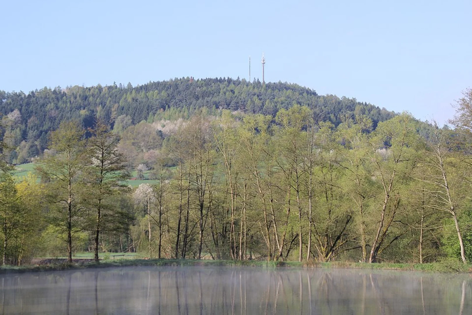
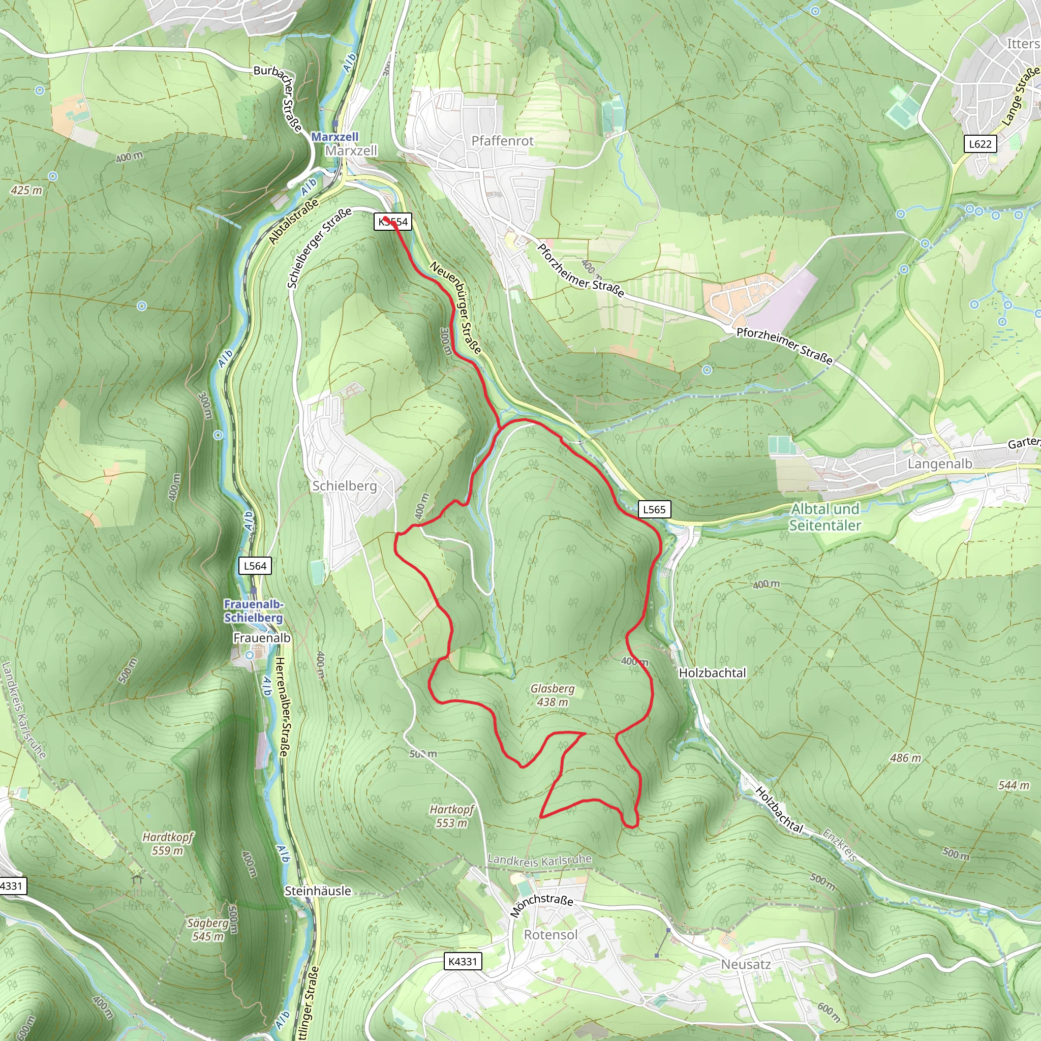
Starting near Karlsruhe, Germany, the Talweg, Schlotterhofweg, and Kriegsweg Loop is a captivating 12 km (7.5 miles) loop trail with an elevation gain of approximately 300 meters (984 feet). This medium-difficulty trail offers a blend of natural beauty, historical landmarks, and diverse wildlife, making it a rewarding experience for hikers.
Getting There To reach the trailhead, you can either drive or use public transport. If driving, head towards the town of Durlach, which is a district of Karlsruhe. The nearest significant landmark is the Turmberg, a hill that offers panoramic views of the surrounding area. For those using public transport, take the S-Bahn to Durlach station. From there, it's a short bus ride or a 20-minute walk to the trailhead near Turmberg.
Trail Overview The trail begins near the Turmberg, a historic site with a medieval tower that dates back to the 11th century. From here, the path meanders through dense forests and open meadows, offering a variety of landscapes. The initial section of the trail, known as Talweg, is relatively flat and easy, making it a good warm-up for the more challenging sections ahead.
Key Sections and Landmarks
#### Talweg The Talweg section is approximately 4 km (2.5 miles) long and features gentle inclines. This part of the trail is well-marked and easy to navigate. You'll pass through lush forests, where you might spot deer, foxes, and a variety of bird species. Keep an eye out for the occasional wild boar, especially during the early morning or late evening hours.
#### Schlotterhofweg After completing the Talweg, you'll transition to the Schlotterhofweg section. This part of the trail is about 3 km (1.9 miles) long and includes a moderate climb. The path here is narrower and more rugged, so sturdy hiking boots are recommended. Along this section, you'll encounter several small streams and picturesque wooden bridges. The sound of flowing water adds a serene ambiance to your hike.
#### Kriegsweg The final section, Kriegsweg, is the most challenging part of the loop. Spanning approximately 5 km (3.1 miles), this section includes steep ascents and descents. The trail here is rocky and can be slippery, especially after rain, so caution is advised. Historically, this path was used during various conflicts, including the Thirty Years' War, adding a layer of historical significance to your hike. You'll also come across several old bunkers and fortifications, remnants of World War II.
Navigation and Safety For navigation, it's highly recommended to use the HiiKER app, which provides detailed maps and real-time updates. The trail is generally well-marked, but having a reliable navigation tool will ensure you stay on track.
Flora and Fauna The trail is rich in biodiversity. In spring and summer, the meadows are adorned with wildflowers, including orchids and lilies. The forested areas are home to oak, beech, and pine trees. Wildlife is abundant, with frequent sightings of deer, wild boar, and various bird species. If you're lucky, you might even spot a rare black woodpecker.
Historical Significance The region around Karlsruhe has a rich history. The Turmberg, where the trail begins, was a strategic lookout point during medieval times. The Kriegsweg section of the trail offers a glimpse into the area's more recent history, with remnants from World War II scattered along the path. These historical elements add a unique dimension to your hiking experience.
Final Stretch As you near the end of the loop, the trail descends gently back towards the starting point near Turmberg. This final stretch offers stunning views of the Rhine Valley and the Black Forest in the distance, providing a perfect ending to your hike.
This 12 km loop trail near Karlsruhe offers a balanced mix of natural beauty, historical landmarks, and moderate physical challenge, making it an ideal choice for hikers looking to explore the region.
What to expect?
Activity types
Comments and Reviews
User comments, reviews and discussions about the Talweg, Schlotterhofweg and Kriegsweg Loop, Germany.
4.0
average rating out of 5
2 rating(s)

