Download
Preview
Add to list
More
11.4 km
~3 hrs 11 min
553 m
Point-to-Point
“Journey through the enchanting Black Forest from Marxzell to Dobel, blending history, nature, and moderate challenge.”
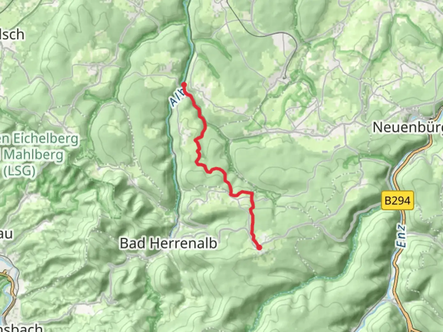
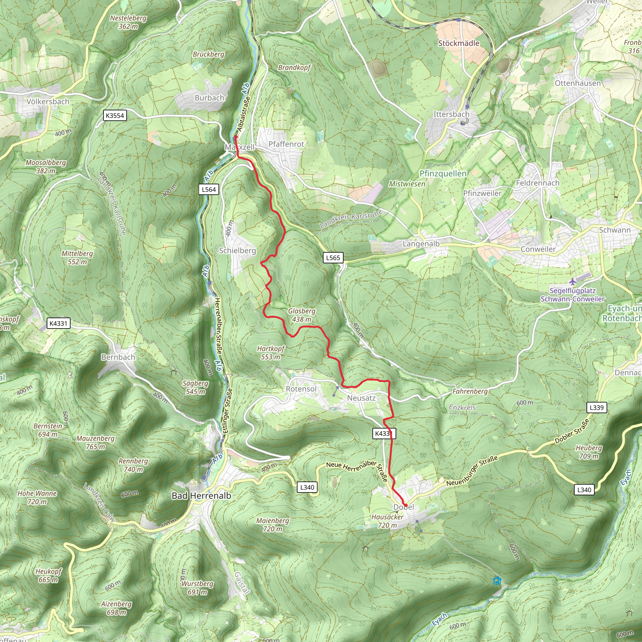
Starting near Karlsruhe, Germany, the trail from Marxzell to Dobel via Hoehenrundweg and Europarundweg offers a captivating journey through the Black Forest. This point-to-point trail spans approximately 11 km (around 7 miles) with an elevation gain of about 500 meters (1,640 feet), making it a moderately challenging hike suitable for those with a reasonable level of fitness.
Getting There To reach the trailhead, you can take a train or bus to the town of Marxzell. From Karlsruhe, the S1 tram line will take you directly to the Marxzell station. If you're driving, you can park near the Marxzell train station, which is conveniently located close to the trail's starting point.
Trail Overview The trail begins in Marxzell, a quaint town known for its historical significance and charming architecture. As you set off, you'll quickly find yourself immersed in the lush greenery of the Black Forest. The initial part of the hike involves a steady ascent, gaining approximately 200 meters (656 feet) in the first 3 km (1.9 miles). This section offers a mix of shaded forest paths and open clearings, providing a variety of scenic views.
Significant Landmarks Around the 4 km (2.5 miles) mark, you'll encounter the first significant landmark: the ruins of Frauenalb Abbey. This former Benedictine monastery, dating back to the 12th century, offers a glimpse into the region's rich history. Take a moment to explore the ruins and enjoy the serene atmosphere before continuing your hike.
Nature and Wildlife As you progress, the trail meanders through dense forests and open meadows, offering opportunities to spot local wildlife such as deer, foxes, and a variety of bird species. The Black Forest is also home to numerous plant species, including the iconic Black Forest spruce and vibrant wildflowers that bloom in the spring and summer months.
Navigation and Terrain The trail is well-marked, but it's always a good idea to have a reliable navigation tool like HiiKER to ensure you stay on track. The terrain varies from well-maintained paths to more rugged sections with roots and rocks, so sturdy hiking boots are recommended.
Elevation Gain and Scenic Views The most challenging part of the hike comes around the 7 km (4.3 miles) mark, where you'll encounter a steeper ascent, gaining another 200 meters (656 feet) over the next 2 km (1.2 miles). This effort is rewarded with panoramic views of the surrounding Black Forest and, on clear days, even distant glimpses of the Rhine Valley.
Final Stretch to Dobel The final 2 km (1.2 miles) of the trail involve a gentle descent into the town of Dobel. This picturesque town is known for its spa facilities and offers a perfect place to relax and unwind after your hike. Dobel is well-connected by public transport, with regular buses and trains back to Karlsruhe.
Historical Significance The region around Marxzell and Dobel has a rich history, with evidence of human settlement dating back to the Roman era. The Black Forest itself has been a source of inspiration for countless legends and fairy tales, adding a mystical element to your hiking experience.
This trail offers a perfect blend of natural beauty, historical landmarks, and moderate physical challenge, making it an ideal choice for hikers looking to explore the enchanting Black Forest region.
Comments and Reviews
User comments, reviews and discussions about the Marxzell to Dobel via Hoehenrundweg and Europarundweg, Germany.
4.33
average rating out of 5
3 rating(s)
