Download
Preview
Add to list
More
8.9 km
~2 hrs 12 min
262 m
Loop
“This 9 km loop trail near Hochtaunuskreis blends serene forests, historical sites, and stunning mountain views.”
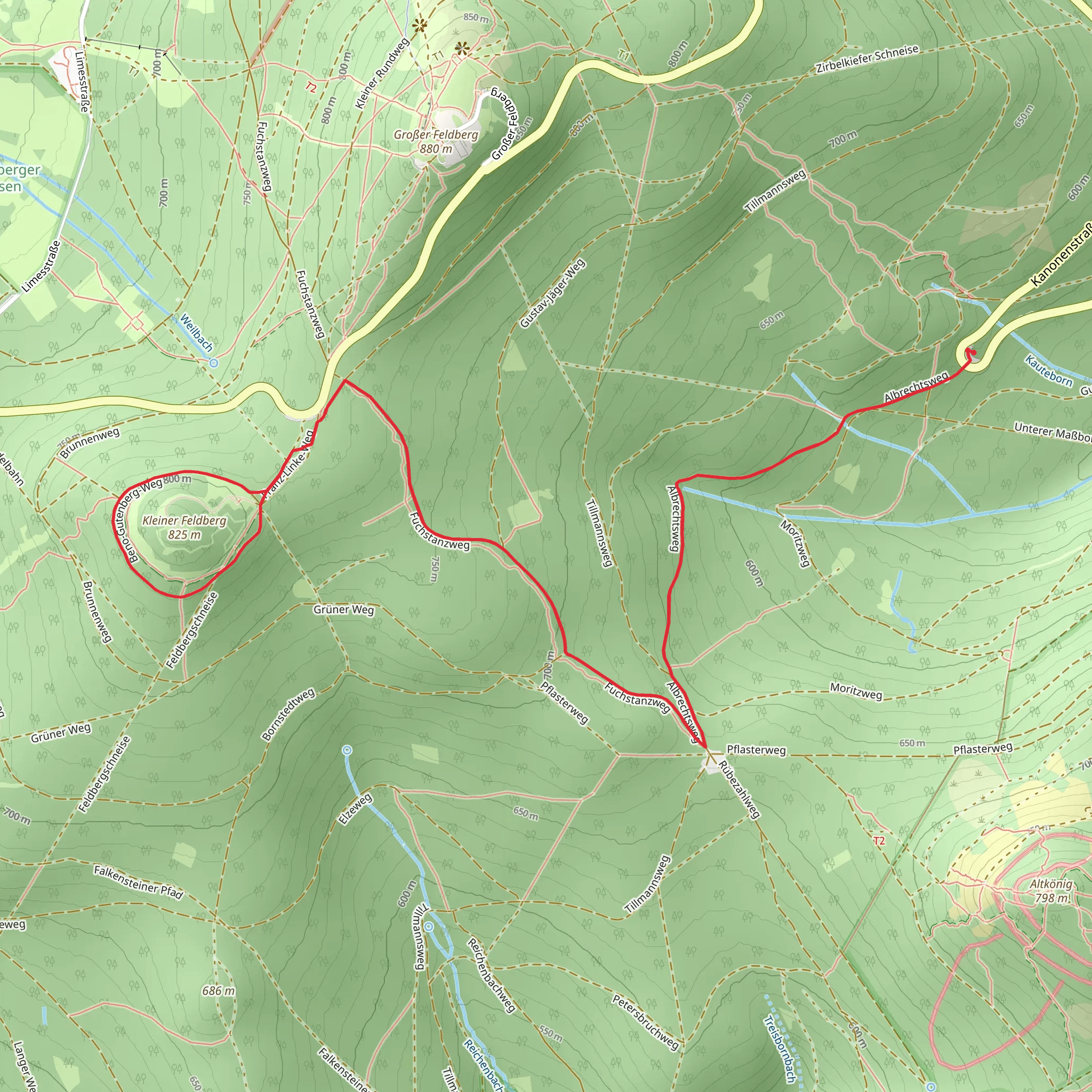
Starting near Hochtaunuskreis, Germany, this 9 km (approximately 5.6 miles) loop trail offers a moderate hiking experience with an elevation gain of around 200 meters (656 feet). The trailhead is conveniently accessible by both public transport and car. If you're using public transport, you can take a train to Bad Homburg station and then a bus to the nearest stop at Saalburg, which is a short walk from the trailhead. For those driving, parking is available near the Saalburg Roman Fort, a significant historical landmark in the area.Trail OverviewThe trail combines three distinct paths: Albrechtsweg, Fuchstanzweg, and Beno-Gutenberg-Weg. As you embark on this loop, you'll traverse through dense forests, open meadows, and historical sites, making it a diverse and enriching hike.Albrechtsweg SectionStarting from the trailhead, the first section of the trail is Albrechtsweg. This part of the trail is relatively flat and winds through a serene forest. The path is well-marked and easy to follow. Keep an eye out for various species of birds and small mammals that inhabit this area. After about 2 km (1.2 miles), you'll begin a gentle ascent, gaining approximately 50 meters (164 feet) in elevation.Fuchstanzweg SectionAs you transition onto Fuchstanzweg, the trail becomes a bit steeper, with an elevation gain of around 100 meters (328 feet) over the next 3 km (1.9 miles). This section offers stunning views of the surrounding Taunus Mountains. The trail here is a mix of dirt paths and rocky terrain, so sturdy hiking boots are recommended. You'll pass by several clearings that provide excellent spots for a short break and some photography.Beno-Gutenberg-Weg SectionThe final section, Beno-Gutenberg-Weg, is named after the famous German seismologist Beno Gutenberg. This part of the trail is relatively easier, with a gradual descent back towards the starting point. Over the last 4 km (2.5 miles), you'll lose about 50 meters (164 feet) in elevation. This section is particularly rich in flora, with various types of wildflowers and ancient trees lining the path.Historical SignificanceOne of the highlights of this trail is its proximity to the Saalburg Roman Fort, a reconstructed Roman fort that dates back to the 2nd century AD. The fort is part of the Upper Germanic-Rhaetian Limes, a UNESCO World Heritage site. It's worth taking some time to explore this historical landmark either before or after your hike.Navigation and SafetyFor navigation, it's highly recommended to use the HiiKER app, which provides detailed maps and real-time updates. The trail is generally well-marked, but having a reliable navigation tool will ensure you stay on track. Always carry enough water, especially during the warmer months, and be prepared for sudden weather changes typical of mountainous regions.This loop trail offers a perfect blend of natural beauty, moderate physical challenge, and historical intrigue, making it a must-visit for hikers in the region.
What to expect?
Activity types
Comments and Reviews
User comments, reviews and discussions about the Albrechtsweg, Fuchstanzweg and Beno-Gutenberg-Weg Loop, Germany.
4.43
average rating out of 5
7 rating(s)

