Download
Preview
Add to list
More
4.7 km
~1 hrs 30 min
335 m
Loop
“Discover Heidelberg's scenic 5-km loop trail, blending historical landmarks, lush forests, and panoramic views.”
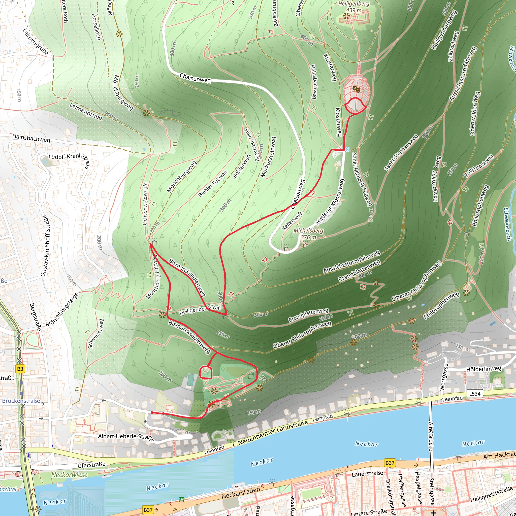
Starting near the picturesque city of Heidelberg, Germany, the Bismarcksäule and Thingstätte via Bismarcksäulenweg is a captivating loop trail that spans approximately 5 kilometers (3.1 miles) with an elevation gain of around 300 meters (984 feet). This medium-difficulty hike offers a blend of historical landmarks, lush forests, and panoramic views, making it a rewarding experience for both novice and seasoned hikers.
Getting There To reach the trailhead, you can either drive or use public transport. If driving, head towards the Philosophenweg area in Heidelberg, where parking is available. For those using public transport, take a bus or tram to the "Heidelberg, Bismarckplatz" stop. From there, it's a short walk to the trailhead.
Trail Highlights
#### Bismarcksäule The first significant landmark you'll encounter is the Bismarcksäule, a tower built in honor of Otto von Bismarck, the first Chancellor of the German Empire. Located approximately 1.5 kilometers (0.93 miles) from the trailhead, the tower offers stunning views of the Neckar River and the surrounding valley. The elevation gain to this point is about 150 meters (492 feet), making it a moderate climb.
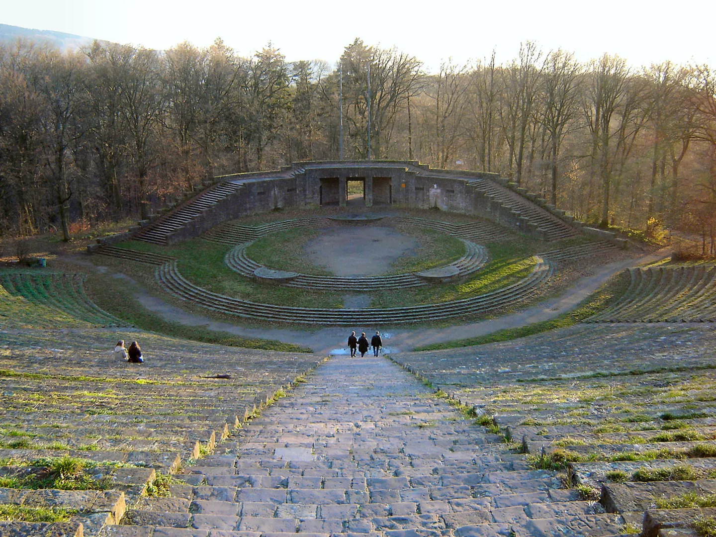
#### Thingstätte Continuing along the trail, you'll reach the Thingstätte, an open-air amphitheater built during the Nazi era for propaganda events. This historical site is located around 3 kilometers (1.86 miles) into the hike and involves an additional elevation gain of 100 meters (328 feet). The amphitheater is a stark reminder of Germany's complex history and offers a unique vantage point for reflection and photography.
Nature and Wildlife The trail meanders through dense forests of oak, beech, and pine, providing ample shade and a serene atmosphere. Keep an eye out for local wildlife, including deer, foxes, and a variety of bird species. The forest floor is often carpeted with wildflowers in the spring and summer, adding a splash of color to your hike.
Navigation and Safety Given the trail's moderate difficulty, it's advisable to use a reliable navigation tool like HiiKER to stay on course. The path is well-marked, but having a digital map can be invaluable, especially in areas where the trail forks or intersects with other paths.
Final Stretch As you loop back towards the starting point, the descent offers a gentle relief from the earlier climbs. The final 1.5 kilometers (0.93 miles) are relatively flat, allowing you to enjoy the last stretch of your hike at a leisurely pace.
This trail not only provides a physical challenge but also a journey through history and nature, making it a must-visit for anyone in the Heidelberg area.
What to expect?
Activity types
Comments and Reviews
User comments, reviews and discussions about the Bismarcksäule and Thingstätte via Bismarcksäulenweg, Germany.
4.14
average rating out of 5
7 rating(s)

