Download
Preview
Add to list
More
13.1 km
~2 hrs 49 min
125 m
Loop
“The Waldlehrpfad Loop near Harburg, Germany, blends scenic nature, local history, and moderate hiking challenges.”
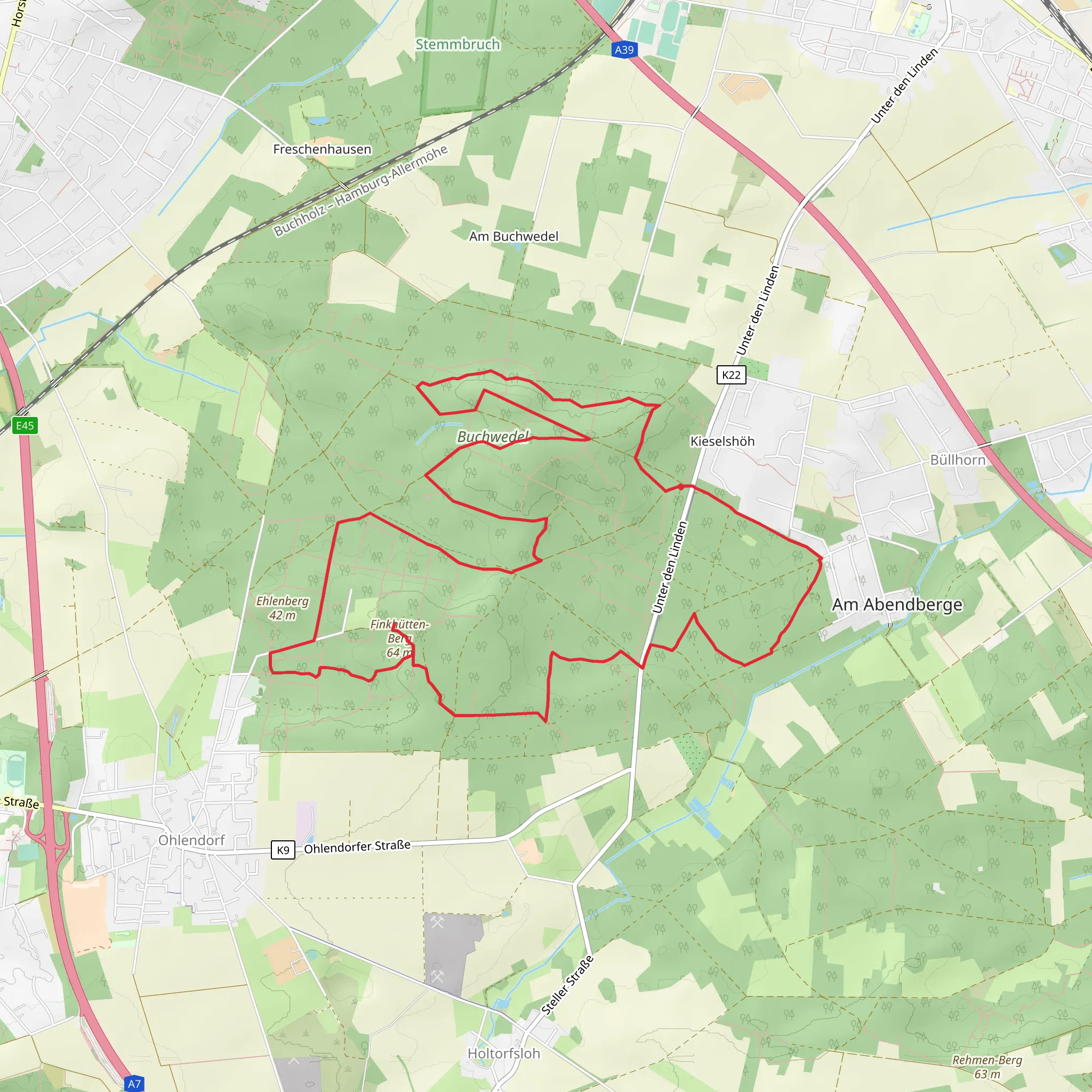
Starting near the picturesque town of Harburg in Germany, the Waldlehrpfad Loop is a delightful 13 km (8 miles) trail that offers a moderate challenge with an elevation gain of approximately 100 meters (328 feet). This loop trail is perfect for those looking to immerse themselves in nature while also enjoying a bit of local history.
Getting There To reach the trailhead, you can either drive or use public transport. If you're driving, set your GPS to Harburg, Germany, and look for parking near the town center. For those using public transport, take a train to Harburg station. From there, it's a short walk to the trailhead, which is conveniently located near the town center.
Trail Overview The Waldlehrpfad Loop is well-marked and offers a variety of terrains, from dense forests to open meadows. The trail is designed to be educational, with numerous information boards along the way that provide insights into the local flora and fauna.
Flora and Fauna As you hike, you'll encounter a diverse range of plant species, including oak, beech, and pine trees. The undergrowth is rich with ferns, wildflowers, and mushrooms, especially in the spring and autumn months. Wildlife is abundant, with chances to spot deer, foxes, and a variety of bird species, including woodpeckers and owls.
Significant Landmarks Around the 4 km (2.5 miles) mark, you'll come across a charming wooden bridge that crosses a small stream. This is a great spot for a short break and some photos. Continuing on, at approximately 7 km (4.3 miles), you'll find an old stone quarry, which has been reclaimed by nature and now serves as a habitat for various species of plants and animals.
Historical Significance The region around Harburg is steeped in history. The trail itself passes near the Harburg Castle, a medieval fortress that dates back to the 11th century. While the castle is not directly on the trail, it's worth a detour if you have the time. The castle offers stunning views of the surrounding countryside and provides a glimpse into the area's rich history.
Navigation For navigation, it's highly recommended to use the HiiKER app, which provides detailed maps and real-time updates. The trail is well-marked, but having a reliable navigation tool can enhance your hiking experience and ensure you stay on the right path.
Elevation and Terrain The elevation gain is gradual, making the trail accessible to most hikers with a moderate level of fitness. The highest point of the trail is around 100 meters (328 feet) above the starting elevation, offering some gentle climbs and descents. The terrain varies from well-trodden paths to more rugged sections, so sturdy hiking boots are advisable.
Preparation Given the moderate difficulty rating, it's wise to bring plenty of water, snacks, and a basic first-aid kit. Weather can be unpredictable, so pack a rain jacket and layers to adjust to changing conditions.
The Waldlehrpfad Loop offers a perfect blend of natural beauty, educational opportunities, and historical intrigue, making it a must-visit for any hiking enthusiast.
What to expect?
Activity types
Comments and Reviews
User comments, reviews and discussions about the Waldlehrpfad Loop, Germany.
5.0
average rating out of 5
1 rating(s)

