Download
Preview
Add to list
More
9.8 km
~2 hrs 30 min
327 m
Loop
“Explore a historic, scenic 10 km loop near Hagen with moderate elevation, perfect for seasoned hikers.”
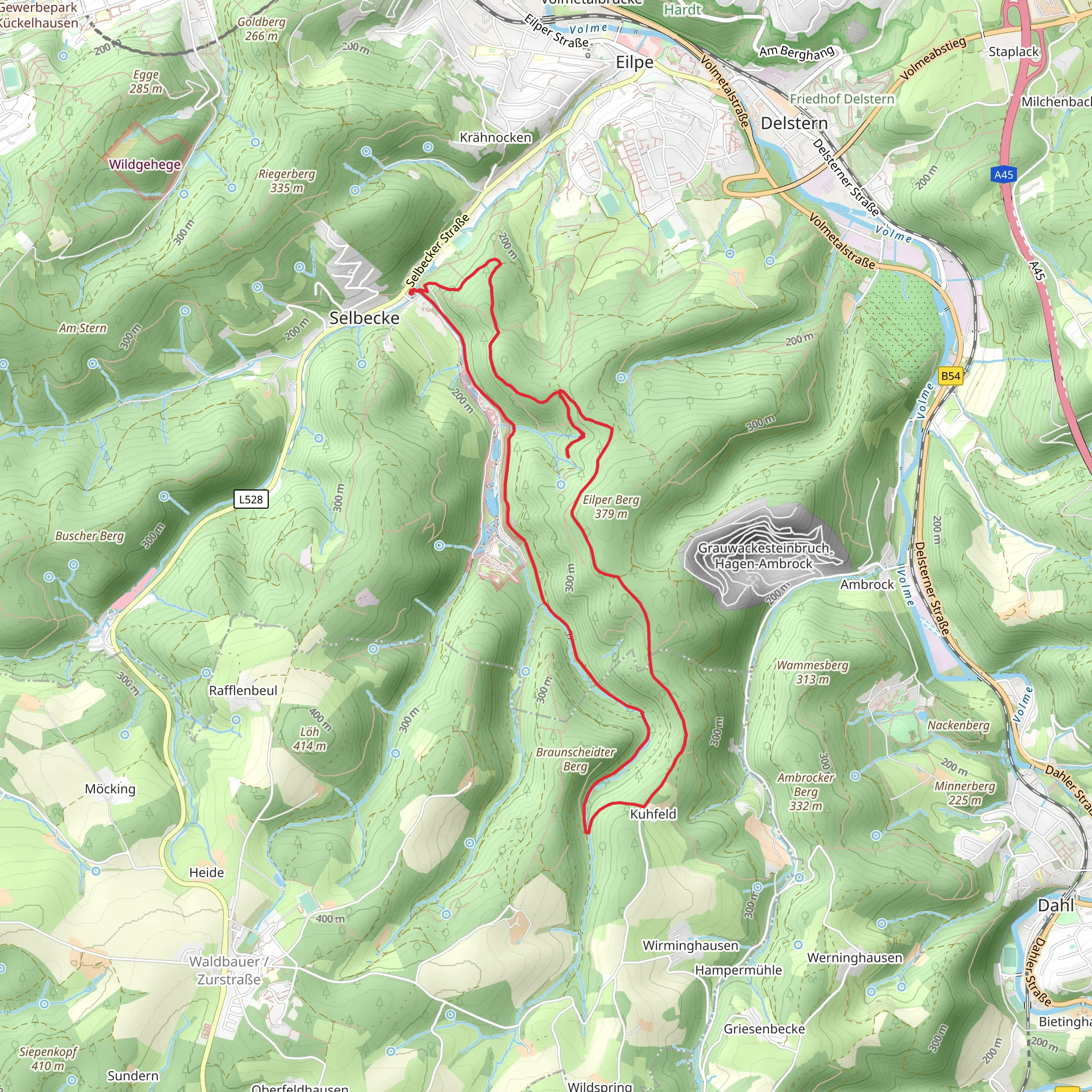
Starting near Hagen, Germany, this 10 km (6.2 miles) loop trail offers a delightful mix of natural beauty and historical significance. With an elevation gain of approximately 300 meters (984 feet), it is rated as a medium difficulty hike, making it suitable for moderately experienced hikers.
Getting There To reach the trailhead, you can either drive or use public transport. If driving, head towards the town of Hagen and look for parking near the starting point, which is close to the address of "Hagen, North Rhine-Westphalia, Germany." For those using public transport, take a train or bus to Hagen Hauptbahnhof (Hagen Central Station). From there, local buses can take you closer to the trailhead.
Trail Overview The trail begins with a gentle ascent through lush forests, offering a serene start to your hike. As you progress, you'll encounter the Hanseweg, a historic trade route that dates back to the Hanseatic League, a powerful economic and defensive alliance of merchant guilds and market towns in Northwestern and Central Europe.
Key Landmarks and Sections
#### Hanseweg Approximately 2 km (1.2 miles) into the hike, you'll find yourself on the Hanseweg. This section of the trail is relatively flat and offers a glimpse into the region's rich history. The Hanseatic League played a crucial role in the economic development of the area, and remnants of old trade routes and markers can still be seen.
#### Gloertalsperre Reservoir Around the 5 km (3.1 miles) mark, you'll reach the Gloertalsperre Reservoir. This is a perfect spot to take a break and enjoy the scenic views. The reservoir is surrounded by dense forests and offers opportunities for bird watching. Keep an eye out for local wildlife such as deer and various bird species.
#### Elevation Gain As you continue, the trail begins to ascend more steeply, gaining around 300 meters (984 feet) in elevation. This section can be challenging, but the panoramic views from the higher elevations are well worth the effort. Make sure to have your navigation tools handy; HiiKER is a reliable app for this purpose.
Flora and Fauna The trail is rich in biodiversity. You'll walk through mixed forests dominated by beech and oak trees. In spring and summer, the forest floor is carpeted with wildflowers, adding a splash of color to your hike. Wildlife is abundant, so keep your eyes peeled for squirrels, foxes, and a variety of bird species.
Final Stretch The last 2 km (1.2 miles) of the trail loop back towards the starting point. This section is mostly downhill, providing a relaxing end to your hike. As you descend, you'll pass through more open areas, offering different perspectives of the surrounding landscape.
Preparation Tips Given the medium difficulty rating, it's advisable to wear sturdy hiking boots and bring plenty of water. Weather can be unpredictable, so pack a light rain jacket. The trail is well-marked, but having a map or using HiiKER for navigation is recommended.
This trail offers a perfect blend of natural beauty and historical intrigue, making it a rewarding experience for any hiker.
What to expect?
Activity types
Comments and Reviews
User comments, reviews and discussions about the Ruthenhagen via Hanseweg and Gloertalsperre Weg, Germany.
4.6
average rating out of 5
5 rating(s)

