Download
Preview
Add to list
More
11.6 km
~2 hrs 40 min
209 m
Loop
“Immerse in Görlitz's natural beauty and history on the 12 km Grenzmuehlteich and Gondelteich trail.”
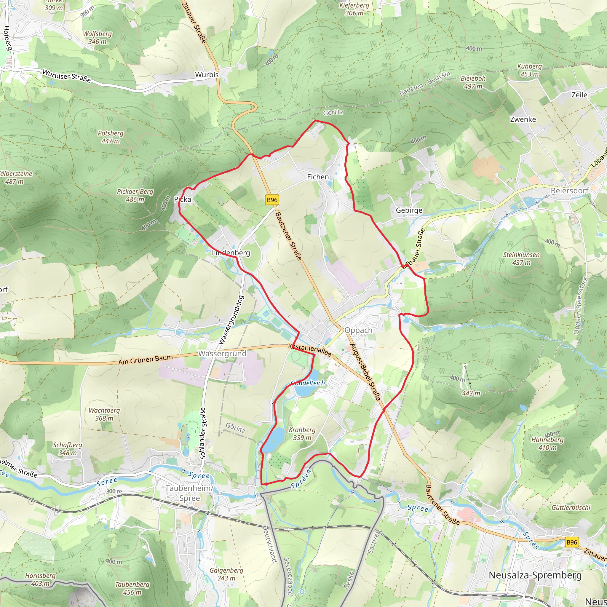
Starting near the picturesque town of Görlitz, Germany, the Grenzmuehlteich and Gondelteich via Ringweg Oppach trail offers a delightful 12 km (7.5 miles) loop with an elevation gain of approximately 200 meters (656 feet). This medium-difficulty trail is perfect for those looking to immerse themselves in the natural beauty and historical richness of the region.
Getting There To reach the trailhead, you can either drive or use public transport. If driving, head towards Görlitz and follow signs to Oppach. There is ample parking available near the starting point. For those using public transport, take a train to Görlitz and then a local bus to Oppach. The nearest significant landmark to the trailhead is the Oppach town center.
Trail Overview The trail begins near the Oppach town center and quickly leads you into a serene forested area. The path is well-marked, but it's advisable to use the HiiKER app for navigation to ensure you stay on track.
Key Landmarks and Sections
#### Grenzmuehlteich About 3 km (1.9 miles) into the hike, you'll reach Grenzmuehlteich, a tranquil pond surrounded by lush greenery. This is a great spot to take a short break and enjoy the peaceful surroundings. The pond is home to various species of birds, so keep your binoculars handy if you're a bird-watching enthusiast.
#### Gondelteich Continuing on, you'll arrive at Gondelteich around the 6 km (3.7 miles) mark. This larger pond offers stunning reflections of the surrounding trees and is a popular spot for local anglers. The area around Gondelteich is also rich in flora, with a variety of wildflowers blooming in the warmer months.
Historical Significance The region around Görlitz and Oppach is steeped in history. Görlitz itself is one of the best-preserved medieval towns in Germany, and the surrounding countryside has been inhabited for centuries. As you hike, you'll come across remnants of old mills and historical markers that tell the story of the area's past. The trail also passes by several old stone bridges, which are a testament to the region's historical infrastructure.
Wildlife and Nature The trail is abundant with wildlife. Deer, foxes, and various bird species are commonly spotted along the route. The forested sections are particularly rich in biodiversity, with a mix of deciduous and coniferous trees providing a habitat for numerous animals.
Final Stretch The last 3 km (1.9 miles) of the trail loop back towards Oppach, offering a gentle descent that provides a relaxing end to your hike. The path here is wide and well-maintained, making it easy to navigate.
Preparation Tips Given the medium difficulty rating, it's advisable to wear sturdy hiking boots and bring plenty of water. The trail can be muddy in sections, especially after rain, so be prepared for varying trail conditions. A lightweight rain jacket is also recommended, as weather in the region can be unpredictable.
Using the HiiKER app will ensure you stay on the correct path and can easily find your way back to the trailhead. Enjoy your hike through this beautiful and historically rich region!
Comments and Reviews
User comments, reviews and discussions about the Grenzmuehlteich and Gondelteich via Ringweg Oppach, Germany.
4.33
average rating out of 5
3 rating(s)
