Download
Preview
Add to list
More
11.8 km
~2 hrs 25 min
42 m
Loop
“Embark on the scenic and accessible 12 km Hundspfot and Hordter Rheinaue Loop near Germersheim, Germany.”
Starting your adventure near Germersheim, Germany, the Hundspfot and Hordter Rheinaue Loop is a delightful 12 km (7.5 miles) loop trail with virtually no elevation gain, making it accessible for a wide range of hikers. The trailhead is conveniently located near the town of Germersheim, which can be reached by car or public transport. If you're driving, you can park near the Germersheim train station. For those using public transport, Germersheim is well-connected by regional trains and buses.
Trail Overview
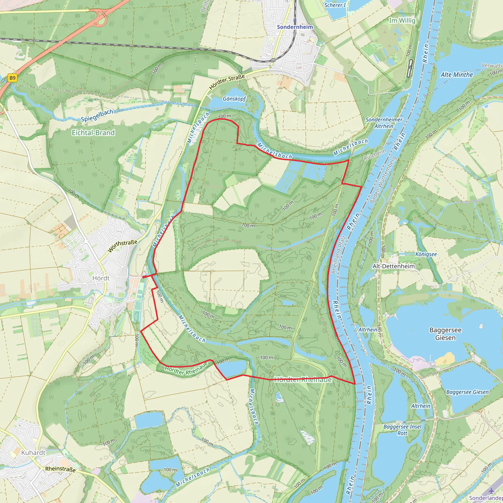
The trail meanders through the picturesque Hordter Rheinaue, a floodplain area along the Rhine River. This region is known for its lush wetlands, diverse flora, and abundant wildlife. As you start your hike, you'll be greeted by the serene beauty of the riverbanks, where you might spot waterfowl such as herons and ducks. The trail is well-marked, but it's always a good idea to have a navigation tool like HiiKER to ensure you stay on track.
Key Landmarks and Points of Interest
1. Rhine Riverbanks (0-2 km / 0-1.2 miles): The initial stretch of the trail runs parallel to the Rhine River. This section offers stunning views of the water and the surrounding wetlands. Keep an eye out for the various bird species that inhabit this area. The riverbanks are also a great spot for a short break or a picnic.
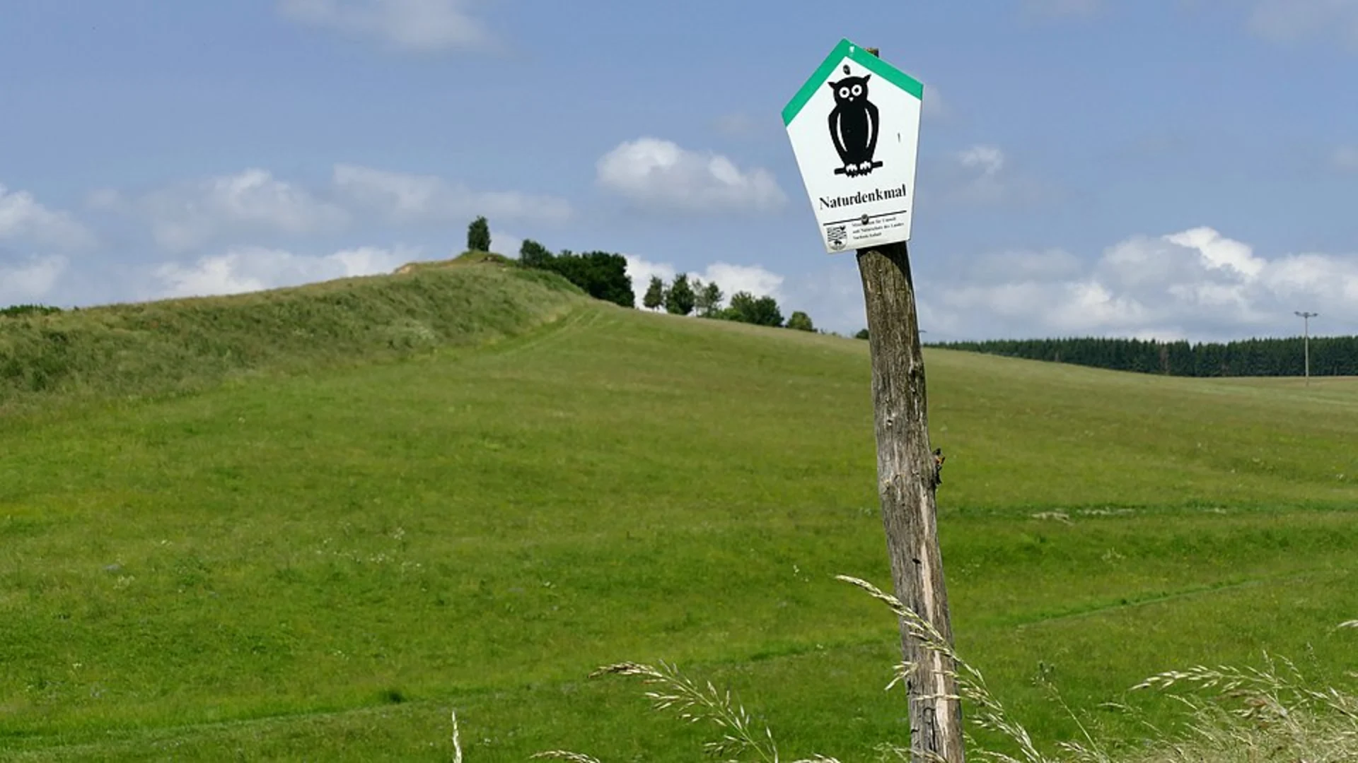
2. Hordter Rheinaue Nature Reserve (2-6 km / 1.2-3.7 miles): As you continue, you'll enter the Hordter Rheinaue Nature Reserve. This protected area is a haven for wildlife and features a mix of meadows, forests, and marshlands. The trail here is relatively flat and easy to navigate. Look out for deer, foxes, and a variety of bird species. The diverse plant life includes reeds, willows, and wildflowers, making it a botanist's paradise.
3. Historical Significance (6-8 km / 3.7-5 miles): Around the halfway point, you'll come across remnants of historical significance. The region around Germersheim has a rich history dating back to Roman times. You might see old fortifications and ruins that hint at the area's strategic importance over the centuries. Take a moment to appreciate the historical context and imagine the lives of those who once inhabited this land.
4. Return to Germersheim (8-12 km / 5-7.5 miles): The final leg of the loop brings you back towards Germersheim. This section of the trail passes through more open fields and agricultural land. The contrast between the wetlands and the cultivated areas provides a unique perspective on the region's landscape. As you approach the town, you'll have the opportunity to explore Germersheim itself, which boasts charming streets, local eateries, and historical buildings.
Practical Information
- Trail Length: 12 km (7.5 miles) - Elevation Gain: 0 meters (0 feet) - Difficulty: Medium - Best Time to Hike: Spring and autumn are ideal for this trail, as the weather is mild and the flora and fauna are most active. - Navigation: Use HiiKER for accurate trail navigation and to stay updated on any trail changes or closures.
Getting There
By Car: If you're driving, set your GPS to Germersheim train station. There is ample parking available nearby. The trailhead is a short walk from the station.
By Public Transport: Germersheim is accessible by regional trains and buses. From major cities like Karlsruhe or Mannheim, you can take a direct train to Germersheim. The trailhead is easily reachable on foot from the train station.
Prepare for a day of exploration and natural beauty as you embark on the Hundspfot and Hordter Rheinaue Loop. This trail offers a perfect blend of scenic landscapes, wildlife encounters, and historical intrigue, making it a memorable hiking experience.
What to expect?
Activity types
Comments and Reviews
User comments, reviews and discussions about the Hundspfot and Hordter Rheinaue Loop, Germany.
4.29
average rating out of 5
7 rating(s)

