Download
Preview
Add to list
More
112.2 km
~7 days
3168 m
Multi-Day
“Embark on the Albtraufgänger trail for a scenic and historic 112-kilometer journey through Germany's Swabian Jura.”
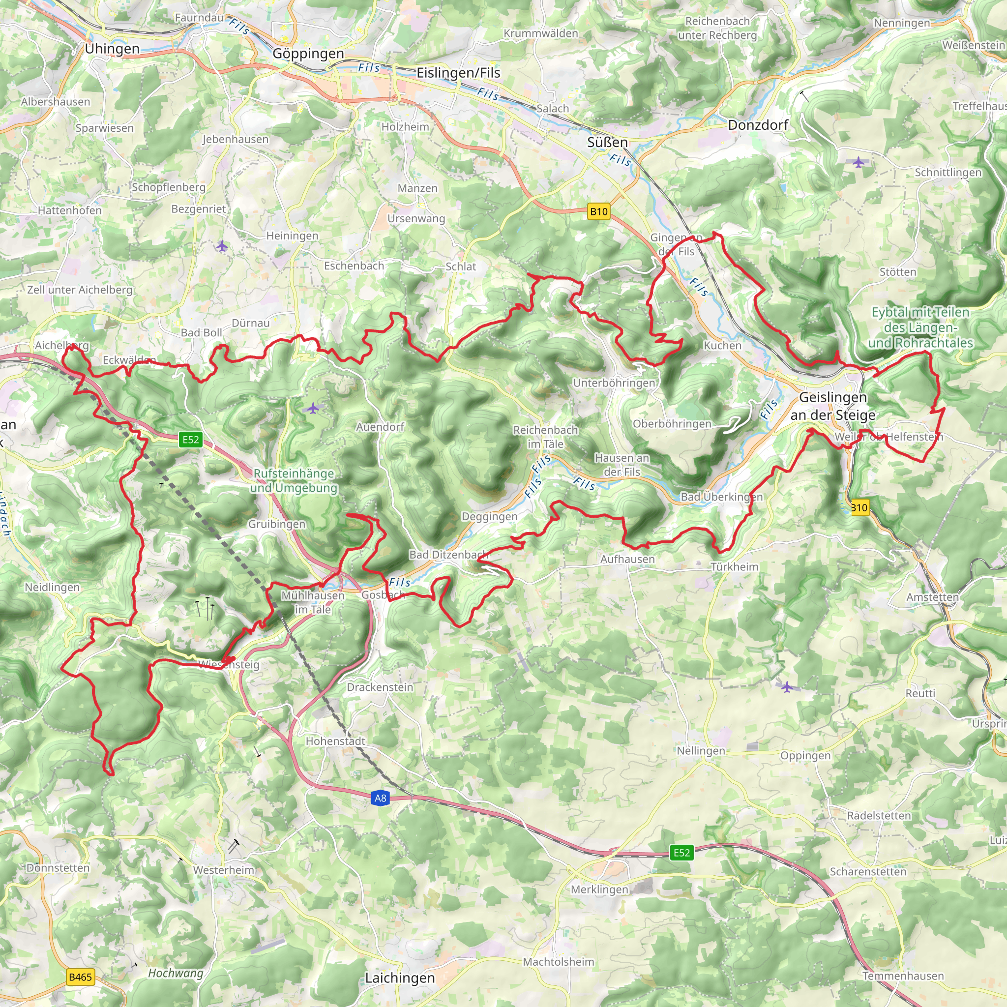
The Albtraufgänger trail, a captivating loop that spans approximately 112 kilometers (about 70 miles) with an elevation gain of around 3100 meters (approximately 10,170 feet), offers an immersive experience through the Swabian Jura in Germany. Starting near the administrative association of Oberes Filstal, the trail is accessible from the town of Geislingen an der Steige, which can be reached by train or car. For those arriving by car, parking is available in the area, while public transport users can take advantage of the local bus and train services that connect to Geislingen.
Navigating the Trail
As you embark on the Albtraufgänger, the HiiKER app will be an invaluable tool for navigation, providing detailed maps and waypoints to ensure you stay on the right path. The trail is well-marked, but having a digital companion like HiiKER can help you keep track of your progress and anticipate upcoming changes in terrain or elevation.
Natural Wonders and Wildlife
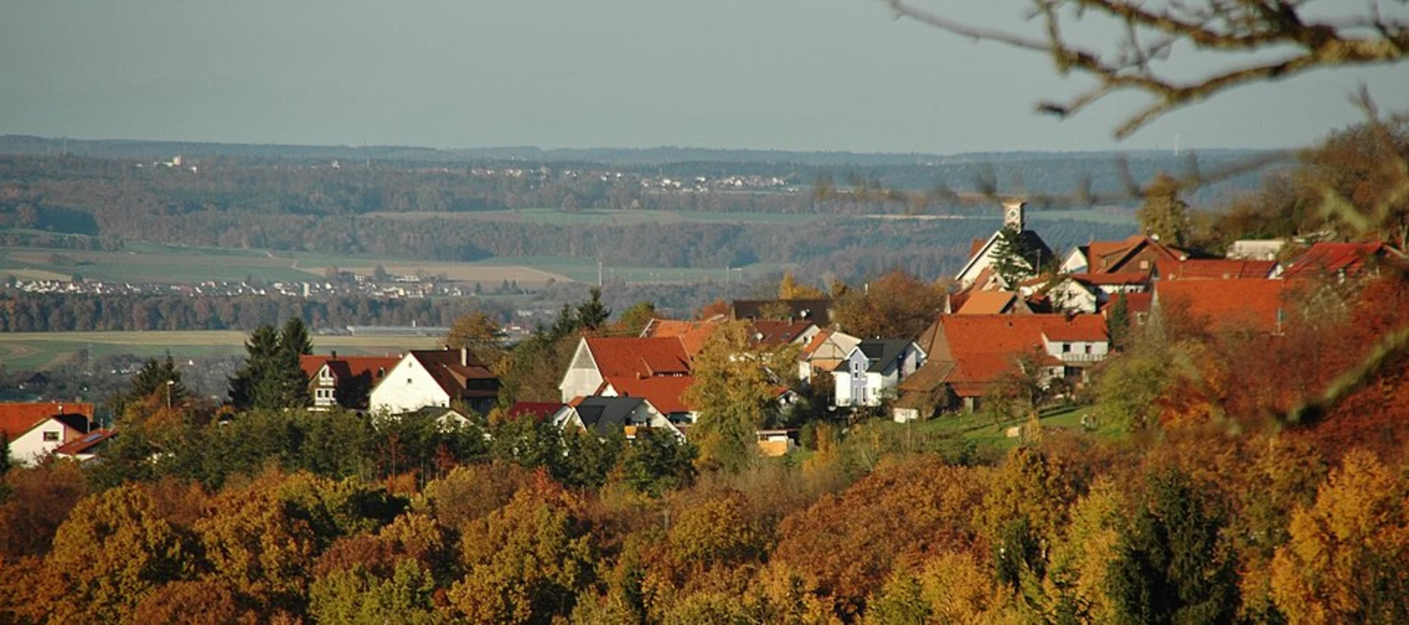
The trail meanders through a diverse landscape, offering hikers a chance to witness the unique geology of the Swabian Jura, characterized by limestone formations and rich forests. The region is home to an array of wildlife, including deer, wild boars, and numerous bird species. Keep an eye out for the rare orchids that can be found in the meadows during spring and early summer.
Historical Significance
The Albtraufgänger trail is not only a journey through nature but also through time. The region is dotted with historical landmarks, including ancient castles and ruins that date back to the Middle Ages. As you hike, you'll encounter remnants of these structures, offering a glimpse into the area's storied past.
Key Sections of the Trail
The trail can be divided into several sections, each with its own unique features and challenges. One of the most notable segments takes you along the Albtrauf, the northern escarpment of the Swabian Jura, providing stunning panoramic views of the surrounding valleys and towns. This section is also where you'll encounter the majority of the trail's elevation gain.
Another highlight is the passage through the Fils Valley, where the trail descends into a more gentle landscape, allowing for a respite from the more strenuous climbs. Here, the trail follows along the river, and hikers can enjoy the soothing sounds of flowing water and the lush greenery of the riverbanks.
Preparing for the Hike
Given the trail's medium difficulty rating, it's important to prepare adequately. Ensure you have sturdy hiking boots, as the terrain can be rocky and uneven in places. Weather in the region can be unpredictable, so pack layers and waterproof gear. It's also advisable to carry enough water and snacks, as there are stretches of the trail with limited access to facilities.
For those planning to complete the trail over several days, there are designated camping spots and huts along the route. Make sure to check availability and any necessary reservations in advance.
Access to the Trailhead
To reach the starting point of the Albtraufgänger trail near the Gemeindeverwaltungsverband Oberes Filstal, you can drive to Geislingen an der Steige and follow local signage to the trailhead. If using public transport, take a train to Geislingen Station and then a bus or taxi to the trailhead, which is a short distance from the town center.
Embarking on the Albtraufgänger trail is an adventure that promises both natural beauty and historical intrigue. With the right preparation and a sense of curiosity, hikers will find this trail to be a rewarding experience that showcases the best of the Swabian Jura.
Comments and Reviews
User comments, reviews and discussions about the Albtraufgänger, Germany.
4.75
average rating out of 5
8 rating(s)

