Download
Preview
Add to list
More
10.3 km
~2 hrs 22 min
185 m
Loop
“Experience the Rotes Moor loop trail's bogs, peaks, and history in Germany's scenic Rhön Biosphere Reserve.”
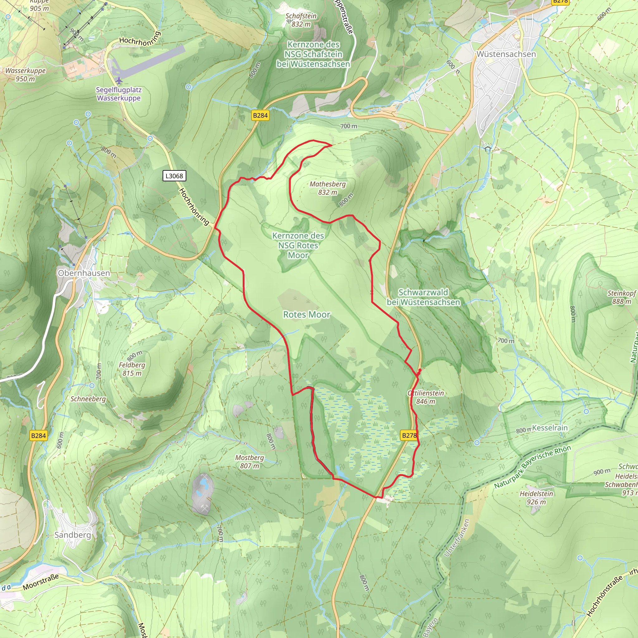
Starting near Fulda, Germany, the Rotes Moor via Moorrundweg is a captivating 10 km (6.2 miles) loop trail with an elevation gain of approximately 100 meters (328 feet). This trail offers a medium difficulty rating, making it suitable for moderately experienced hikers.
Getting There To reach the trailhead, you can drive or use public transport. If driving, head towards the Wasserkuppe, the highest peak in the Rhön Mountains, and park at the designated parking area near the Rotes Moor. For those using public transport, take a train to Fulda and then a bus towards Gersfeld. From Gersfeld, you can catch a local bus or taxi to the trailhead near the Wasserkuppe.
Trail Overview The trail begins at the parking area near the Rotes Moor, a significant raised bog in the Rhön Biosphere Reserve. The initial section of the trail is relatively flat, allowing you to ease into the hike. As you progress, you'll encounter a series of wooden boardwalks that traverse the boggy areas, providing a unique hiking experience and protecting the delicate ecosystem beneath.
Flora and Fauna The Rotes Moor is renowned for its diverse flora and fauna. Keep an eye out for rare plant species such as the sundew and cotton grass, which thrive in the acidic, nutrient-poor conditions of the bog. Birdwatchers will be delighted by the presence of species like the Eurasian curlew and the whinchat. If you're lucky, you might even spot a black grouse, a rare and protected bird in this region.
Significant Landmarks Around the 3 km (1.9 miles) mark, you'll come across the Moorsteg, a wooden observation deck that offers panoramic views of the bog and surrounding landscape. This is an excellent spot for a short break and some photography. Continuing on, the trail gradually ascends, leading you to the Heidelstein, a small peak with an elevation of 926 meters (3,038 feet). The climb is gentle but steady, and the views from the top are well worth the effort.
Historical Significance The Rhön region, including the Rotes Moor, has a rich history. During the Cold War, the area was part of the inner German border, separating East and West Germany. Remnants of this period can still be seen, including old border markers and watchtowers. The trail itself passes near some of these historical sites, providing a poignant reminder of the region's past.
Navigation and Safety Given the trail's medium difficulty rating, it's advisable to use a reliable navigation tool like HiiKER to stay on track. The trail is well-marked, but weather conditions can change rapidly, especially in the higher elevations. Ensure you have appropriate clothing and gear, including waterproof layers and sturdy hiking boots.
Final Stretch As you descend from the Heidelstein, the trail loops back towards the starting point. The final section is a gentle downhill walk through mixed forests, offering a peaceful end to your hike. The entire loop takes around 3-4 hours to complete, depending on your pace and the number of stops you make along the way.
This trail offers a blend of natural beauty, historical significance, and moderate physical challenge, making it a rewarding experience for those who venture into the heart of the Rhön Biosphere Reserve.
What to expect?
Activity types
Comments and Reviews
User comments, reviews and discussions about the Rotes Moor via Moorrundweg, Germany.
4.8
average rating out of 5
5 rating(s)

