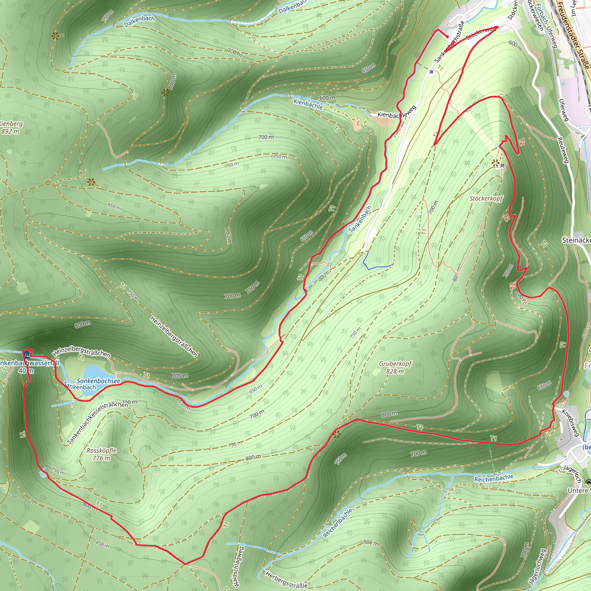
Sankenbachsee, Sankenbach Waterfalls and Stoeckerkopf Loop via Baiersbronn Kniebis
Download
Preview
Add to list
More
12.3 km
~3 hrs 24 min
567 m
Loop
“Experience a stunning 12 km loop trail near Freudenstadt, blending natural beauty, moderate challenge, and historical intrigue.”
Starting near Freudenstadt in Germany, this 12 km (7.5 miles) loop trail offers a delightful mix of natural beauty, moderate physical challenge, and historical intrigue. With an elevation gain of approximately 500 meters (1,640 feet), the trail is rated as medium difficulty, making it accessible for most hikers with a reasonable level of fitness.
Getting There To reach the trailhead, you can either drive or use public transport. If driving, head towards Baiersbronn Kniebis, where parking is available near the start of the trail. For those using public transport, take a train to Freudenstadt Hauptbahnhof and then a bus to Baiersbronn Kniebis. The trailhead is conveniently located near this bus stop.
Trail Highlights
#### Sankenbachsee The first major landmark you'll encounter is the serene Sankenbachsee, a picturesque lake surrounded by dense forest. This is a great spot for a short break, allowing you to take in the tranquil waters and perhaps spot some local wildlife, such as ducks and other waterfowl. The lake is approximately 3 km (1.9 miles) from the trailhead, with a gentle elevation gain of about 100 meters (328 feet).
#### Sankenbach Waterfalls Continuing on, you'll reach the Sankenbach Waterfalls, one of the trail's most stunning features. The falls are about 5 km (3.1 miles) into the hike, with an additional elevation gain of 150 meters (492 feet). The cascading water provides a refreshing backdrop and is particularly impressive after a period of rain. There are several viewpoints along the way, offering different perspectives of the falls.
#### Stoeckerkopf The trail then ascends towards Stoeckerkopf, the highest point of the loop. This section is the most challenging, with a steep climb that adds another 250 meters (820 feet) of elevation gain over the next 3 km (1.9 miles). The effort is well worth it, as the summit offers panoramic views of the surrounding Black Forest. On a clear day, you can see for miles, making it an excellent spot for photography.
Historical Significance The region around Freudenstadt and Baiersbronn has a rich history, dating back to the early medieval period. Freudenstadt itself was founded in 1599 by Duke Frederick I of Württemberg and has a unique layout designed by the architect Heinrich Schickhardt. The area was historically significant for its timber and glass industries, which thrived due to the abundant natural resources of the Black Forest.
Navigation and Safety For navigation, it's highly recommended to use the HiiKER app, which provides detailed maps and real-time updates. The trail is well-marked, but having a reliable navigation tool can help you stay on track and avoid any potential detours.
Flora and Fauna The trail traverses through diverse ecosystems, from dense coniferous forests to open meadows. Keep an eye out for local wildlife, including deer, foxes, and a variety of bird species. The flora is equally impressive, with seasonal wildflowers adding splashes of color to the landscape.
Final Stretch The final 4 km (2.5 miles) of the trail descend gradually back towards the trailhead, offering a more relaxed end to your hike. This section passes through more forested areas and open fields, providing a peaceful conclusion to your journey.
This loop trail offers a well-rounded hiking experience, combining natural beauty, moderate physical challenge, and a touch of historical significance. Whether you're a seasoned hiker or a casual walker, this trail has something to offer for everyone.
What to expect?
Activity types
Comments and Reviews
User comments, reviews and discussions about the Sankenbachsee, Sankenbach Waterfalls and Stoeckerkopf Loop via Baiersbronn Kniebis, Germany.
4.71
average rating out of 5
7 rating(s)
