Moeslepark to Schauinsland via Laufstrecke Schauinsland Berglauf
Download
Preview
Add to list
More
13.0 km
~4 hrs 43 min
1278 m
Point-to-Point
“The 13 km trail from Moeslepark to Schauinsland offers breathtaking views and a rewarding challenge.”
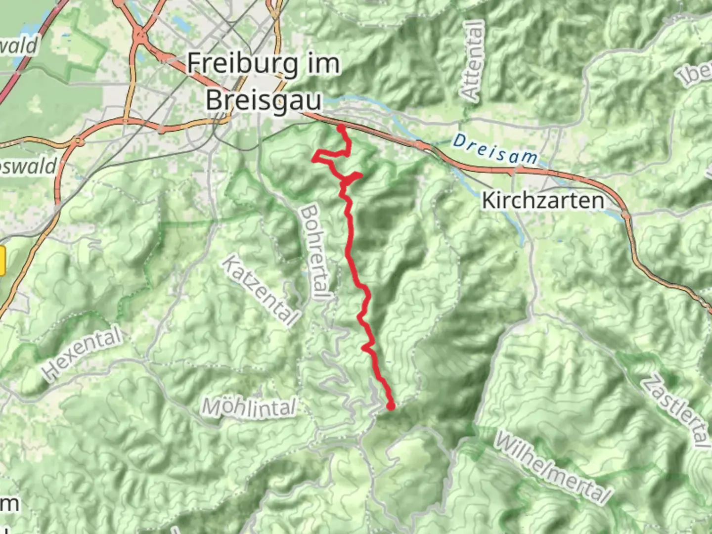
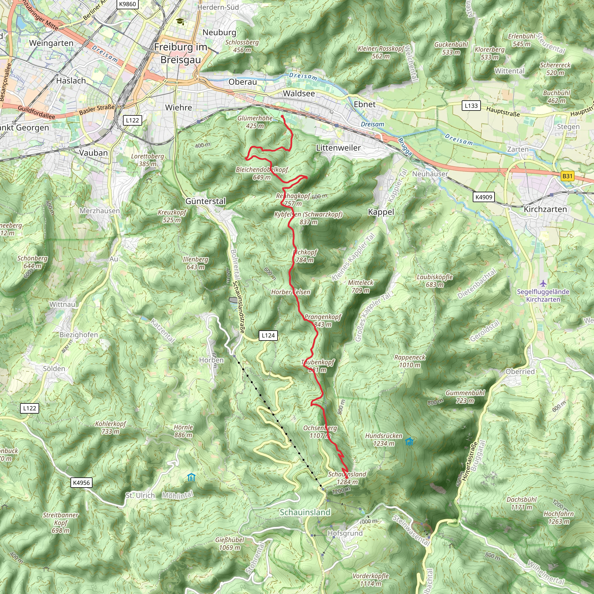
Starting near Freiburg im Breisgau, Germany, the trail from Moeslepark to Schauinsland via Laufstrecke Schauinsland Berglauf offers a challenging yet rewarding hike. This point-to-point trail spans approximately 13 kilometers (8 miles) with an elevation gain of around 1200 meters (3937 feet), making it a medium difficulty hike suitable for those with a moderate level of fitness.### Getting There To reach the trailhead, you can either drive or use public transport. If driving, head towards Moeslepark in Freiburg im Breisgau, where parking is available. For those using public transport, take a train to Freiburg Hauptbahnhof (Freiburg Central Station) and then a tram or bus to the nearest stop at Moeslepark.### Trail Overview The trail begins at Moeslepark, a serene urban park known for its lush greenery and tranquil atmosphere. As you start your ascent, you'll quickly leave the city behind and enter the dense Black Forest, renowned for its towering pine trees and rich biodiversity. The initial part of the trail is relatively gentle, allowing you to acclimate to the terrain.### Key Landmarks and Sections - Kilometer 3 (Mile 1.9): After about 3 kilometers (1.9 miles), you'll reach the Kybfelsen viewpoint. This spot offers panoramic views of Freiburg and the surrounding valleys, making it a perfect place for a short break and some photographs. - Kilometer 6 (Mile 3.7): At around the 6-kilometer (3.7-mile) mark, you'll encounter the St. Valentin Chapel, a small but historically significant site. The chapel dates back to the 18th century and is a testament to the region's rich cultural heritage. - Kilometer 9 (Mile 5.6): As you continue, the trail becomes steeper and more challenging. Around the 9-kilometer (5.6-mile) point, you'll pass through a dense section of the forest known for its diverse wildlife, including deer, foxes, and various bird species. Keep an eye out for these creatures, but remember to maintain a respectful distance.### Final Ascent The final stretch of the trail is the most demanding, with a steep ascent leading up to Schauinsland. This section requires careful navigation, and it's advisable to use the HiiKER app for accurate trail mapping and real-time updates. The effort is well worth it, as the summit of Schauinsland offers breathtaking views of the Black Forest, the Rhine Valley, and even the distant Alps on a clear day.### Historical Significance Schauinsland itself holds historical significance. The name translates to "look into the country," and it has been a popular lookout point for centuries. During the Middle Ages, it was a strategic location for monitoring the surrounding regions. Today, it serves as a beloved destination for hikers and nature enthusiasts.### Practical Tips - Weather: The weather in this region can be unpredictable, so it's essential to check the forecast and dress in layers. - Footwear: Sturdy hiking boots are recommended due to the varied terrain and steep sections. - Supplies: Carry sufficient water and snacks, as there are limited facilities along the trail. - Navigation: Use the HiiKER app for reliable navigation and to stay on track.This trail offers a blend of natural beauty, historical landmarks, and challenging terrain, making it a memorable hike for those prepared to take it on.
What to expect?
Activity types
Comments and Reviews
User comments, reviews and discussions about the Moeslepark to Schauinsland via Laufstrecke Schauinsland Berglauf, Germany.
5.0
average rating out of 5
2 rating(s)
