Albert Mangelsdorff Weiher, Jaspisgruene Teich and Rechneigrabenweiher via Mainweg
Download
3D Flyover
Add to list
More
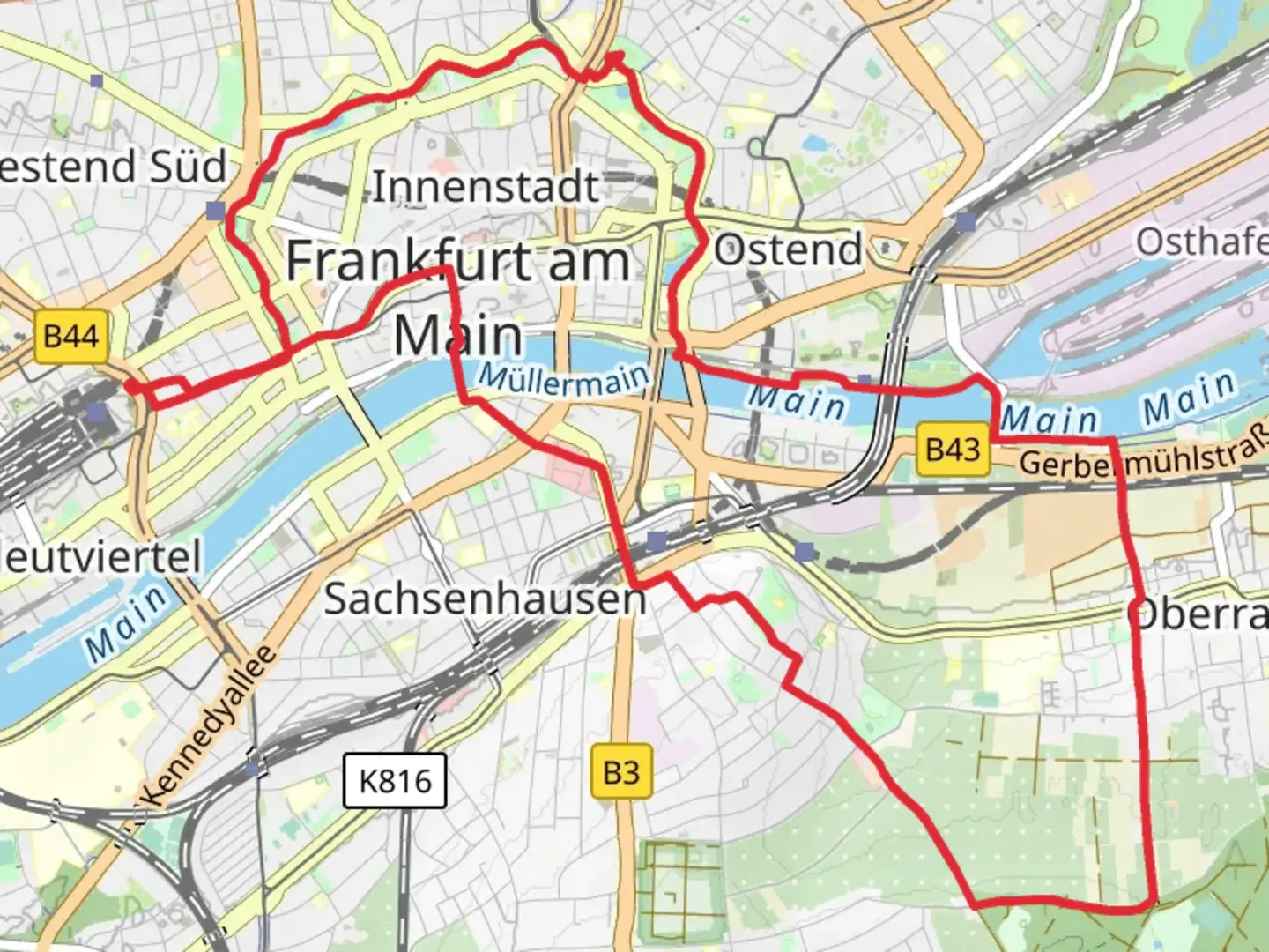
14.9 km
~3 hrs 9 min
108 m
Loop
“A picturesque 15 km loop near Frankfurt blending natural beauty, historical intrigue, and moderate hiking challenges.”
Starting near Frankfurt, Germany, this 15 km (approximately 9.3 miles) loop trail offers a delightful mix of natural beauty and historical significance. With an elevation gain of around 100 meters (328 feet), it is rated as medium difficulty, making it accessible for most hikers with a moderate level of fitness.
Getting There
To reach the trailhead, you can take public transport from Frankfurt. The nearest significant landmark is the Frankfurt Hauptbahnhof (Main Train Station). From there, you can catch a regional train or bus to the vicinity of the trailhead. If you prefer to drive, there are parking facilities available near the starting point.
Trail Overview
The trail begins near the serene Albert Mangelsdorff Weiher, a picturesque pond named after the famous German jazz trombonist. As you start your hike, you'll be greeted by lush greenery and the calming sounds of nature. The path is well-marked, but it's always a good idea to have a reliable navigation tool like HiiKER to ensure you stay on track.
Significant Landmarks and Nature
Albert Mangelsdorff Weiher: This pond is a great spot to start your hike, offering tranquil views and a chance to spot local wildlife such as ducks and swans. The area is also popular for birdwatching, so keep your binoculars handy.
Jaspisgruene Teich: About 5 km (3.1 miles) into the hike, you'll come across the Jaspisgruene Teich, another beautiful pond surrounded by dense forest. The water here has a unique greenish hue, attributed to the jasper minerals in the soil. It's a perfect spot for a short break and some photography.
Rechneigrabenweiher: Approximately 10 km (6.2 miles) into the trail, you'll reach the Rechneigrabenweiher. This pond is historically significant as it was part of an old irrigation system used in the region. The area around the pond is rich in flora and fauna, making it a great place to observe nature.
Historical Significance
The trail passes through areas that have historical importance. The Rechneigrabenweiher, for instance, was part of an ancient irrigation system that dates back several centuries. This system was crucial for the agricultural development of the region. As you hike, you'll also notice remnants of old stone structures and pathways that tell the story of the area's past.
Wildlife and Flora
The trail is home to a variety of wildlife, including deer, foxes, and numerous bird species. The flora is equally diverse, with oak, beech, and pine trees dominating the landscape. During spring and summer, the trail is adorned with wildflowers, adding a splash of color to your hike.
Elevation and Terrain
The elevation gain of around 100 meters (328 feet) is spread out over the 15 km (9.3 miles), making the ascent gradual and manageable. The terrain varies from forest paths to open meadows, providing a mix of shaded and sunny sections. Some parts of the trail can be muddy after rain, so appropriate footwear is recommended.
Navigation and Safety
While the trail is well-marked, using HiiKER for navigation can help you stay on course and provide additional information about the trail. Always carry enough water, snacks, and a basic first aid kit. Mobile reception can be spotty in some areas, so inform someone about your hiking plans before you set off.
This trail offers a perfect blend of natural beauty, historical intrigue, and moderate physical challenge, making it a rewarding experience for any hiker.

What to expect?
Activity types
Comments and Reviews
User comments, reviews and discussions about the Albert Mangelsdorff Weiher, Jaspisgruene Teich and Rechneigrabenweiher via Mainweg, Germany.
4.0
average rating out of 5
1 rating(s)