Download
Preview
Add to list
More
9.0 km
~2 hrs 17 min
296 m
Point-to-Point
“Experience Franconian Switzerland's charm, history, and local brews on the 9 km Weißenohe to Thuisbrunn hike.”
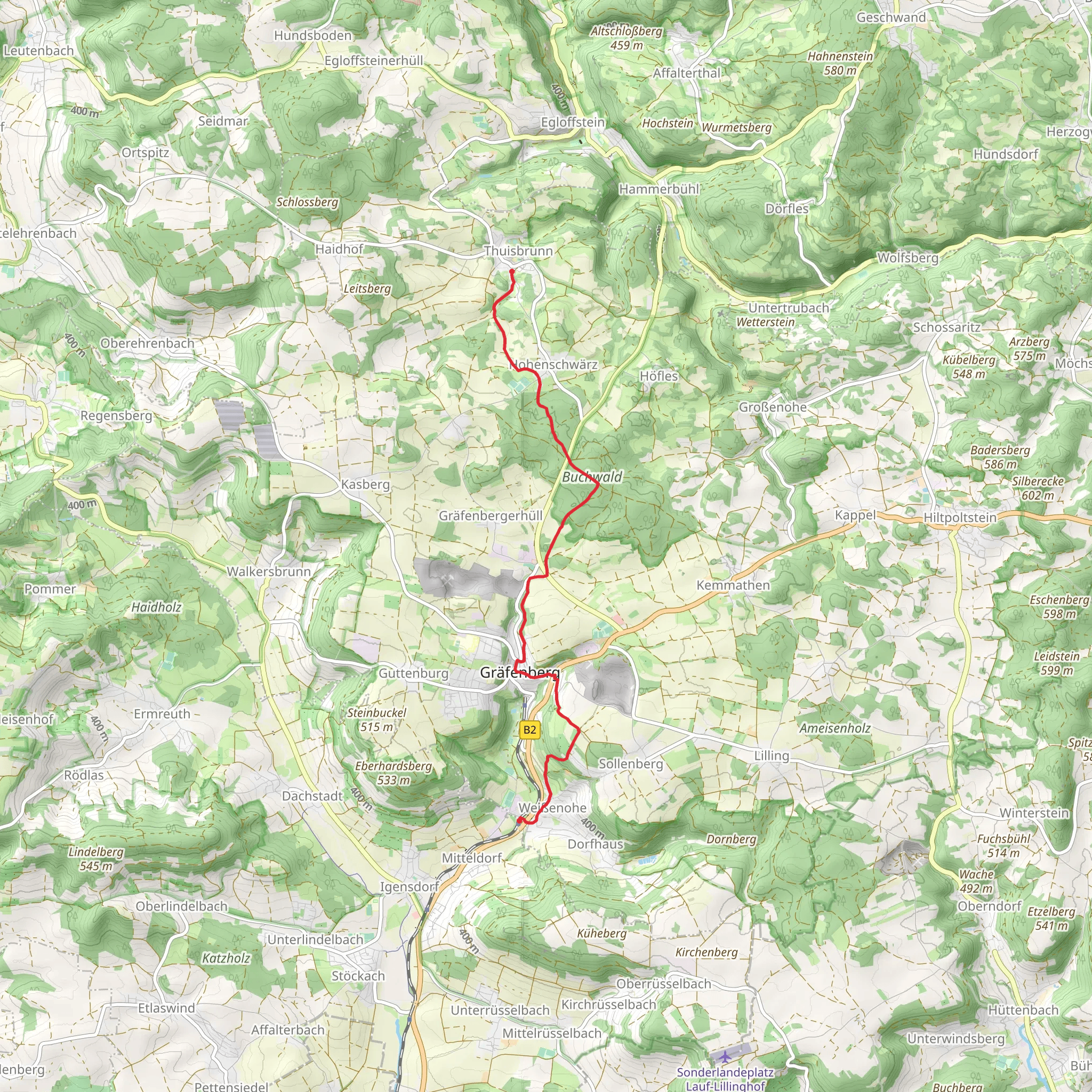
Starting near Forchheim, Germany, the Weißenohe to Thuisbrunn Walk via 5 Seidla Steig is a delightful point-to-point trail that spans approximately 9 km (5.6 miles) with an elevation gain of around 200 meters (656 feet). This trail is rated as medium difficulty, making it suitable for moderately experienced hikers.
Getting There To reach the trailhead, you can take a train to Forchheim, which is well-connected to major cities like Nuremberg and Bamberg. From Forchheim, local buses can take you to Weißenohe, where the trail begins. If you prefer to drive, there are parking facilities available in Weißenohe.
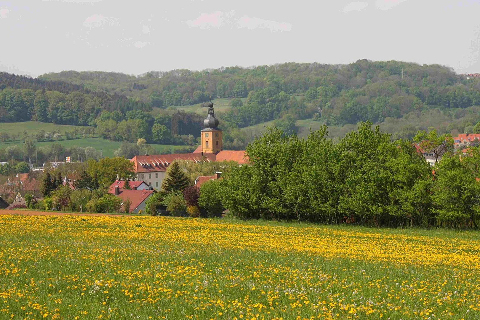
Trail Overview The trail starts in the charming village of Weißenohe, known for its historic Benedictine monastery, which dates back to the 11th century. As you begin your hike, you'll pass through lush forests and rolling hills, typical of the Franconian Switzerland region. The trail is well-marked, but it's advisable to use HiiKER for navigation to ensure you stay on the correct path.
Key Landmarks and Points of Interest - **Weißenohe Monastery**: Just a short distance from the trailhead, this historic site offers a glimpse into the region's religious history. The monastery's architecture is a blend of Romanesque and Baroque styles. - **Franconian Switzerland**: As you hike, you'll traverse through the picturesque landscapes of Franconian Switzerland, characterized by its unique rock formations, dense forests, and serene meadows. - **5 Seidla Steig**: This trail is part of the famous 5 Seidla Steig, a beer hiking trail that connects five traditional Franconian breweries. Along the way, you can stop at local breweries to sample some of the finest beers in the region. Notable breweries include Elch-Bräu in Thuisbrunn and Lindenbräu in Gräfenberg.
Flora and Fauna The trail offers a rich variety of flora and fauna. In spring and summer, wildflowers bloom abundantly, adding vibrant colors to the landscape. You might spot deer, foxes, and a variety of bird species, making it a great trail for nature enthusiasts.
Elevation and Terrain The trail features a moderate elevation gain of around 200 meters (656 feet), with some steep sections that require careful footing. The highest point offers panoramic views of the surrounding countryside, making the climb well worth the effort.
Historical Significance The region is steeped in history, with numerous castles and ruins dotting the landscape. The trail itself passes near several historical sites, including the ruins of Thuisbrunn Castle, which dates back to the 12th century. These landmarks provide a fascinating glimpse into the area's medieval past.
Practical Tips - **Footwear**: Sturdy hiking boots are recommended due to the varied terrain. - **Weather**: Check the weather forecast before you set out, as conditions can change rapidly. - **Supplies**: Carry enough water and snacks, especially if you plan to stop at the breweries along the way. - **Navigation**: Use HiiKER to keep track of your progress and ensure you stay on the correct path.
The Weißenohe to Thuisbrunn Walk via 5 Seidla Steig offers a perfect blend of natural beauty, historical intrigue, and local culture, making it a must-do for any hiking enthusiast visiting the Franconian Switzerland region.
What to expect?
Activity types
Comments and Reviews
User comments, reviews and discussions about the Weißenohe to Thuisbrunn Walk via 5 Seidla Steig, Germany.
5.0
average rating out of 5
2 rating(s)

