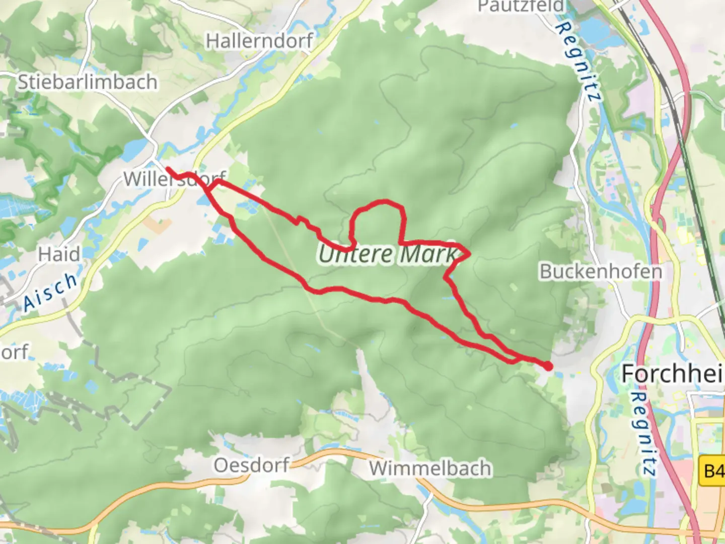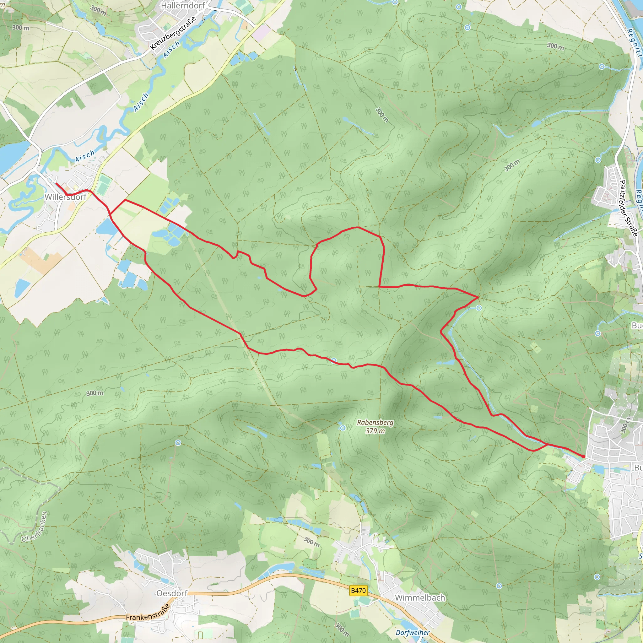
Burk-Schlammersdorf, Lauferlebnis Fraenkische Schweiz and Burk Lunzkeller
Download
Preview
Add to list
More
14.7 km
~3 hrs 19 min
230 m
Loop
“This 15 km loop near Forchheim, Germany, blends scenic beauty with historical landmarks in a moderately challenging hike.”
Starting near Forchheim, Germany, this 15 km (approximately 9.3 miles) loop trail offers a delightful mix of natural beauty and historical intrigue. With an elevation gain of around 200 meters (656 feet), the trail is rated as medium difficulty, making it suitable for moderately experienced hikers.
Getting There Forchheim is well-connected by public transport. If you're coming by train, Forchheim Station is the nearest major stop. From there, you can take a local bus or taxi to the trailhead. If you're driving, Forchheim is easily accessible via the A73 motorway. Parking is available near the trailhead, which is close to the town center.
Trail Highlights #### Nature and Scenery The trail meanders through the picturesque Franconian Switzerland region, known for its rugged rock formations, dense forests, and serene meadows. Early in the hike, you'll pass through lush woodlands, where the canopy provides ample shade and the air is filled with the scent of pine and oak. Keep an eye out for local wildlife, including deer, foxes, and a variety of bird species.
#### Historical Landmarks One of the significant landmarks along the trail is the Burk Castle ruins, located approximately 5 km (3.1 miles) from the start. This medieval fortress offers a glimpse into the region's storied past and provides a fantastic vantage point for panoramic views of the surrounding landscape. Another historical site is the Lunzkeller, an ancient cave that has been used for various purposes over the centuries, including as a shelter and storage space.
Navigation To ensure you stay on track, it's advisable to use the HiiKER app, which provides detailed maps and real-time navigation. The trail is well-marked, but having a reliable navigation tool can help you explore with confidence.
Flora and Fauna As you continue, the trail opens up into rolling meadows dotted with wildflowers, especially vibrant in the spring and summer months. The diverse plant life attracts numerous pollinators, making it a haven for nature enthusiasts. The trail also skirts several small streams, where you might spot frogs, dragonflies, and other aquatic creatures.
Elevation and Terrain The trail features a mix of gentle inclines and steeper sections, with the most significant elevation gain occurring in the first half of the hike. The terrain varies from well-trodden paths to rocky outcrops, so sturdy hiking boots are recommended. The highest point of the trail offers sweeping views of the Franconian Switzerland region, making the climb well worth the effort.
Practical Information There are several rest areas along the trail, including picnic spots and benches, where you can take a break and enjoy the scenery. Make sure to carry enough water and snacks, as there are limited facilities once you leave Forchheim. The trail is accessible year-round, but the best times to hike are in the spring and autumn when the weather is mild and the landscape is at its most vibrant.
By the time you loop back to the starting point near Forchheim, you'll have experienced a rich tapestry of natural beauty and historical depth, making this trail a rewarding adventure for any hiker.
Comments and Reviews
User comments, reviews and discussions about the Burk-Schlammersdorf, Lauferlebnis Fraenkische Schweiz and Burk Lunzkeller, Germany.
4.0
average rating out of 5
2 rating(s)
