Download
Preview
Add to list
More
9.0 km
~2 hrs 3 min
154 m
Loop
“The Bauernwald and Galgenberg Loop in Esslingen, Germany, offers a stunning 9 km journey through history and nature.”
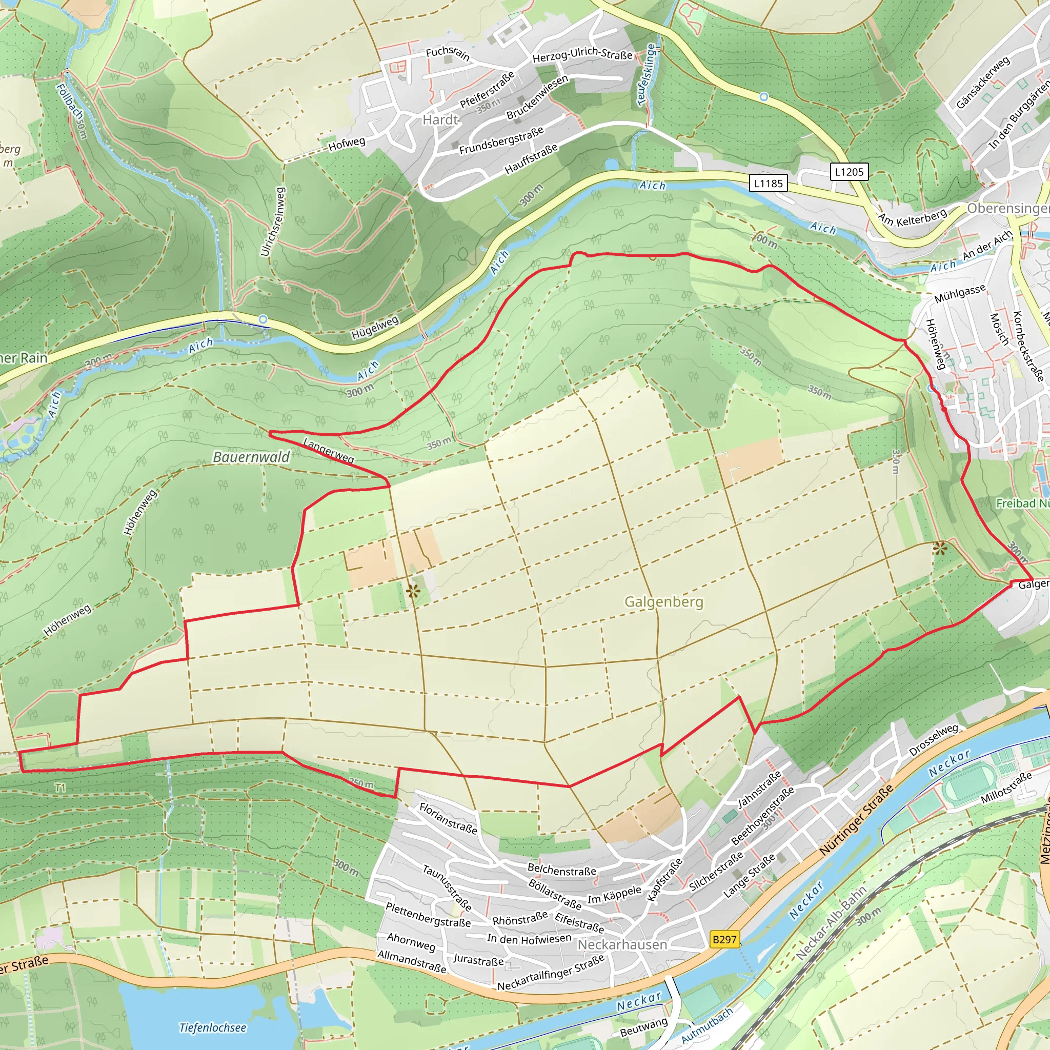
Starting near the picturesque town of Esslingen, Germany, the Bauernwald and Galgenberg Loop offers a delightful 9 km (5.6 miles) journey through a blend of historical and natural landscapes. The trailhead is conveniently accessible by both public transport and car. If you're coming by train, Esslingen is well-connected to Stuttgart, and from the Esslingen train station, local buses can take you closer to the trailhead. For those driving, parking is available near the starting point, which is close to the Esslingen University of Applied Sciences.
Trail Overview
The loop trail is approximately 9 km (5.6 miles) long with an elevation gain of around 100 meters (328 feet), making it a moderately challenging hike suitable for most fitness levels. The trail is well-marked, but it's always a good idea to have a reliable navigation tool like HiiKER to ensure you stay on track.
Historical Significance
As you embark on the trail, you'll quickly find yourself immersed in the rich history of the region. Esslingen itself is a town with a deep historical background, dating back to the Middle Ages. The trail takes you through areas that were once significant during various historical periods, including the Bauernwald, which translates to "Farmers' Forest." This area was historically used for agriculture and forestry by local farmers.
One of the most intriguing parts of the hike is the Galgenberg, or "Gallows Hill." This site was historically used for executions, and while it may sound grim, it offers a fascinating glimpse into the past. The hill provides panoramic views of the surrounding countryside, making it a perfect spot for a rest and some reflection.
Nature and Wildlife
The trail meanders through dense forests and open meadows, offering a diverse range of flora and fauna. In the spring and summer months, the meadows are alive with wildflowers, attracting a variety of butterflies and bees. The forested sections are home to deer, foxes, and a plethora of bird species, making it a haven for wildlife enthusiasts.
Landmarks and Points of Interest
Around the 3 km (1.9 miles) mark, you'll come across a charming wooden bridge that crosses a small stream. This is a great spot for a quick break and some photos. Continuing on, at approximately 5 km (3.1 miles), you'll reach a scenic viewpoint that offers stunning vistas of the Swabian Alps in the distance.
Another notable landmark is the old stone well located around the 7 km (4.3 miles) point. This well has been a source of fresh water for centuries and is a testament to the ingenuity of the region's early inhabitants.
Trail Conditions and Preparation
The trail is generally well-maintained, but it's advisable to wear sturdy hiking boots, especially after rain, as some sections can become muddy. The elevation gain is gradual, making it manageable for most hikers, but be prepared for a few steeper sections, particularly as you approach Galgenberg.
Getting There
For those using public transport, take a train to Esslingen station. From there, local buses can take you closer to the trailhead near the Esslingen University of Applied Sciences. If driving, set your GPS to Esslingen University of Applied Sciences, where parking is available.
Remember to carry enough water, snacks, and a first-aid kit. A map or a navigation app like HiiKER is essential to ensure you stay on the right path. Enjoy your hike through this beautiful and historically rich region!
What to expect?
Activity types
Comments and Reviews
User comments, reviews and discussions about the Bauernwald and Galgenberg Loop, Germany.
4.5
average rating out of 5
2 rating(s)

