Download
Preview
Add to list
More
8.1 km
~1 hrs 41 min
36 m
Loop
“Embark on the MVV Wanderweg Dreieck Ottenhofen for an 8 km scenic loop through picturesque Bavarian landscapes.”
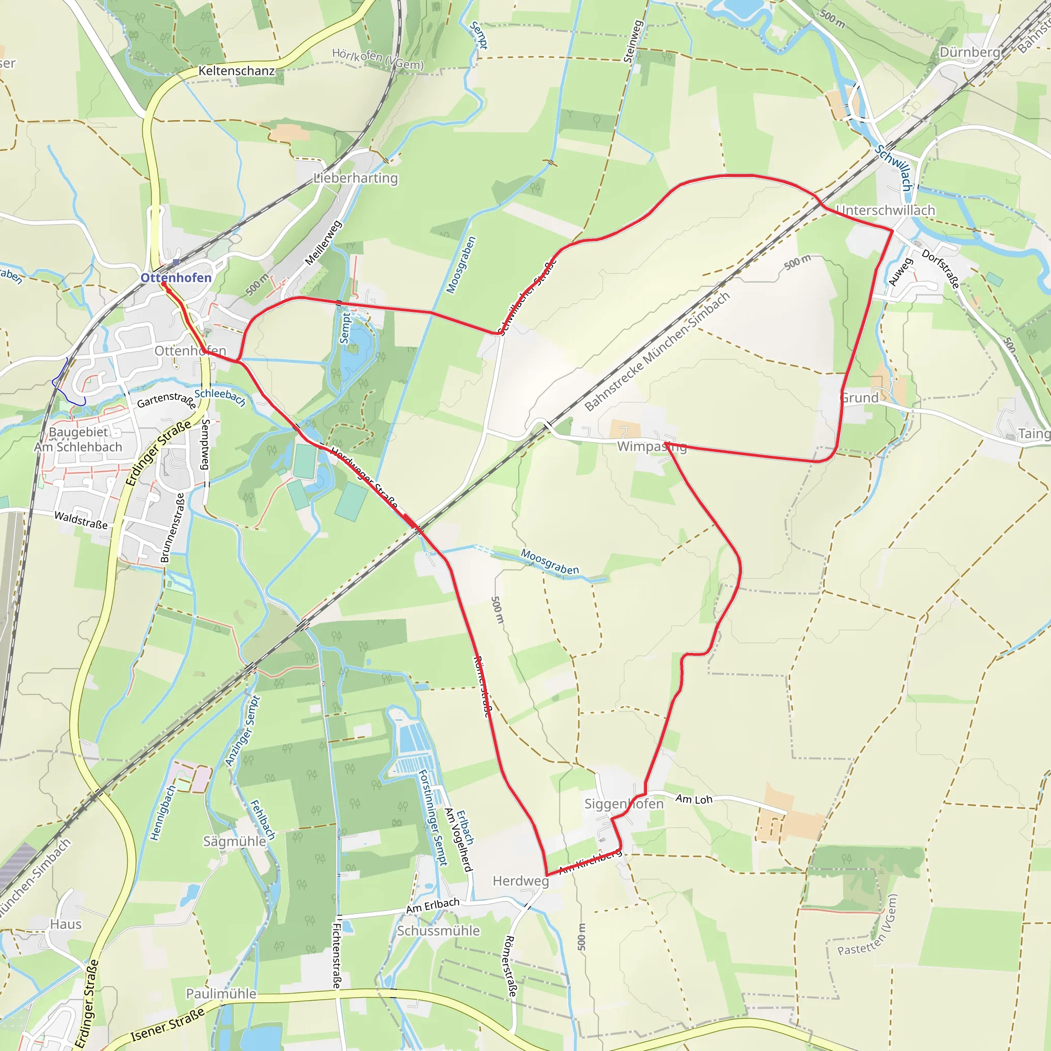
Starting near the charming town of Erding, Germany, the MVV Wanderweg Dreieck Ottenhofen is an 8 km (approximately 5 miles) loop trail with no significant elevation gain, making it accessible for a wide range of hikers. The trailhead is conveniently located near Erding, which is easily accessible by both public transport and car. If you're traveling by public transport, you can take the S-Bahn S2 line to Ottenhofen station, which is a short walk from the trailhead. For those driving, there are parking facilities available near the starting point.
Trail Overview
The MVV Wanderweg Dreieck Ottenhofen offers a delightful mix of natural beauty and cultural landmarks. As you embark on this medium-difficulty hike, you'll traverse through picturesque Bavarian countryside, characterized by rolling fields, dense woodlands, and serene water bodies. The trail is well-marked, but it's always a good idea to have a reliable navigation tool like HiiKER to ensure you stay on track.
Key Landmarks and Points of Interest
#### Ottenhofen Village At the beginning of your hike, you'll pass through the quaint village of Ottenhofen. This small village is known for its traditional Bavarian architecture and friendly locals. Take a moment to appreciate the charming houses and well-maintained gardens.
#### Erding River About 2 km (1.2 miles) into the hike, you'll encounter the Erding River. This serene waterway is a perfect spot for a short break. The riverbanks are often dotted with wildflowers, and you might even spot some local wildlife, such as ducks and herons.
#### Historical Significance The region around Erding has a rich history dating back to the medieval period. As you hike, you'll come across several historical markers and plaques that provide insights into the area's past. One notable site is the remnants of an old mill, located approximately 4 km (2.5 miles) into the trail. This mill played a crucial role in the local economy during the 18th century.
Flora and Fauna
The trail is a haven for nature enthusiasts. The woodlands are home to a variety of tree species, including oak, beech, and pine. In the spring and summer months, the forest floor is carpeted with wildflowers, adding a splash of color to your hike. Birdwatchers will be delighted by the diverse avian population, which includes species like the European robin, blackbird, and great tit.
Practical Information
- Distance: 8 km (5 miles) - Elevation Gain: 0 meters (0 feet) - Difficulty: Medium - Trail Type: Loop
Getting There
- By Public Transport: Take the S-Bahn S2 line to Ottenhofen station. The trailhead is a short walk from the station. - By Car: Parking is available near the trailhead in Ottenhofen.
Tips for Hikers
- Navigation: Use HiiKER for accurate trail navigation. - Footwear: Comfortable hiking shoes are recommended due to the mixed terrain. - Weather: Check the weather forecast before heading out, as the trail can become muddy after rain. - Supplies: Carry enough water and snacks, as there are limited facilities along the trail.
Enjoy your hike on the MVV Wanderweg Dreieck Ottenhofen, where natural beauty and historical intrigue await at every turn.
What to expect?
Activity types
Comments and Reviews
User comments, reviews and discussions about the MVV Wanderweg Dreieck Ottenhofen, Germany.
average rating out of 5
0 rating(s)

