Download
Preview
Add to list
More
10.6 km
~2 hrs 28 min
209 m
Loop
“Explore the scenic 11 km Mettenberg via Stromberg trail, rich in history, nature, and stunning landscapes.”
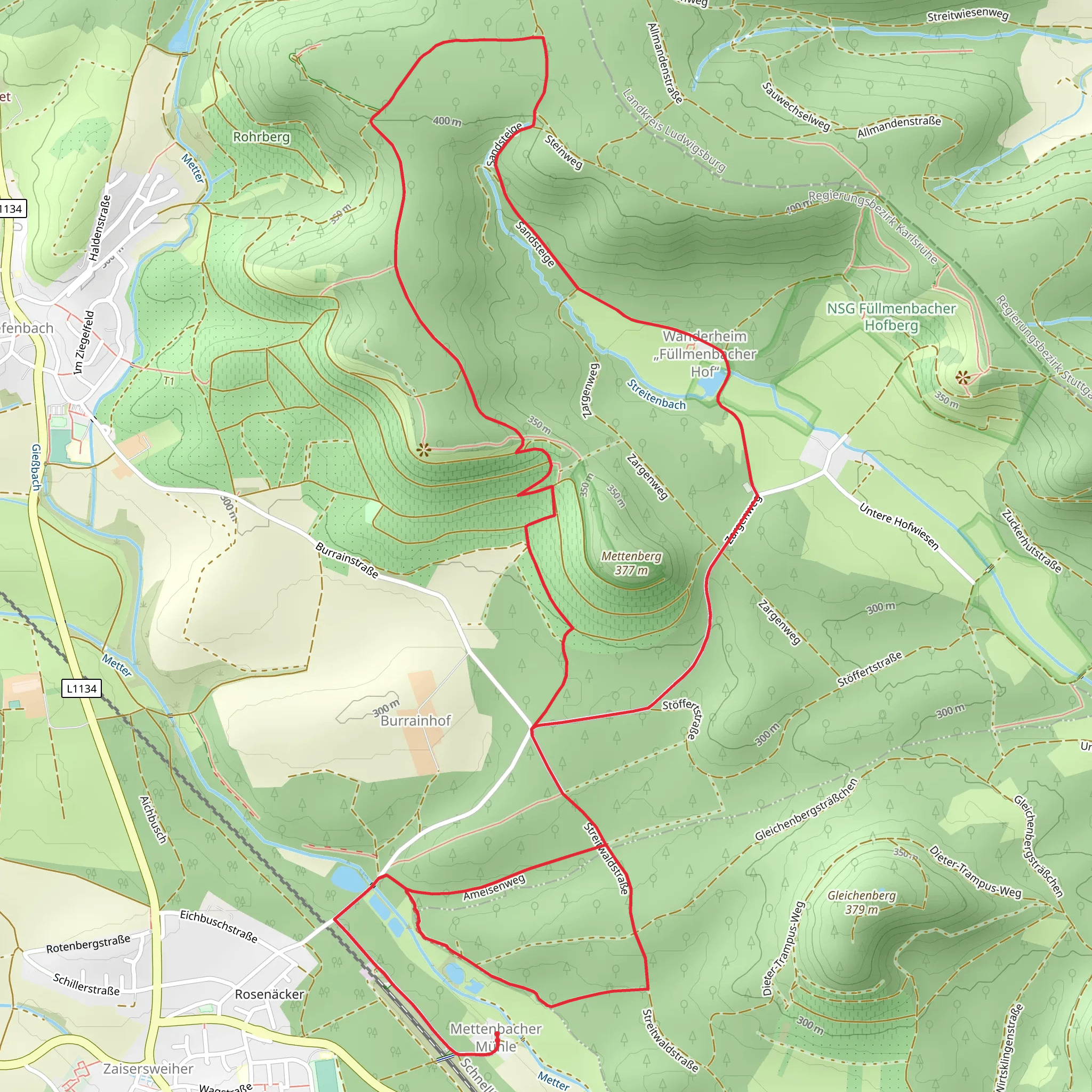
Starting near Enzkreis, Germany, the Mettenberg via Stromberg trail is a captivating 11 km (approximately 6.8 miles) loop with an elevation gain of around 200 meters (656 feet). This medium-difficulty trail offers a blend of natural beauty, historical landmarks, and diverse wildlife, making it a rewarding experience for hikers.
Getting There To reach the trailhead, you can drive or use public transport. If driving, set your GPS to Enzkreis, Germany, and look for parking near the starting point. For public transport, take a train or bus to the nearest station in Enzkreis, and from there, you can either walk or take a short taxi ride to the trailhead.
Trail Overview The trail begins with a gentle ascent through lush forests, where you can enjoy the serene ambiance and the sound of rustling leaves. As you progress, the path becomes more varied, with sections of open meadows and dense woodland. The initial 2 km (1.2 miles) offer a gradual climb, gaining about 50 meters (164 feet) in elevation.
Key Landmarks and Nature Around the 3 km (1.9 miles) mark, you'll encounter the first significant landmark, the historic Stromberg Castle ruins. These ruins date back to the medieval period and provide a glimpse into the region's rich history. Take a moment to explore the remnants and imagine the lives of those who once inhabited this fortress.
Continuing on, the trail leads you through a picturesque valley, where you might spot local wildlife such as deer, foxes, and various bird species. The flora is equally impressive, with a mix of deciduous and coniferous trees, wildflowers, and ferns. This section is relatively flat, allowing you to fully appreciate the natural surroundings.
Midpoint and Elevation Gain At approximately 5.5 km (3.4 miles), you'll reach the midpoint of the loop, where the trail begins to ascend more steeply. Over the next 2 km (1.2 miles), you'll gain about 100 meters (328 feet) in elevation. This part of the hike can be challenging, but the effort is well worth it as you approach the summit of Mettenberg.
Summit and Views The summit of Mettenberg offers panoramic views of the surrounding landscape, including the Black Forest and the Swabian Jura. On a clear day, you can see for miles, making it an ideal spot for a rest and some photography. The elevation here is the highest point of the trail, providing a sense of accomplishment.
Descent and Return The descent begins gradually, with the trail winding through more forested areas. Around the 8 km (5 miles) mark, you'll pass by a charming stream, where you can take a short break and enjoy the soothing sounds of flowing water. The final 3 km (1.9 miles) of the trail are relatively easy, with a gentle downhill slope leading you back to the trailhead.
Navigation and Safety For navigation, it's recommended to use the HiiKER app, which provides detailed maps and real-time updates. Ensure you have adequate water, snacks, and appropriate footwear, as some sections can be slippery, especially after rain. Always check the weather forecast before heading out and inform someone of your plans.
This trail offers a perfect blend of natural beauty, historical intrigue, and physical challenge, making it a must-visit for any hiking enthusiast.
What to expect?
Activity types
Comments and Reviews
User comments, reviews and discussions about the Mettenberg via Stromberg, Germany.
5.0
average rating out of 5
2 rating(s)

