Download
Preview
Add to list
More
14.2 km
~3 hrs 36 min
454 m
Loop
“The 14 km Rosenwanderweg trail in Donnersbergkreis offers a captivating blend of nature, history, and wildlife.”
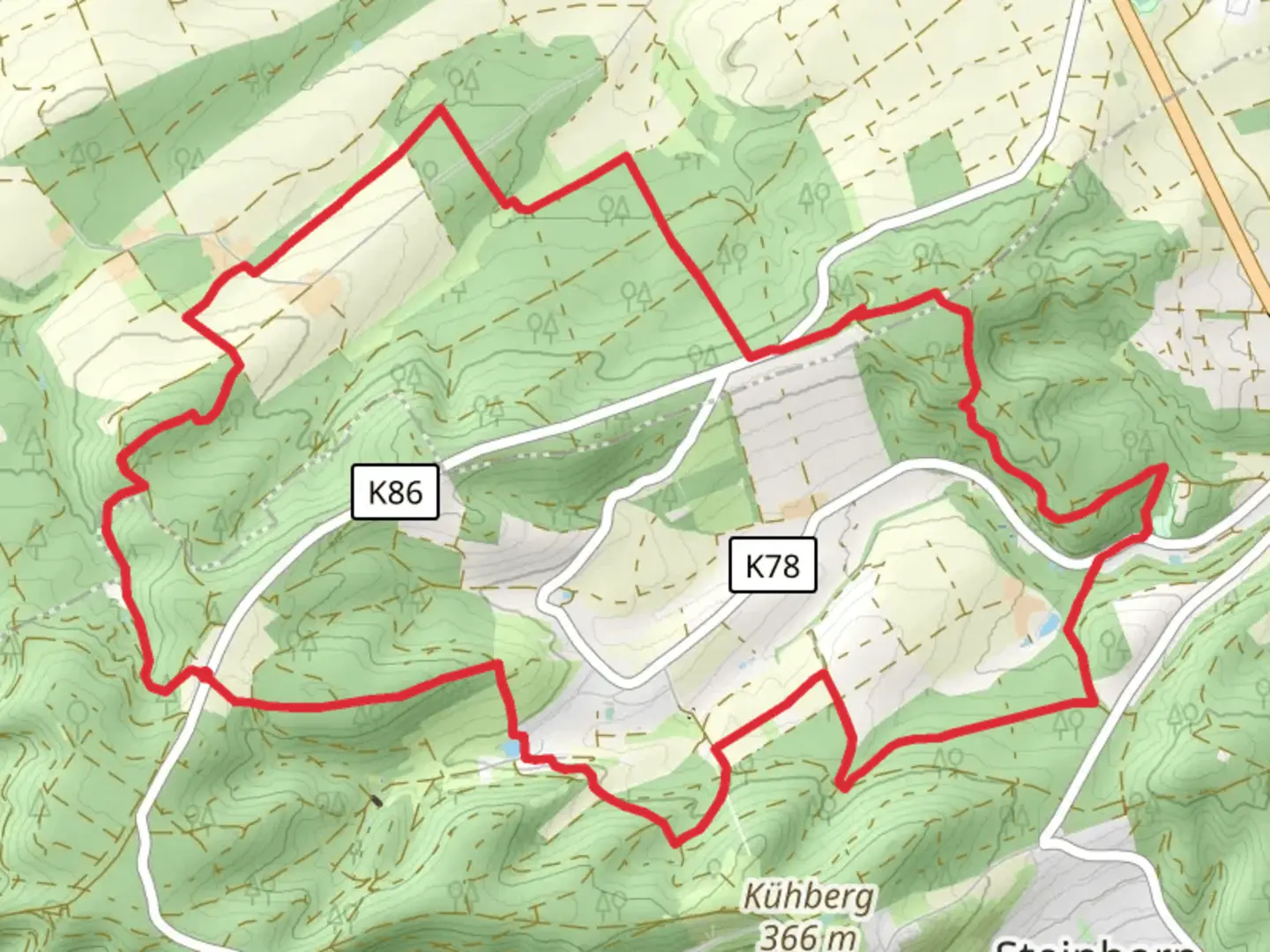
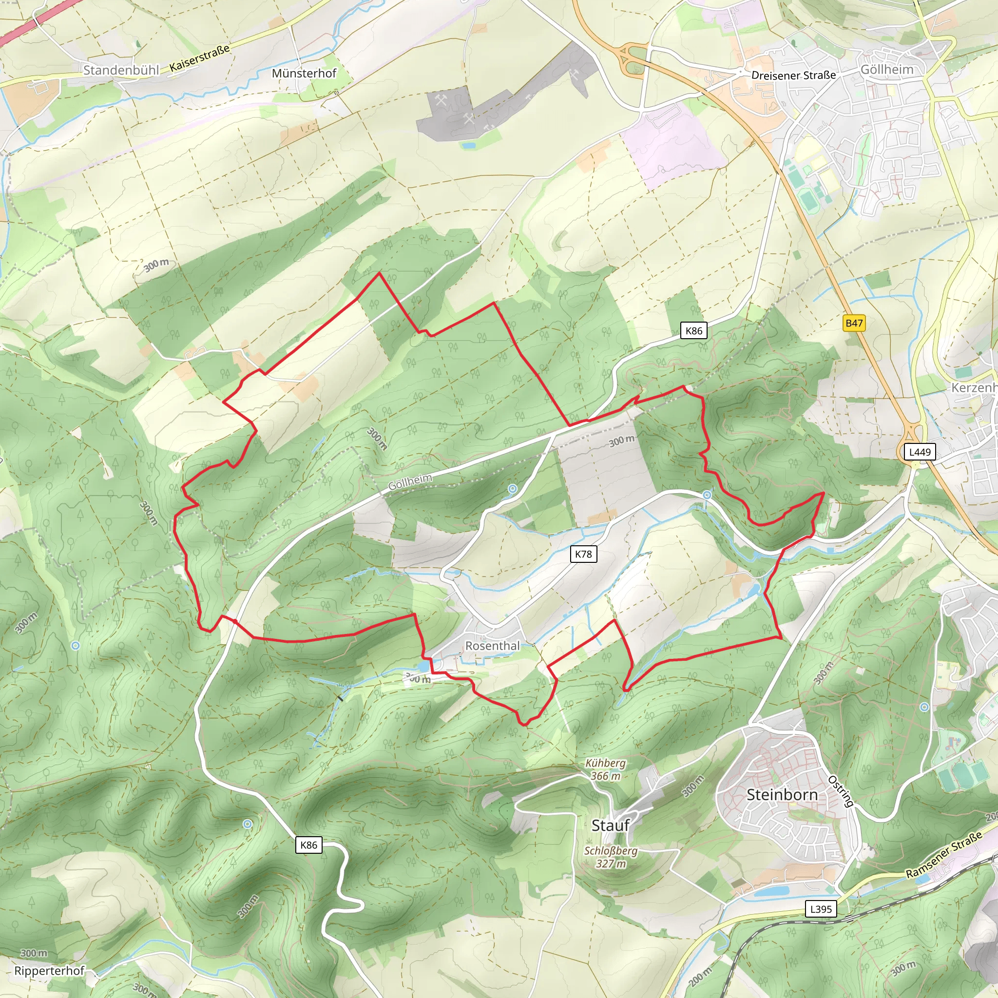
Starting near Donnersbergkreis, Germany, the Rosenwanderweg and Saar Rhein Main Weg Teil 1 is a captivating 14 km (8.7 miles) loop trail with an elevation gain of around 400 meters (1,312 feet). This medium-difficulty trail offers a blend of natural beauty, historical landmarks, and diverse wildlife, making it an excellent choice for hikers looking to explore the region.
Getting There To reach the trailhead, you can either drive or use public transport. If driving, set your GPS to Donnersbergkreis, and you’ll find parking options near the starting point. For those using public transport, take a train to Kirchheimbolanden, the nearest town, and then a local bus or taxi to the trailhead.
Trail Overview The trail begins with a gentle ascent through lush forests, where you’ll be greeted by the scent of pine and the sound of rustling leaves. As you climb, the path becomes steeper, offering panoramic views of the surrounding countryside. The first 3 km (1.9 miles) will take you through dense woodland, gradually gaining about 150 meters (492 feet) in elevation.
Significant Landmarks At around the 4 km (2.5 miles) mark, you’ll come across the ruins of an old castle, a testament to the region’s rich history. This site offers a perfect spot for a short break and some exploration. The castle ruins are a reminder of the medieval times when this area was a strategic point of defense.
Continuing on, the trail leads you to a picturesque meadow filled with wildflowers, especially roses, which the trail is named after. This section is relatively flat and stretches for about 2 km (1.2 miles), providing a welcome respite from the earlier climb.
Nature and Wildlife The trail is home to a variety of wildlife, including deer, foxes, and numerous bird species. Keep an eye out for the European green woodpecker and the Eurasian jay, both commonly seen in this area. The flora is equally diverse, with oak, beech, and pine trees dominating the landscape.
Midpoint and Elevation Gain Around the 7 km (4.3 miles) midpoint, you’ll reach the highest point of the trail, offering stunning views of the Donnersberg massif. Here, you’ve gained approximately 400 meters (1,312 feet) in elevation. This is an ideal spot for a longer break, where you can enjoy a packed lunch while taking in the breathtaking scenery.
Historical Significance The Donnersberg region has a rich history dating back to the Celtic era. The trail passes by several ancient sites, including remnants of Celtic fortifications. These historical markers provide a glimpse into the lives of the early inhabitants of the area.
Final Stretch The descent begins after the midpoint, leading you through a series of switchbacks that gradually bring you back down to the valley floor. This section is about 5 km (3.1 miles) long and can be a bit challenging due to loose rocks, so watch your footing. The final 2 km (1.2 miles) are relatively flat, taking you through a serene forest path that eventually loops back to the starting point.
Navigation For navigation, it’s highly recommended to use the HiiKER app, which provides detailed maps and real-time updates to ensure you stay on track.
Practical Tips - Wear sturdy hiking boots with good ankle support. - Carry enough water and snacks, as there are no facilities along the trail. - Check the weather forecast before you go, as conditions can change rapidly. - Bring a first aid kit and a fully charged phone for emergencies.
This trail offers a perfect blend of natural beauty, historical intrigue, and physical challenge, making it a must-visit for any hiking enthusiast.
What to expect?
Activity types
Comments and Reviews
User comments, reviews and discussions about the Rosenwanderweg and Saar Rhein Main Weg Teil 1, Germany.
average rating out of 5
0 rating(s)
