Download
Preview
Add to list
More
7.0 km
~1 hrs 47 min
237 m
Loop
“Explore the Mosel Camino and Brauneberg Jufferweg: a 7 km trail of scenic views, history, and vineyards.”
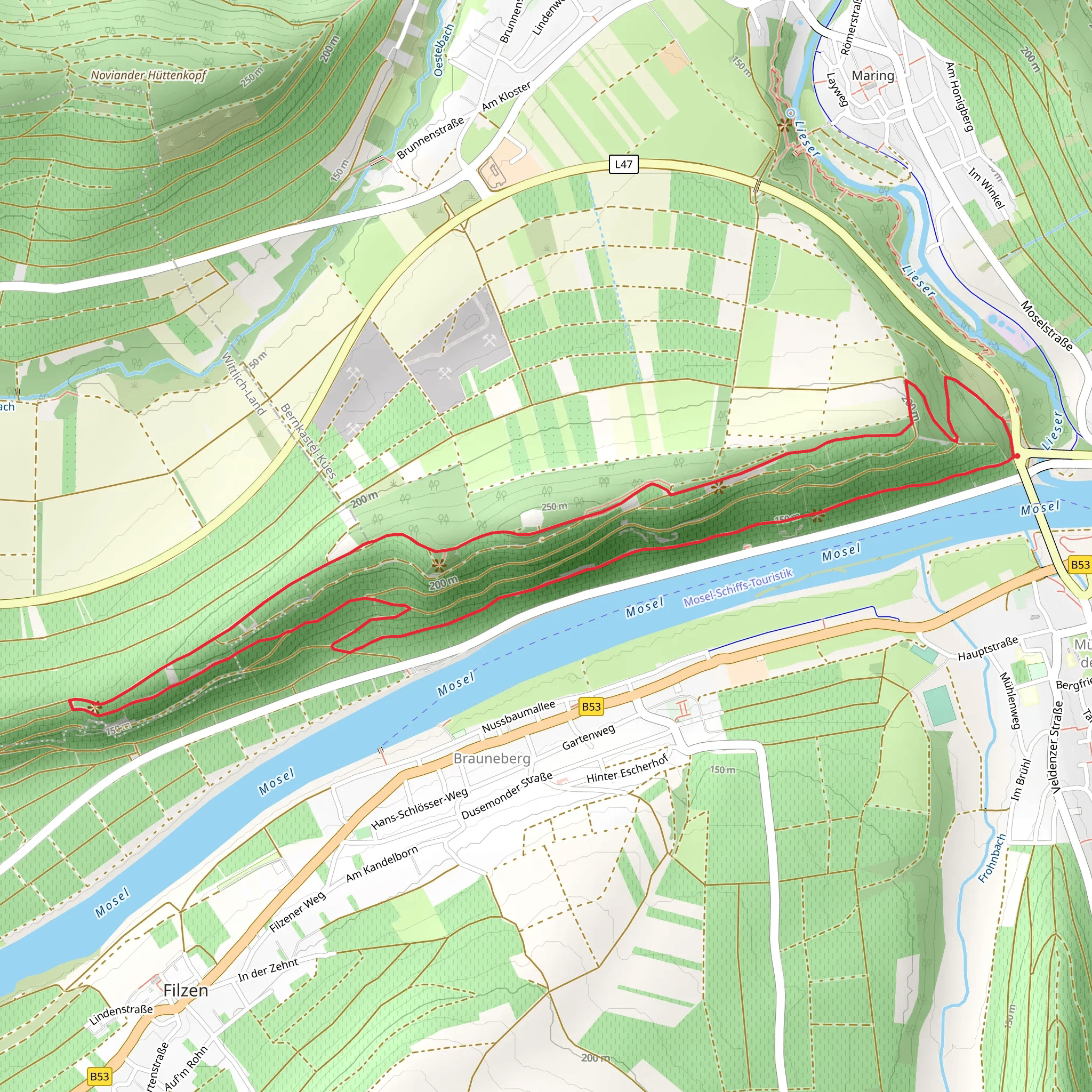
Starting near Bernkastel-Wittlich, Germany, the Mosel Camino and Brauneberg Jufferweg is a picturesque loop trail that spans approximately 7 km (4.35 miles) with an elevation gain of around 200 meters (656 feet). This medium-difficulty trail offers a blend of natural beauty, historical landmarks, and cultural significance, making it a rewarding experience for hikers.
Getting There
To reach the trailhead, you can either drive or use public transport. If you're driving, head towards Bernkastel-Wittlich and look for parking options near the starting point. For those using public transport, the nearest significant landmark is the Bernkastel-Kues bus station. From there, local buses or a short taxi ride can get you to the trailhead.
Trail Highlights
#### Scenic Views and Vineyards
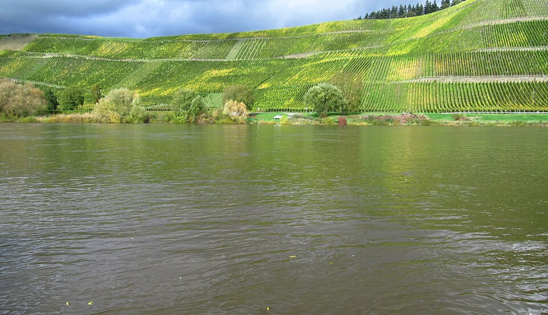
The trail meanders through the stunning Mosel Valley, renowned for its terraced vineyards and sweeping views of the Moselle River. As you hike, you'll pass through lush vineyards that produce some of Germany's finest Riesling wines. The trail offers several vantage points where you can pause to take in the panoramic views of the river and surrounding hills.
#### Historical Significance
The Mosel Camino is part of the larger Camino de Santiago network, a historic pilgrimage route. Along the way, you'll encounter markers and signs that indicate its connection to this ancient path. The Brauneberg Jufferweg section is named after the famous Brauneberg Juffer vineyard, which has a rich history dating back to Roman times. Keep an eye out for informational plaques that provide insights into the region's winemaking heritage.
Flora and Fauna
The trail is a haven for nature enthusiasts. Depending on the season, you might spot a variety of wildlife, including deer, foxes, and numerous bird species. The flora is equally diverse, with wildflowers, shrubs, and trees lining the path. In spring and summer, the trail bursts into a riot of colors, making it a photographer's delight.
Navigation and Safety
For navigation, it's highly recommended to use the HiiKER app, which provides detailed maps and real-time updates. The trail is well-marked, but having a reliable navigation tool ensures you stay on track. The terrain is varied, with some steep sections, so sturdy hiking boots are advisable. Carry enough water and snacks, as there are limited facilities along the route.
Points of Interest
- Brauneberg Juffer Vineyard: Approximately 3 km (1.86 miles) into the hike, you'll reach this iconic vineyard. Take a moment to appreciate the meticulously maintained vines and perhaps sample some local wine if you visit during harvest season. - Moselle River Views: Around the halfway mark, the trail offers breathtaking views of the Moselle River. This is an ideal spot for a rest and some photography. - Historical Markers: Scattered along the trail, these markers provide fascinating insights into the region's history and its significance as part of the Camino de Santiago.
Final Stretch
As you loop back towards the starting point, the trail descends gently, offering more scenic views and a chance to reflect on the journey. The final section is relatively easy, allowing you to finish the hike on a relaxed note.
This trail is a perfect blend of natural beauty, historical intrigue, and moderate physical challenge, making it a must-visit for any hiking enthusiast.
Comments and Reviews
User comments, reviews and discussions about the Mosel Camino and Brauneberg Jufferweg, Germany.
5.0
average rating out of 5
2 rating(s)

