Wasseralm, Berchtesgadener Land to Carl-von-Stahl-Haus Walk via Seeleinsee and AV Weg 416
Download
Preview
Add to list
More
13.2 km
~1 day 0 hrs
1603 m
Point-to-Point
“Embark on a challenging 13 km hike in Berchtesgadener Land, featuring stunning alpine views and rich biodiversity.”
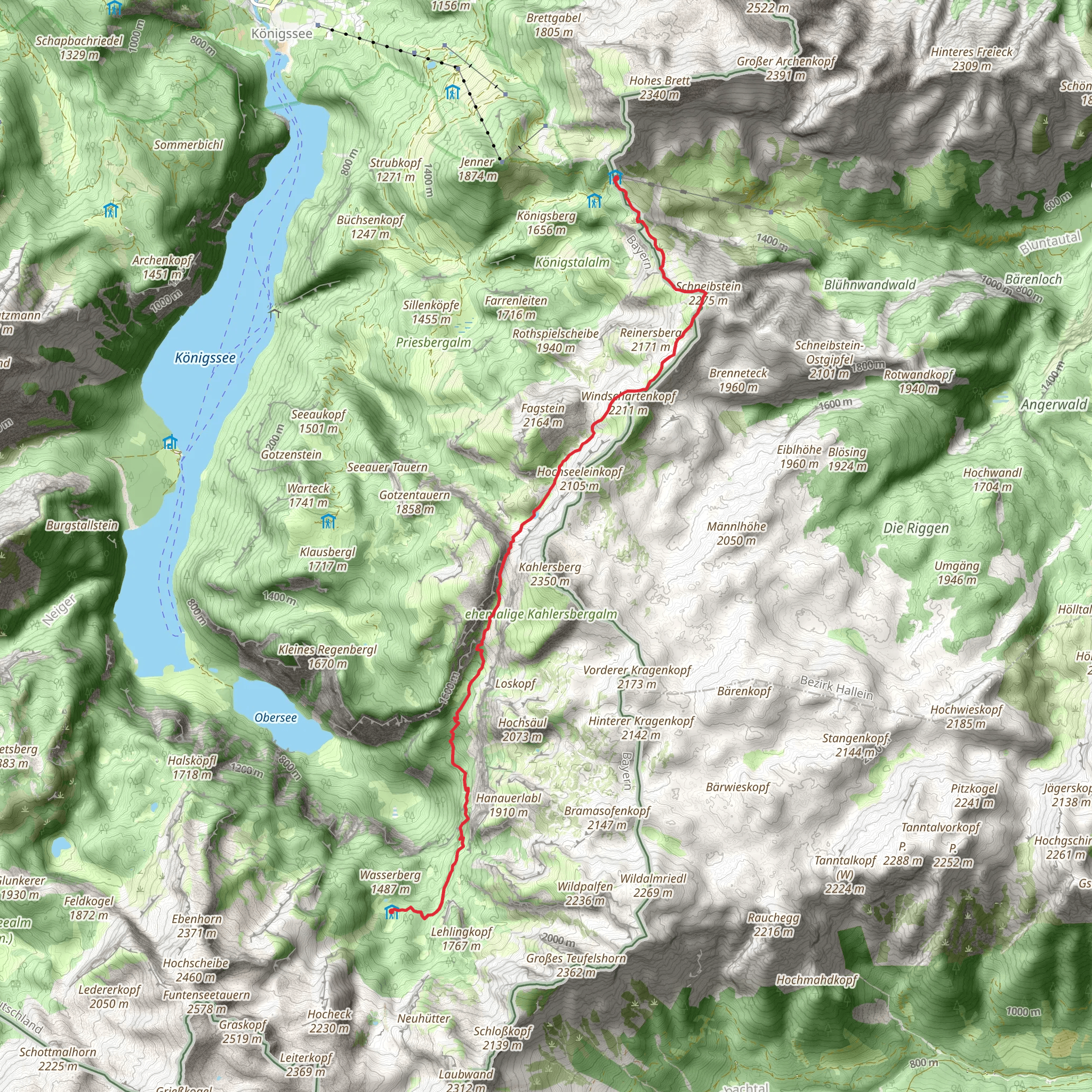
Starting your hike near Berchtesgadener Land, Germany, this 13 km (8 miles) point-to-point trail offers a challenging yet rewarding experience with an elevation gain of approximately 1600 meters (5250 feet). The trailhead is accessible by car or public transport. If you're driving, you can park near the Königssee parking area. For those using public transport, take a bus to the Königssee bus stop, which is well-connected from Berchtesgaden.
Initial Ascent and Terrain
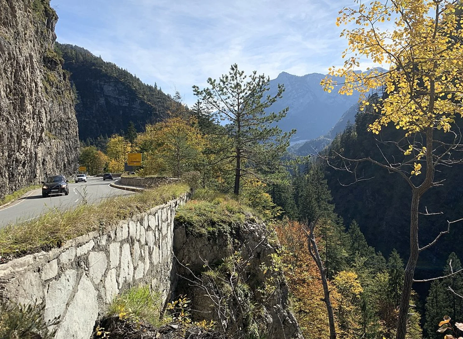
The trail begins with a steep ascent through dense forest, where you'll immediately start gaining elevation. The first few kilometers are quite demanding, so be prepared for a rigorous climb. The path is well-marked, but it's advisable to use HiiKER for navigation to ensure you stay on track. As you ascend, the forest gradually thins out, offering glimpses of the surrounding mountains.
Seeleinsee Lake
Around the 5 km (3 miles) mark, you'll reach the picturesque Seeleinsee Lake. This alpine lake is a perfect spot for a short break. The crystal-clear waters reflect the surrounding peaks, creating a serene and breathtaking view. The elevation here is approximately 1800 meters (5905 feet), and the terrain becomes rockier as you continue your hike.
AV Weg 416
After Seeleinsee, the trail merges with AV Weg 416. This section is less steep but still challenging, with rocky paths and occasional scree slopes. The trail is well-maintained, but caution is advised, especially in wet conditions. The flora here is diverse, with alpine flowers dotting the landscape during the summer months.
Wildlife and Nature
Keep an eye out for local wildlife, including marmots and chamois. Birdwatchers might spot golden eagles soaring above. The area is rich in biodiversity, and the changing altitudes offer a variety of ecosystems, from dense forests to alpine meadows.
Historical Significance
The Berchtesgadener Land region is steeped in history. During World War II, it was a significant area for the German military, and remnants of this era can still be found. The trail itself, however, is more focused on natural beauty and less on historical landmarks.
Final Ascent to Carl-von-Stahl-Haus
The final stretch to Carl-von-Stahl-Haus is the most challenging part of the hike. The elevation gain here is significant, and the path becomes narrower and more rugged. The hut is situated at an elevation of approximately 1736 meters (5695 feet). Once you reach Carl-von-Stahl-Haus, you'll be rewarded with panoramic views of the surrounding peaks and valleys. The hut offers basic amenities and is a great place to rest and refuel before heading back or continuing your adventure.
Getting Back
From Carl-von-Stahl-Haus, you can either retrace your steps or arrange for transportation back to Berchtesgaden. The hut is accessible by a cable car that descends to the Obersalzberg area, where you can catch a bus back to Berchtesgaden.
This trail offers a mix of challenging terrain, stunning natural beauty, and a touch of historical intrigue, making it a must-do for any avid hiker.
What to expect?
Activity types
Comments and Reviews
User comments, reviews and discussions about the Wasseralm, Berchtesgadener Land to Carl-von-Stahl-Haus Walk via Seeleinsee and AV Weg 416, Germany.
4.0
average rating out of 5
3 rating(s)
