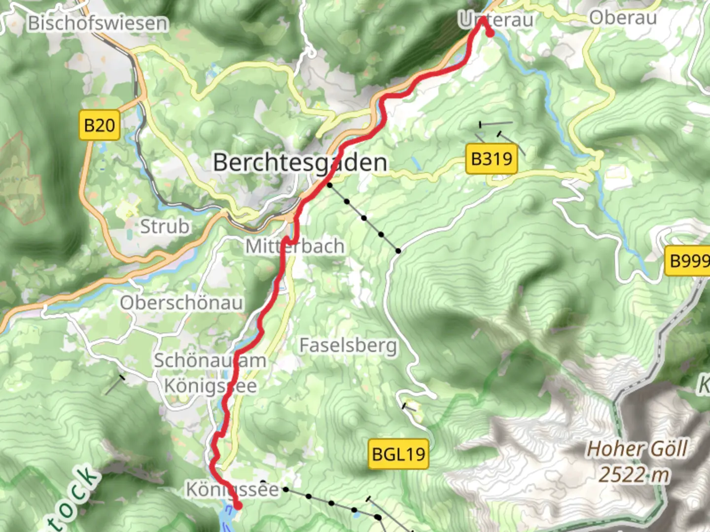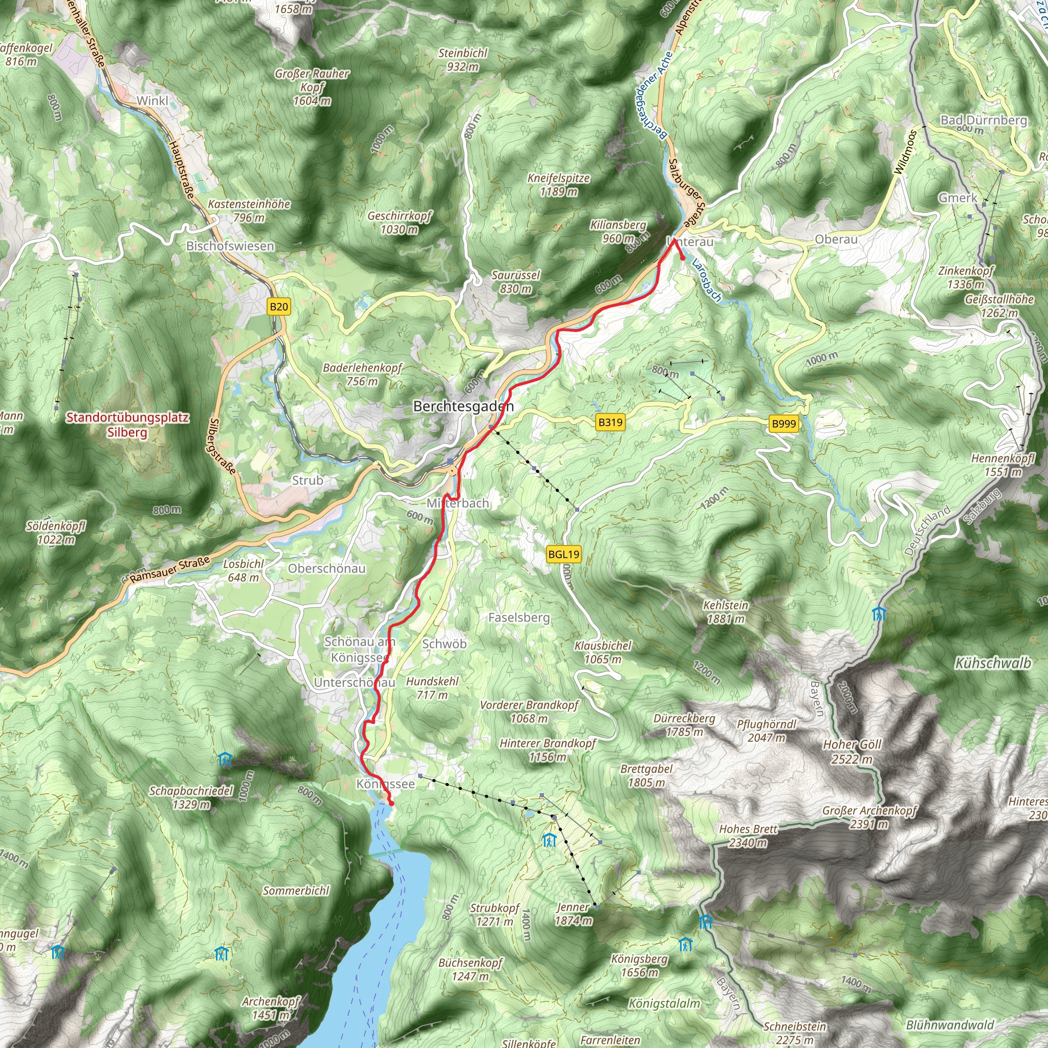
Unterau to Konigssee Walk via River Berchtesgadener Ache
Download
Preview
Add to list
More
10.2 km
~2 hrs 22 min
201 m
Point-to-Point
“A picturesque 10 km hike from Unterau to Königssee, blending natural beauty, history, and alpine vistas.”
Starting near Berchtesgadener Land in Germany, the Unterau to Königssee Walk via River Berchtesgadener Ache is a picturesque point-to-point trail that stretches approximately 10 km (6.2 miles) with an elevation gain of around 200 meters (656 feet). This medium-difficulty hike offers a blend of natural beauty, historical significance, and serene landscapes.
Getting There To reach the trailhead, you can either drive or use public transport. If driving, head towards Berchtesgadener Land and look for parking options near the starting point. For those using public transport, take a train or bus to Berchtesgaden, which is well-connected to major cities like Munich and Salzburg. From Berchtesgaden, local buses can take you closer to the trailhead.
Trail Overview The trail begins near the scenic Berchtesgadener Land, a region known for its stunning alpine landscapes and rich history. As you start your hike, you'll follow the River Berchtesgadener Ache, a serene waterway that guides you through lush forests and open meadows.
Key Landmarks and Sections
#### River Berchtesgadener Ache The first few kilometers of the trail run parallel to the River Berchtesgadener Ache. This section is relatively flat and offers a peaceful start to your hike. Keep an eye out for local wildlife such as deer and various bird species that frequent the riverbanks.
#### Historical Significance As you continue, you'll pass through areas steeped in history. The Berchtesgadener Land region has a rich cultural heritage, with historical sites dating back to medieval times. Look out for old farmhouses and traditional Bavarian architecture that dot the landscape.
#### Elevation Gain Around the halfway mark, the trail begins to ascend, gaining approximately 200 meters (656 feet) in elevation. This section can be a bit challenging but offers rewarding views of the surrounding mountains and valleys. Make sure to take breaks and hydrate as you navigate this incline.
#### Scenic Views As you approach the latter part of the trail, the landscape opens up to offer breathtaking views of the Bavarian Alps. On clear days, you can see the towering peaks of Watzmann and Jenner, two of the most iconic mountains in the region.
Final Stretch to Königssee The final stretch of the trail leads you to the shores of Königssee, a pristine alpine lake known for its crystal-clear waters and dramatic backdrop. This area is a popular destination for tourists and locals alike, offering opportunities for boat rides and lakeside relaxation.
Navigation and Safety For navigation, it's highly recommended to use HiiKER, a reliable tool that provides detailed maps and real-time updates. Ensure you have appropriate hiking gear, including sturdy footwear, weather-appropriate clothing, and sufficient water and snacks.
Wildlife and Flora Throughout the hike, you'll encounter a variety of flora and fauna. The region is home to diverse plant species, including alpine flowers and dense forests of spruce and fir. Wildlife sightings may include marmots, chamois, and a variety of bird species.
This trail offers a perfect blend of natural beauty, historical intrigue, and moderate physical challenge, making it a must-visit for any hiking enthusiast exploring the Bavarian Alps.
What to expect?
Activity types
Comments and Reviews
User comments, reviews and discussions about the Unterau to Konigssee Walk via River Berchtesgadener Ache, Germany.
4.0
average rating out of 5
3 rating(s)
