Download
Preview
Add to list
More
13.6 km
~4 hrs 41 min
1188 m
Point-to-Point
“Embark on a scenic 14 km hike from Taubensee to Bayerisch Gmain, rich in natural beauty and history.”
Starting near Berchtesgadener Land, Germany, the Taubensee to Bayerisch Gmain Walk via Karkopf and Dreisesselberg is a point-to-point trail that spans approximately 14 kilometers (8.7 miles) with an elevation gain of around 1100 meters (3609 feet). This medium-difficulty hike offers a blend of natural beauty, historical significance, and challenging terrain.
Getting There To reach the trailhead, you can either drive or use public transport. If driving, head towards Berchtesgadener Land and look for parking near the Taubensee area. For those using public transport, take a train to Bad Reichenhall station, and from there, a local bus can take you closer to the trailhead. The nearest significant landmark to the starting point is the picturesque Taubensee Lake.
Trail Overview The trail begins near Taubensee, a serene lake surrounded by lush greenery. As you start your hike, you'll be greeted by the tranquil waters and the sounds of local wildlife. The initial part of the trail is relatively gentle, allowing you to ease into the hike.
Karkopf After approximately 5 kilometers (3.1 miles) and an elevation gain of about 400 meters (1312 feet), you'll reach Karkopf. This section of the trail offers panoramic views of the surrounding mountains and valleys. The terrain here becomes steeper, so be prepared for a more strenuous climb. The flora changes as you ascend, with alpine meadows giving way to rocky outcrops.
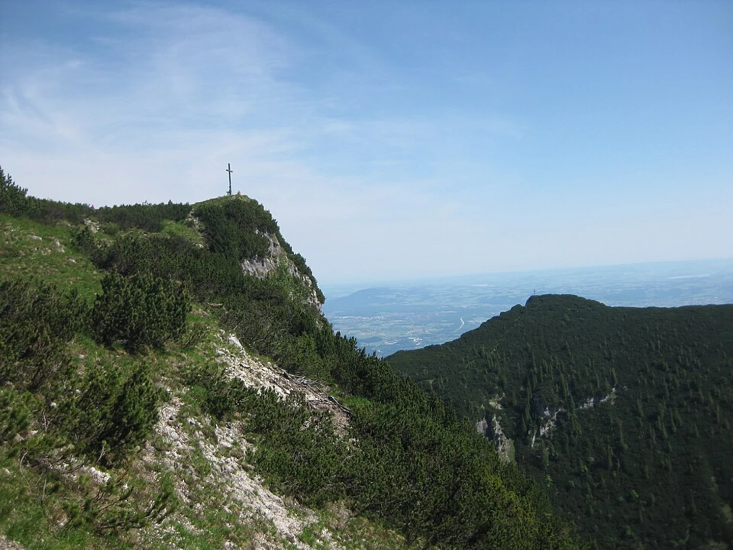
Dreisesselberg Continuing for another 4 kilometers (2.5 miles) and gaining an additional 300 meters (984 feet) in elevation, you'll arrive at Dreisesselberg. This peak is named after the three rock formations that resemble chairs. The views from here are breathtaking, offering a 360-degree panorama of the Bavarian Alps. This is a great spot to take a break and enjoy a packed lunch.
Wildlife and Nature Throughout the hike, keep an eye out for local wildlife such as chamois, marmots, and various bird species. The trail passes through diverse ecosystems, from dense forests to open meadows, each teeming with flora and fauna. In spring and summer, the meadows are adorned with wildflowers, adding a splash of color to the landscape.
Historical Significance The region has a rich history, with remnants of old trade routes and historical landmarks scattered along the trail. The area around Berchtesgadener Land has been inhabited for centuries, and you may come across ancient stone markers and ruins that hint at its storied past.
Navigation Given the trail's complexity, it's advisable to use a reliable navigation tool like HiiKER to ensure you stay on the right path. The app provides detailed maps and real-time updates, which can be invaluable, especially in areas where the trail may not be well-marked.
Final Stretch to Bayerisch Gmain The final 5 kilometers (3.1 miles) of the trail involve a descent of about 400 meters (1312 feet) towards Bayerisch Gmain. This section is less strenuous but requires careful footing, especially if the ground is wet. As you approach Bayerisch Gmain, the trail winds through charming villages and pastures, offering a glimpse into rural Bavarian life.
Reaching Bayerisch Gmain, you'll find various amenities including cafes and restaurants where you can relax and reflect on your hike. Public transport options are available here to take you back to your starting point or onward to your next destination.

What to expect?
Activity types
Comments and Reviews
User comments, reviews and discussions about the Taubensee to Bayerisch Gmain Walk via Karkopf and Dreisesselberg, Germany.
average rating out of 5
0 rating(s)