Roßfeld to Hinterbrand Scenic Walk via Hoher Goll and Gollscharte
Download
Preview
Add to list
More
11.9 km
~4 hrs 51 min
1489 m
Point-to-Point
“Traverse lush meadows and rugged peaks on the 12 km Roßfeld to Hinterbrand Scenic Walk, rich in history and vistas.”
Starting near Berchtesgadener Land, Germany, the Roßfeld to Hinterbrand Scenic Walk via Hoher Goll and Gollscharte is a point-to-point trail that spans approximately 12 km (7.5 miles) with an elevation gain of around 1400 meters (4593 feet). This trail is rated as medium difficulty and offers a blend of natural beauty, historical significance, and challenging terrain.
Getting There To reach the trailhead, you can either drive or use public transport. If driving, head towards the Roßfeld Panoramastraße, a scenic road that offers parking options. For those using public transport, take a train to Berchtesgaden Hauptbahnhof and then a bus towards Roßfeld Panoramastraße. The nearest significant landmark to the trailhead is the Roßfeld Panoramastraße viewpoint.
Trail Overview The trail begins with a gradual ascent through lush alpine meadows and dense forests. Early on, you'll encounter a series of switchbacks that help you gain elevation steadily. As you climb, the views open up, offering panoramic vistas of the Berchtesgaden Alps.
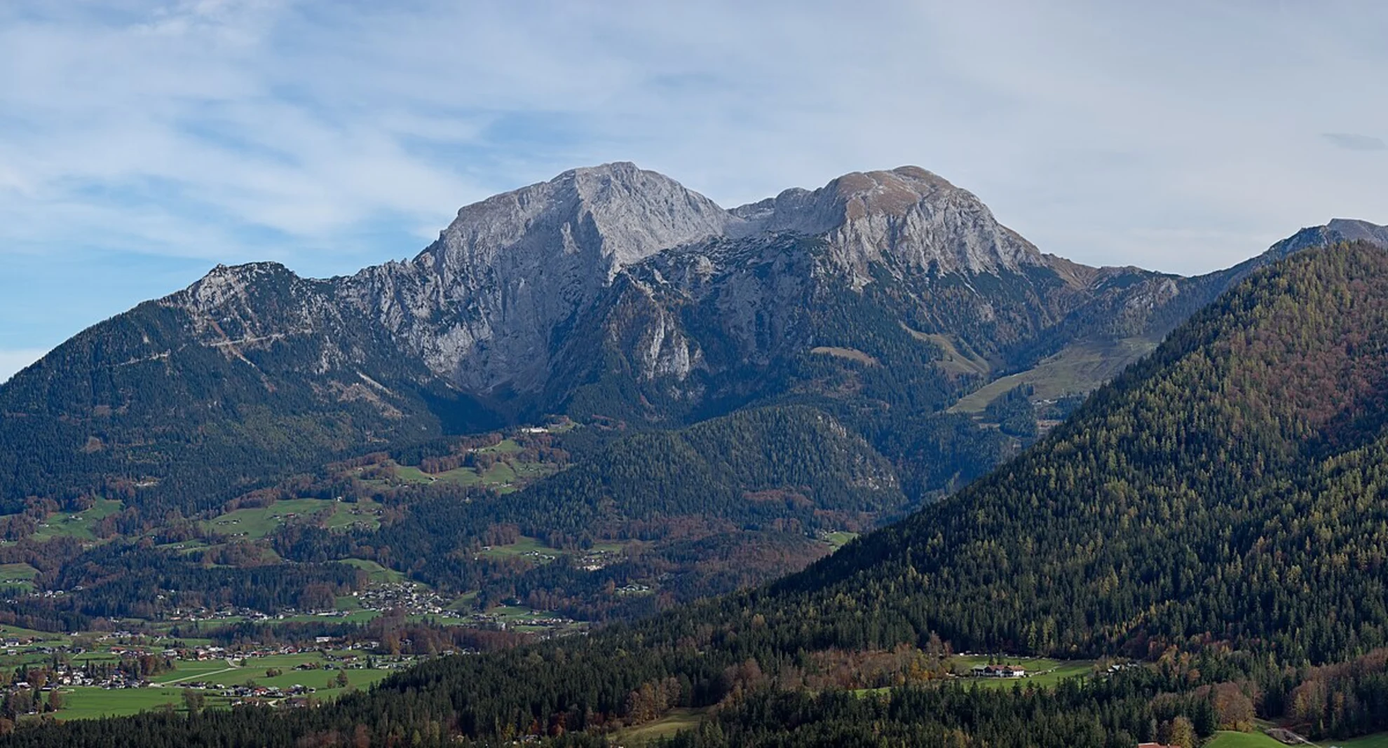
Key Landmarks and Sections #### Hoher Goll Around the 5 km (3.1 miles) mark, you'll reach the base of Hoher Goll, one of the most prominent peaks in the region. The ascent to Hoher Goll is steep and rocky, requiring careful footing. This section is particularly rewarding, offering breathtaking views of the surrounding peaks and valleys.
#### Gollscharte After summiting Hoher Goll, the trail descends slightly before reaching Gollscharte, a mountain pass that serves as a natural gateway between peaks. This area is known for its rugged beauty and is a great spot for a short rest. The elevation gain to this point is approximately 1000 meters (3281 feet).
Flora and Fauna The trail is rich in biodiversity. In the lower sections, you'll find a variety of alpine flowers, including edelweiss and gentians. As you ascend, the vegetation becomes sparser, giving way to hardy shrubs and mosses. Wildlife is abundant; keep an eye out for marmots, chamois, and golden eagles soaring overhead.
Historical Significance The Berchtesgadener Land region has a deep historical significance. During World War II, the area was home to the Eagle's Nest, a retreat for Adolf Hitler. While the trail itself does not pass by this site, the region's history adds a layer of depth to your hiking experience.
Final Stretch to Hinterbrand The final section of the trail involves a descent towards Hinterbrand. This part of the hike is less strenuous but requires attention due to loose rocks and uneven terrain. The descent offers stunning views of the Königssee and the Watzmann massif. The trail ends near the Hinterbrand parking area, where you can catch a bus back to Berchtesgaden or arrange for a pick-up.
Navigation For navigation, it is highly recommended to use the HiiKER app, which provides detailed maps and real-time updates. This will help you stay on track and ensure a safe and enjoyable hike.
This trail offers a perfect blend of natural beauty, challenging terrain, and historical context, making it a must-do for any avid hiker visiting the Berchtesgadener Land region.

What to expect?
Activity types
Comments and Reviews
User comments, reviews and discussions about the Roßfeld to Hinterbrand Scenic Walk via Hoher Goll and Gollscharte, Germany.
4.0
average rating out of 5
1 rating(s)