Kehlstein and Hoher Goll Loop via Kehlstein Hohen Goll Uber Mannlgrat
Download
Preview
Add to list
More
14.1 km
~1 day 0 hrs
1814 m
Loop
“This challenging 14 km loop near Berchtesgadener Land combines breathtaking landscapes, historical intrigue, and diverse wildlife.”
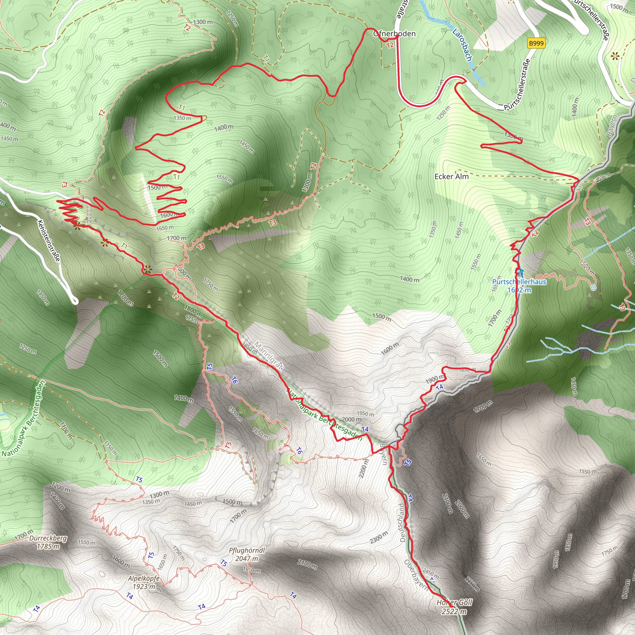
Starting your adventure near Berchtesgadener Land, Germany, the Kehlstein and Hoher Goll Loop via Kehlstein Hohen Goll Uber Mannlgrat is a challenging yet rewarding 14 km (8.7 miles) loop with an elevation gain of approximately 1800 meters (5905 feet). This trail offers a mix of historical significance, breathtaking landscapes, and diverse wildlife.
Getting There To reach the trailhead, you can drive or use public transport. If driving, head towards Berchtesgaden, a well-known town in the region. From there, follow signs to Obersalzberg, where you can park your car. For those using public transport, take a train to Berchtesgaden Hauptbahnhof and then a bus to Obersalzberg. The trailhead is conveniently located near the Documentation Center Obersalzberg, a significant historical site.
Trail Overview The trail begins with a steady ascent towards the Kehlsteinhaus, also known as the Eagle's Nest. This historical landmark, perched at an elevation of 1834 meters (6017 feet), was a gift to Adolf Hitler for his 50th birthday and offers panoramic views of the surrounding Alps. The initial climb is steep but manageable, with well-marked paths and occasional rest spots.
Kehlsteinhaus to Mannlgrat From the Kehlsteinhaus, the trail continues along the Mannlgrat ridge. This section is more technical, requiring careful navigation and a good head for heights. The ridge offers stunning views of the Berchtesgaden Alps and the Königsee below. It's advisable to use a reliable navigation tool like HiiKER to stay on track.
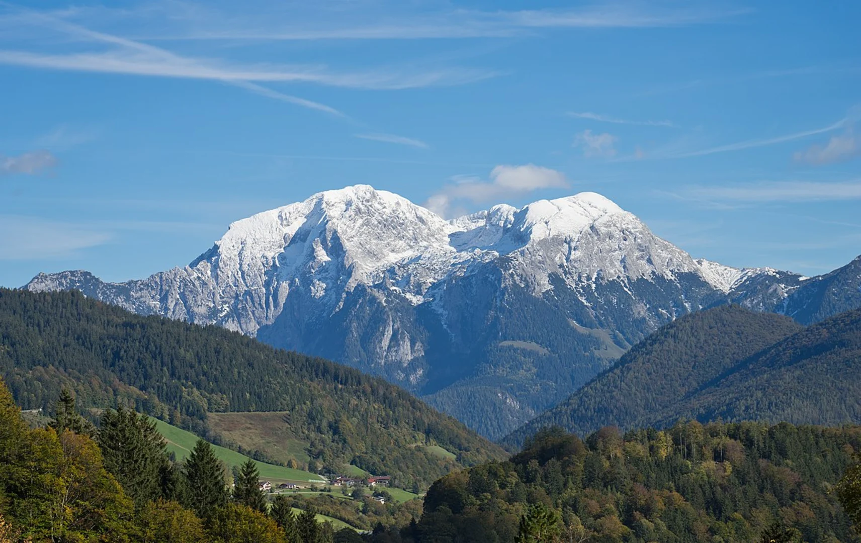
Mannlgrat to Hoher Goll After traversing the Mannlgrat, the trail ascends towards the Hoher Goll, the highest peak in the area at 2522 meters (8274 feet). This part of the hike is strenuous, with rocky terrain and steep inclines. However, the effort is well worth it as the summit provides unparalleled 360-degree views of the surrounding mountains and valleys. Keep an eye out for alpine wildlife such as chamois and marmots.
Descent and Return The descent from Hoher Goll is equally challenging, requiring careful footing and attention to the trail markers. The path winds through alpine meadows and dense forests, offering a different perspective of the landscape. As you make your way back to the trailhead, you'll pass through the picturesque Eckerwald forest, known for its rich biodiversity and serene atmosphere.
Historical Significance The region is steeped in history, particularly from World War II. The Kehlsteinhaus and the Documentation Center Obersalzberg provide insights into the area's past, making this hike not only a physical challenge but also an educational experience.
Wildlife and Nature The trail traverses diverse ecosystems, from alpine meadows to dense forests. Birdwatchers will enjoy spotting species like the golden eagle and the alpine chough. The flora varies with elevation, featuring everything from hardy alpine flowers to lush forest undergrowth.
Preparation and Safety Given the trail's difficulty, proper preparation is essential. Wear sturdy hiking boots, carry sufficient water, and pack layers to adjust to changing weather conditions. A map and compass or a navigation tool like HiiKER are crucial for staying on course, especially in the more technical sections.
This hike offers a blend of natural beauty, historical intrigue, and physical challenge, making it a must-do for experienced hikers visiting the Berchtesgadener Land region.
What to expect?
Activity types
Comments and Reviews
User comments, reviews and discussions about the Kehlstein and Hoher Goll Loop via Kehlstein Hohen Goll Uber Mannlgrat, Germany.
4.0
average rating out of 5
3 rating(s)
