Download
Preview
Add to list
More
10.2 km
~3 hrs 23 min
812 m
Loop
“The Grünstein Loop is a 10 km trail offering stunning views, rich wildlife, and moderate hiking challenges.”
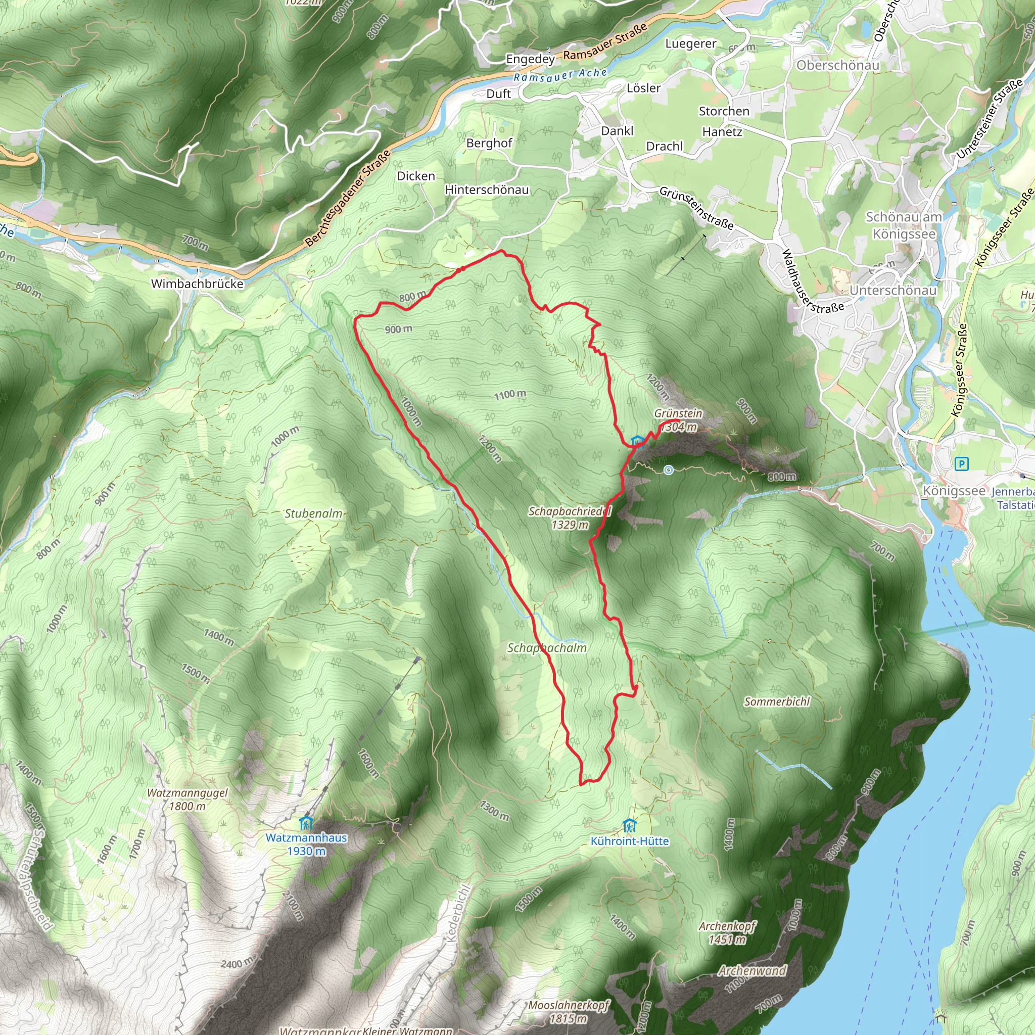
Starting near Berchtesgadener Land in Germany, the Grünstein Loop is a captivating 10 km (6.2 miles) trail with an elevation gain of approximately 800 meters (2,625 feet). This loop trail is rated as medium difficulty, making it suitable for moderately experienced hikers.### Getting There To reach the trailhead, you can either drive or use public transport. If driving, head towards the town of Schönau am Königssee, where ample parking is available near the Königssee lake. For those using public transport, take a train to Berchtesgaden Hauptbahnhof and then a bus to the Königssee bus stop. The trailhead is a short walk from there.### Trail Overview The Grünstein Loop offers a diverse hiking experience, combining lush forests, rocky paths, and panoramic views. Starting from the trailhead near Königssee, the initial part of the hike takes you through dense woodland, where you can enjoy the serene atmosphere and the sound of birds chirping. After about 2 km (1.2 miles), the trail begins to ascend more steeply.### Key Sections and Landmarks#### Forest Ascent The first significant climb starts around the 2 km (1.2 miles) mark, where the trail gains elevation rapidly. This section is characterized by a series of switchbacks that make the ascent manageable. Keep an eye out for the diverse flora, including beech and spruce trees, and occasional sightings of deer and other wildlife.#### Grünsteinhütte At approximately 4 km (2.5 miles) into the hike, you will reach the Grünsteinhütte, a charming mountain hut where you can take a break. This is an excellent spot to enjoy some traditional Bavarian snacks and beverages. The hut also offers stunning views of the surrounding mountains and valleys.#### Summit Push From the Grünsteinhütte, the trail continues to climb towards the Grünstein summit. This section is more rugged, with rocky paths and occasional scrambles. The summit is reached at around the 5 km (3.1 miles) mark, offering breathtaking 360-degree views of the Berchtesgaden Alps, including the iconic Watzmann massif and the pristine Königssee lake below.### Descent and Return The descent begins shortly after the summit, following a different path that loops back towards the trailhead. This section is less steep but requires careful footing due to loose rocks and uneven terrain. As you descend, you will pass through more forested areas and might encounter streams and small waterfalls, especially after recent rains.### Historical Significance The Berchtesgadener Land region is steeped in history. The nearby Königssee lake has been a popular destination for centuries, attracting visitors with its crystal-clear waters and dramatic alpine scenery. The area was also a favorite retreat for Bavarian kings, adding a layer of historical intrigue to your hike.### Navigation For navigation, it is highly recommended to use the HiiKER app, which provides detailed maps and real-time updates to ensure you stay on the correct path.### Wildlife and Flora Throughout the hike, you will encounter a variety of wildlife, including deer, foxes, and numerous bird species. The flora is equally diverse, with a mix of deciduous and coniferous trees, alpine flowers, and moss-covered rocks adding to the trail's natural beauty.This trail offers a perfect blend of physical challenge, natural beauty, and historical context, making it a must-do for any hiking enthusiast visiting the Berchtesgadener Land region.
What to expect?
Activity types
Comments and Reviews
User comments, reviews and discussions about the Grünstein Loop, Germany.
4.43
average rating out of 5
7 rating(s)

