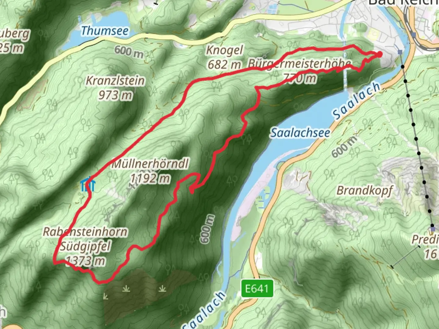
Bürgermeisterhöhe and Kugelbachalm Loop via Salzalpensteig
Download
Preview
Add to list
More
12.2 km
~4 hrs 13 min
1071 m
Loop
“Experience breathtaking views and rich history on the 12 km Bürgermeisterhöhe and Kugelbachalm Loop via Salzalpensteig.”
Starting near the picturesque Berchtesgadener Land in Germany, this 12 km (7.5 miles) loop trail offers a rewarding hike with an elevation gain of approximately 1000 meters (3280 feet). The trailhead is conveniently accessible by both car and public transport. If you're driving, you can park near the town of Bad Reichenhall. For those using public transport, take a train to Bad Reichenhall station and then a local bus to the trailhead.Trail OverviewThe Bürgermeisterhöhe and Kugelbachalm Loop via Salzalpensteig is a medium-difficulty hike that takes you through a variety of landscapes, from dense forests to open alpine meadows. The trail is well-marked, but it's advisable to use the HiiKER app for navigation to ensure you stay on track.Initial AscentThe hike begins with a steady ascent through a lush forest. This section is about 3 km (1.9 miles) long and gains around 400 meters (1312 feet) in elevation. The forest is home to a variety of wildlife, including deer and numerous bird species. Keep an eye out for the occasional red fox darting through the underbrush.BürgermeisterhöheAfter the initial climb, you'll reach Bürgermeisterhöhe, a scenic viewpoint offering panoramic views of the surrounding mountains and valleys. This is a great spot to take a break and enjoy the scenery. The elevation here is approximately 800 meters (2625 feet) above sea level.KugelbachalmContinuing on, the trail leads you to Kugelbachalm, an alpine meadow that sits at around 1200 meters (3937 feet). This section is about 4 km (2.5 miles) from Bürgermeisterhöhe and involves another 400 meters (1312 feet) of elevation gain. The meadow is often dotted with wildflowers in the spring and summer, and you might even spot some grazing cattle. There is a small hut here where you can rest and perhaps enjoy some local Bavarian snacks.Descent and ReturnThe descent begins after Kugelbachalm and takes you back through a different section of forest. This part of the trail is about 5 km (3.1 miles) long and gradually brings you back to the trailhead. The descent is less steep but can be slippery after rain, so watch your footing.Historical SignificanceThe Salzalpensteig, part of which this loop trail follows, is historically significant as it was once a major salt trade route. Salt, often referred to as "white gold," was a valuable commodity, and this route facilitated its transport from the mines in Berchtesgaden to other parts of Europe. Along the trail, you might notice remnants of old salt mines and historical markers that provide insight into this fascinating history.Flora and FaunaThe trail is rich in biodiversity. In addition to the wildlife mentioned earlier, the area is home to various plant species, including edelweiss and alpine roses. The forests are predominantly made up of beech, fir, and spruce trees.Getting ThereTo reach the trailhead, drive to Bad Reichenhall and follow the signs to the designated parking area. If you're using public transport, take a train to Bad Reichenhall station and then a local bus to the trailhead. The bus schedules are frequent, making it a convenient option for those without a car.This loop trail offers a blend of natural beauty, historical significance, and moderate physical challenge, making it a must-do for hikers visiting the Berchtesgadener Land region.

What to expect?
Activity types
Comments and Reviews
User comments, reviews and discussions about the Bürgermeisterhöhe and Kugelbachalm Loop via Salzalpensteig, Germany.
4.0
average rating out of 5
1 rating(s)