Download
Preview
Add to list
More
12.4 km
~3 hrs 10 min
420 m
Loop
“"Experience breathtaking views and rich history on the moderately challenging Walchensee Bucht Southwest Loop."”
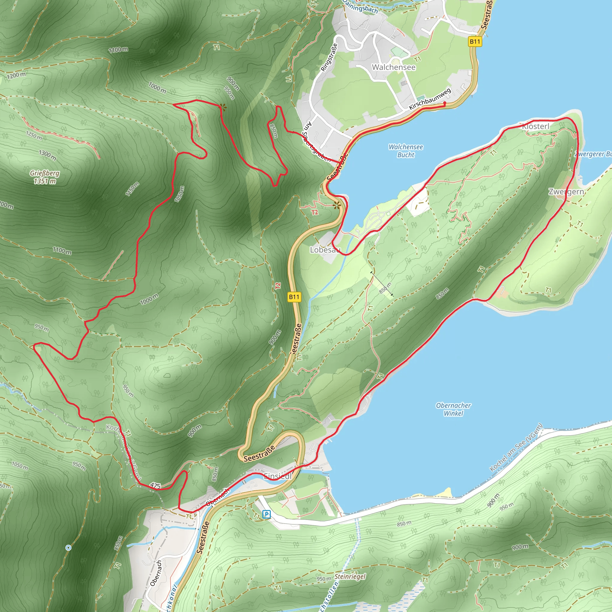
Starting near Bad Tölz-Wolfratshausen, Germany, the Walchensee Bucht Southwest Loop is a captivating 12 km (7.5 miles) loop trail with an elevation gain of approximately 400 meters (1,312 feet). This trail offers a medium difficulty rating, making it suitable for moderately experienced hikers.
Getting There To reach the trailhead, you can either drive or use public transport. If driving, head towards Bad Tölz-Wolfratshausen and look for parking options near the starting point. For those using public transport, take a train to Kochel am See station, which is the nearest significant landmark. From there, you can catch a local bus or taxi to the trailhead.
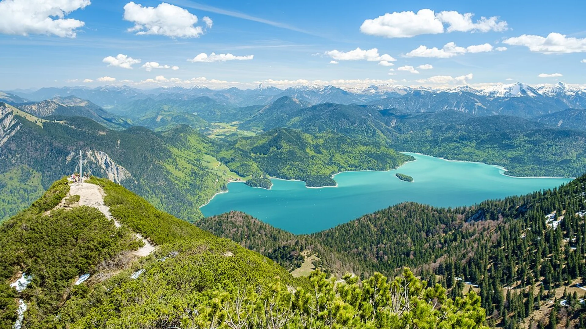
Trail Overview The trail begins with a gentle ascent through lush forests, offering a serene start to your hike. As you progress, the path becomes steeper, leading you to higher elevations where you can enjoy panoramic views of the surrounding landscape. The first significant landmark you'll encounter is the Walchensee, one of the deepest and largest alpine lakes in Germany. The lake's crystal-clear waters are a sight to behold, especially on a sunny day.
Flora and Fauna The trail is rich in biodiversity. Keep an eye out for various species of birds, including the Eurasian jay and the black woodpecker. The forested areas are home to deer and, occasionally, you might spot a fox. The flora is equally diverse, with a mix of deciduous and coniferous trees, as well as a variety of wildflowers during the spring and summer months.
Historical Significance The region around Walchensee has a rich history. During your hike, you'll come across remnants of ancient settlements and old farmhouses that date back several centuries. The area was also significant during World War II, serving as a strategic location for various military operations. Informational plaques along the trail provide insights into these historical events, adding an educational aspect to your hike.
Navigation and Safety Given the trail's moderate difficulty, it's advisable to use a reliable navigation tool like HiiKER to ensure you stay on the right path. The trail is well-marked, but having a digital map can be incredibly useful, especially in areas where the path may be less clear. Always carry sufficient water, snacks, and a first-aid kit. Weather conditions can change rapidly, so check the forecast and dress in layers.
Scenic Highlights Around the halfway point, you'll reach a viewpoint that offers breathtaking vistas of the Walchensee and the surrounding mountains. This is an excellent spot for a break and some photography. As you descend, the trail takes you through meadows and past small streams, providing a peaceful and picturesque end to your hike.
Final Stretch The last segment of the trail loops back towards the starting point, gradually descending through forested areas. This part of the hike is less strenuous, allowing you to enjoy the natural beauty at a more relaxed pace. As you near the end, you'll pass by a few traditional Bavarian houses, giving you a glimpse into the local culture and architecture.
This trail offers a perfect blend of natural beauty, historical significance, and moderate physical challenge, making it a rewarding experience for any hiker.
What to expect?
Activity types
Comments and Reviews
User comments, reviews and discussions about the Walchensee Bucht Southwest Loop, Germany.
4.43
average rating out of 5
7 rating(s)

