Download
Preview
Add to list
More
9.7 km
~2 hrs 9 min
135 m
Loop
“Explore the Thanning to Feldkirchen Loop: a scenic, moderate 10 km hike with lush meadows, historic sites, and panoramic views.”
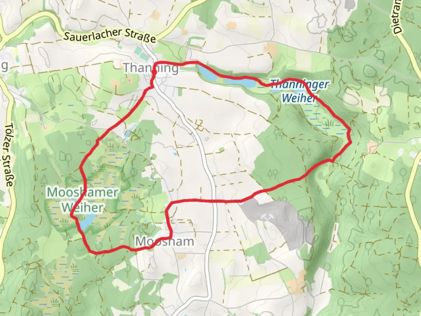
Starting near Bad Tölz-Wolfratshausen in Germany, the Thanning to Feldkirchen Loop via Thanninger Weiher is a picturesque 10 km (6.2 miles) loop trail with an elevation gain of approximately 100 meters (328 feet). This trail is rated as medium difficulty, making it accessible for most hikers with a moderate level of fitness.### Getting There To reach the trailhead, you can either drive or use public transport. If driving, head towards the small village of Thanning, which is easily accessible from the larger towns of Bad Tölz or Wolfratshausen. There is ample parking available near the trailhead. For those using public transport, take a train to Wolfratshausen and then a local bus to Thanning. The nearest significant landmark to the trailhead is the Thanninger Weiher, a serene pond that marks the beginning of your adventure.### Trail Overview The trail begins near Thanninger Weiher, a tranquil pond that offers a perfect spot for a brief rest or a picnic before you start your hike. As you set off, you'll be greeted by lush meadows and rolling hills, typical of the Bavarian countryside. The first section of the trail is relatively flat, making it an easy warm-up.### Significant Landmarks and Nature Around the 2 km (1.2 miles) mark, you'll come across the Thanninger Weiher itself, a beautiful pond surrounded by reeds and frequented by various bird species. This is a great spot for birdwatching, so bring your binoculars if you're a nature enthusiast.Continuing on, the trail gradually ascends, offering panoramic views of the surrounding landscape. At approximately 4 km (2.5 miles), you'll reach the highest point of the trail, where you can take in sweeping vistas of the Bavarian Alps in the distance. This section is particularly scenic during the autumn months when the foliage turns vibrant shades of red and gold.### Historical Significance As you descend towards Feldkirchen, you'll pass through areas rich in history. The region around Bad Tölz-Wolfratshausen has been inhabited since the Bronze Age, and you may come across ancient farmhouses and chapels that date back several centuries. Feldkirchen itself is home to the Church of St. Peter and Paul, a historic landmark worth a brief detour.### Wildlife and Flora The trail is abundant with wildlife. Deer, foxes, and various bird species are commonly spotted along the route. The flora is equally diverse, with wildflowers blooming in the spring and summer months, adding a splash of color to the verdant landscape.### Navigation and Safety Given the moderate difficulty of the trail, it's advisable to use a reliable navigation tool like HiiKER to ensure you stay on track. The trail is well-marked, but having a digital map can provide additional peace of mind. Wear sturdy hiking boots, as some sections can be muddy, especially after rain.### Final Stretch The final stretch of the trail loops back towards Thanning, passing through dense woodlands and open fields. This section is relatively flat and offers a relaxing end to your hike. As you approach the trailhead, you'll once again see the Thanninger Weiher, signaling the end of your journey.This loop trail offers a perfect blend of natural beauty, historical landmarks, and moderate physical challenge, making it a rewarding experience for any hiker.

What to expect?
Activity types
Comments and Reviews
User comments, reviews and discussions about the Thanning to Feldkirchen Loop via Thanninger Weiher, Germany.
4.75
average rating out of 5
4 rating(s)