Download
Preview
Add to list
More
9.6 km
~3 hrs 14 min
794 m
Loop
“Journey through lush forests, meadows, and historical landmarks on the scenic 10 km Staffel Loop in Bavaria.”
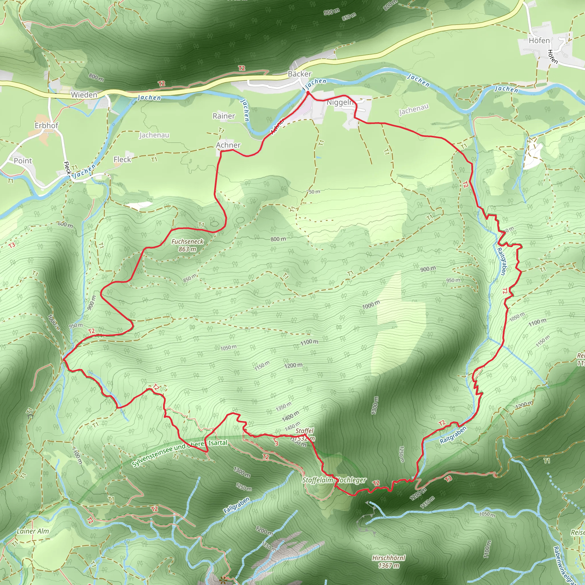
Starting near the picturesque town of Bad Tölz-Wolfratshausen in Germany, the Staffel Loop via Av Weg 492 offers a delightful 10 km (6.2 miles) journey with an elevation gain of approximately 700 meters (2,297 feet). This loop trail is rated as medium difficulty, making it suitable for moderately experienced hikers.### Getting There To reach the trailhead, you can either drive or use public transport. If driving, head towards Bad Tölz-Wolfratshausen and look for parking options near the trailhead. For those using public transport, take a train to Bad Tölz station. From there, local buses or a short taxi ride can get you to the starting point.### Trail Overview The trail begins with a gentle ascent through lush forests, offering a serene start to your hike. As you progress, the path becomes steeper, leading you through a mix of dense woodland and open meadows. The initial 3 km (1.9 miles) will see you gaining around 300 meters (984 feet) in elevation, providing a good warm-up for the more challenging sections ahead.### Key Landmarks and Points of Interest - Waldherralm: Around the 4 km (2.5 miles) mark, you’ll come across the charming Waldherralm, a traditional Bavarian mountain hut. This is an excellent spot to take a break, enjoy some local snacks, and soak in the panoramic views of the surrounding valleys. - Staffel Summit: The trail continues to climb, reaching its highest point at the Staffel Summit, approximately 5 km (3.1 miles) into the hike. Here, you’ll be rewarded with breathtaking vistas of the Bavarian Alps and the Isar Valley. This is a perfect spot for photos and a well-deserved rest. - Historical Significance: The region around Bad Tölz has a rich history, dating back to Roman times. The town itself was a significant trading hub in the Middle Ages, and remnants of its historical significance can be seen in the architecture and local museums.### Flora and Fauna The trail is abundant with diverse flora and fauna. In the spring and summer months, the meadows are adorned with wildflowers, while the forests are home to a variety of bird species. Keep an eye out for deer and other wildlife, particularly in the early morning or late afternoon.### Navigation and Safety Given the elevation gain and varying terrain, it’s advisable to use a reliable navigation tool like HiiKER to stay on track. The trail is well-marked, but having a digital map can provide additional peace of mind. Ensure you have sturdy hiking boots, sufficient water, and weather-appropriate clothing.### Descent and Return The descent begins after the Staffel Summit, with the trail winding back through forested areas and open fields. The return journey covers the remaining 5 km (3.1 miles), gradually easing in difficulty as you approach the trailhead. The total elevation loss mirrors the gain, making for a balanced and enjoyable loop.This trail offers a perfect blend of natural beauty, moderate challenge, and historical intrigue, making it a must-visit for hikers exploring the Bavarian region.
What to expect?
Activity types
Comments and Reviews
User comments, reviews and discussions about the Staffel Loop via Av Weg 492, Germany.
4.5
average rating out of 5
2 rating(s)

