Download
Preview
Add to list
More
10.4 km
~2 hrs 46 min
418 m
Loop
“Explore a 10 km loop near Bad Kreuznach, blending natural beauty, historical landmarks, and moderate challenge.”
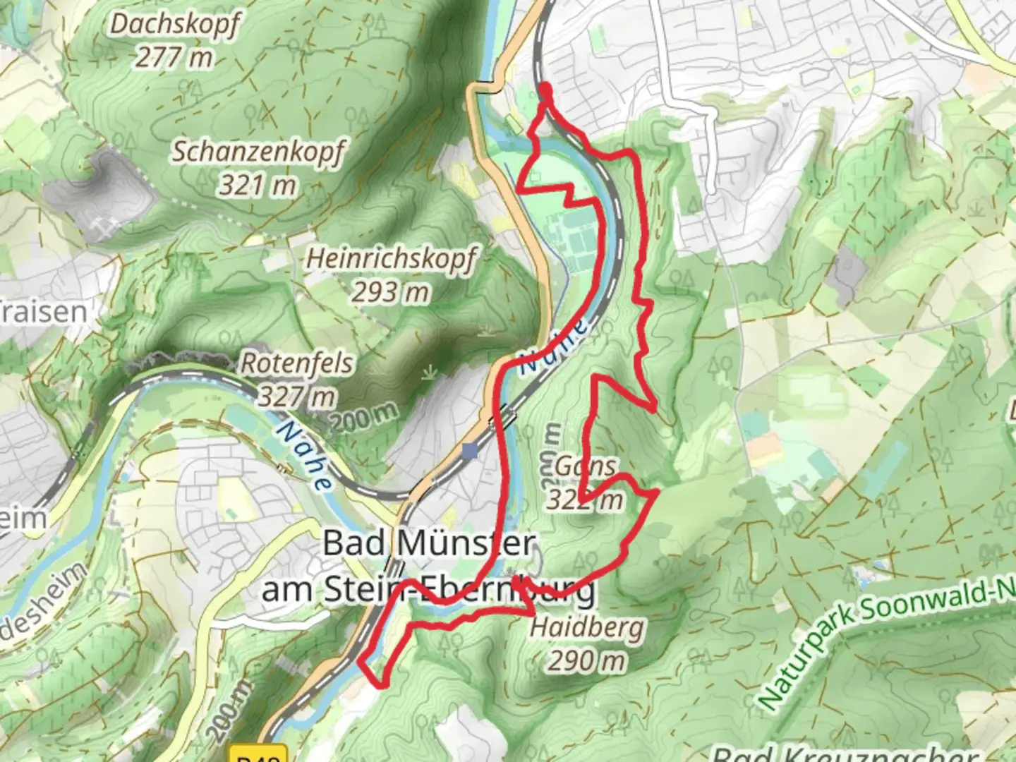
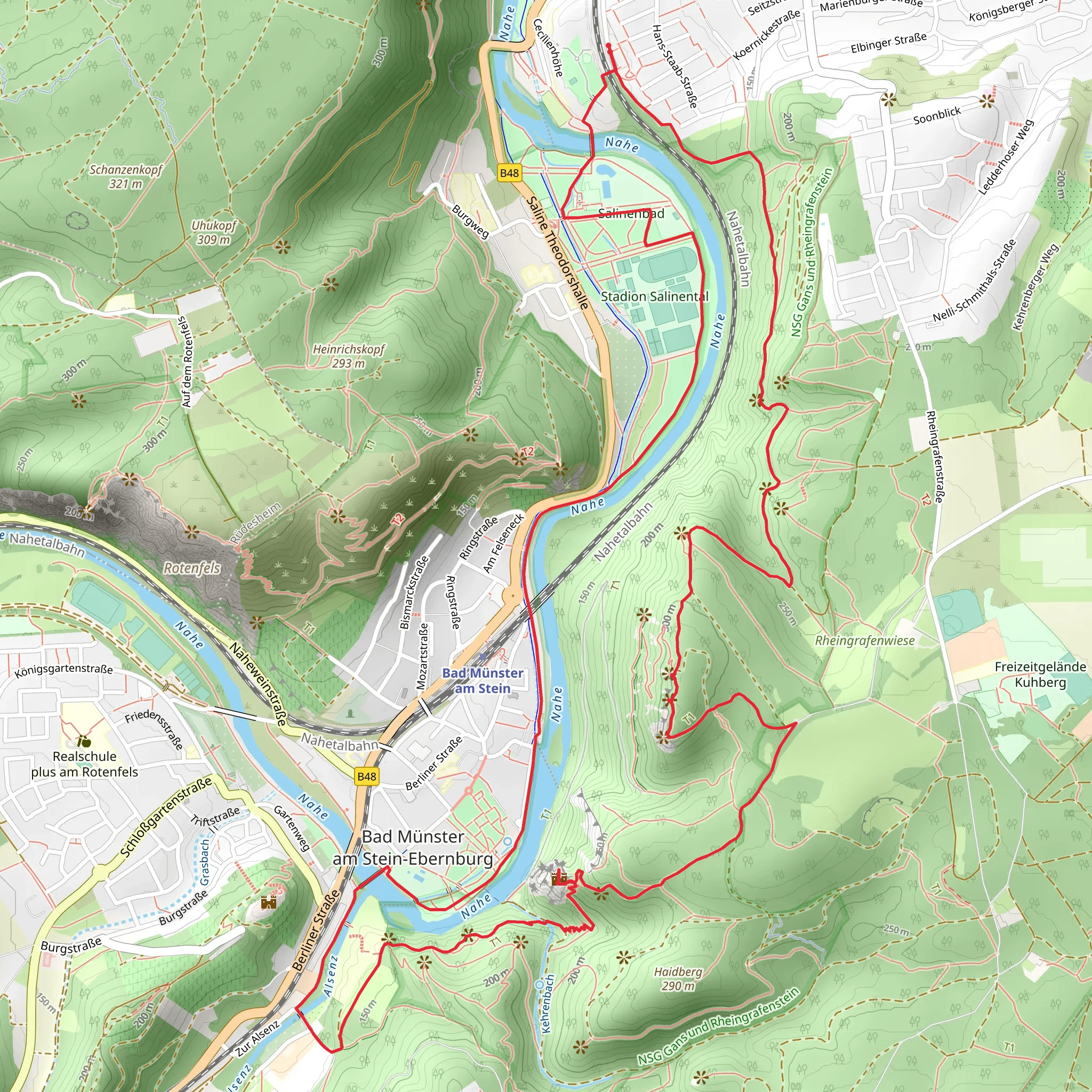
Starting near the charming town of Bad Kreuznach, Germany, this 10 km (6.2 miles) loop trail offers a delightful mix of natural beauty, historical landmarks, and moderate physical challenge. With an elevation gain of approximately 400 meters (1,312 feet), hikers can expect a moderately strenuous journey that rewards with stunning vistas and intriguing sites.
Getting There
To reach the trailhead, you can either drive or use public transport. If driving, set your GPS to Bad Kreuznach, a well-known spa town in Rhineland-Palatinate. There are several parking options available near the town center. For those using public transport, Bad Kreuznach is well-connected by train. From the Bad Kreuznach train station, it's a short walk or a quick bus ride to the trailhead.
Trail Highlights
#### Nahe River
The trail begins by following the scenic Nahe River, offering serene views and the gentle sound of flowing water. This section is relatively flat, making it a good warm-up for the more challenging parts ahead. Keep an eye out for local wildlife such as ducks, herons, and even the occasional kingfisher.
#### Rheingrafenstein Rock
Approximately 3 km (1.9 miles) into the hike, you'll encounter the imposing Rheingrafenstein Rock. This massive rock formation rises steeply from the riverbank and offers panoramic views of the Nahe Valley. The climb to the top is steep but manageable, and the effort is well worth it for the breathtaking vistas. Historically, Rheingrafenstein was a strategic lookout point, and remnants of ancient fortifications can still be seen.
#### Burg Rheingrafenstein
Continuing on, you'll reach the ruins of Burg Rheingrafenstein, a medieval castle that dates back to the 11th century. The castle was once a stronghold for the Rheingrafen family and played a significant role in regional conflicts. Today, it stands as a picturesque ruin, perfect for exploration and photography. Information plaques provide historical context, making it a fascinating stop for history buffs.
#### Gans
Around the 7 km (4.3 miles) mark, you'll come across the Gans, another prominent rock formation. This section of the trail involves a bit of scrambling, so be prepared for a more rugged terrain. The Gans offers another excellent viewpoint, where you can take a well-deserved break and soak in the surrounding landscape.
Flora and Fauna
The trail is rich in biodiversity. Depending on the season, you might see wildflowers such as orchids and lilies, as well as a variety of trees including oak, beech, and pine. Wildlife is abundant, with chances to spot deer, foxes, and a variety of bird species.
Navigation
For navigation, it's highly recommended to use HiiKER, which provides detailed maps and real-time updates. The trail is well-marked, but having a reliable navigation tool can enhance your hiking experience and ensure you stay on the right path.
Final Stretch
The last few kilometers of the trail loop back towards Bad Kreuznach, descending gradually and offering a gentle cooldown. This section passes through lush forests and open meadows, providing a peaceful end to your hike.
Practical Tips
- Wear sturdy hiking boots, as the trail includes rocky and uneven sections. - Bring plenty of water and snacks, especially if you plan to explore the castle ruins and rock formations. - Check the weather forecast before heading out, as some sections can become slippery when wet. - A camera is a must for capturing the stunning views and historical sites.
This trail offers a perfect blend of natural beauty, historical intrigue, and moderate physical challenge, making it a rewarding experience for any hiker.
What to expect?
Activity types
Comments and Reviews
User comments, reviews and discussions about the Nahe, Burguine Rheingrafenstein and Gans via Tour Natur, Germany.
4.67
average rating out of 5
3 rating(s)
