Download
Preview
Add to list
More
8.8 km
~2 hrs 25 min
398 m
Loop
“A scenic 9 km loop near Bad Kreuznach, blending lush forests, panoramic views, and rich history.”
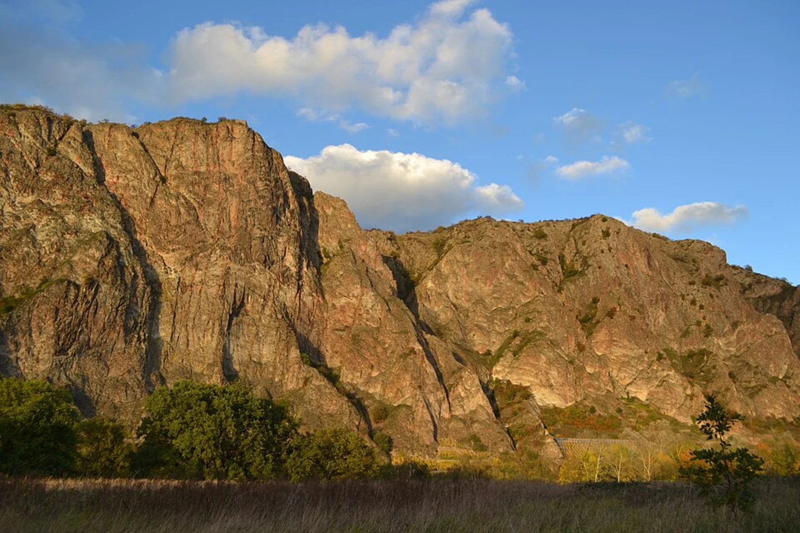
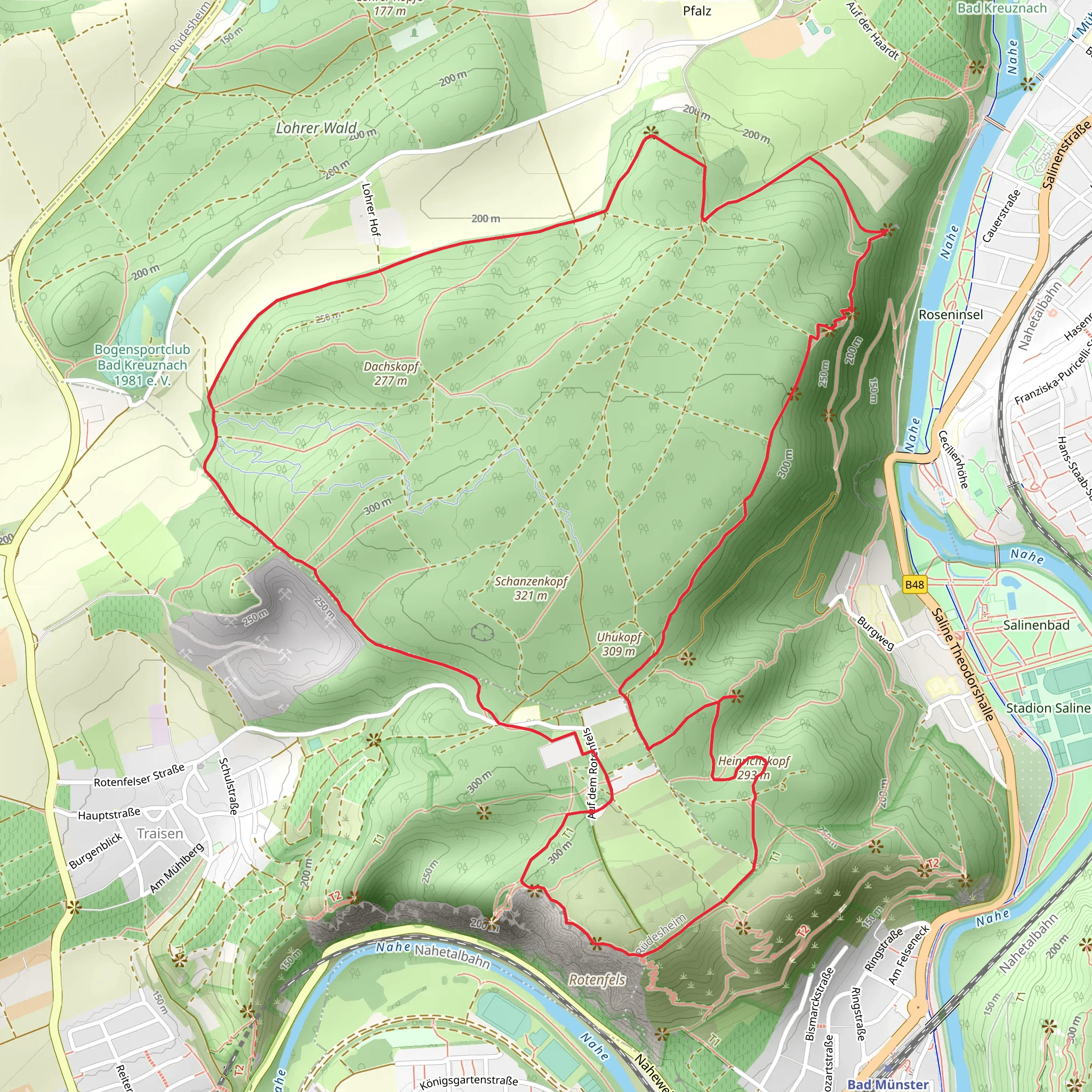
Starting near the picturesque town of Bad Kreuznach, Germany, this 9 km (approximately 5.6 miles) loop trail offers a delightful mix of natural beauty and historical intrigue. With an elevation gain of around 300 meters (approximately 984 feet), the trail is rated as medium difficulty, making it accessible for most hikers with a moderate level of fitness.### Getting There To reach the trailhead, you can either drive or use public transport. If driving, head towards Bad Kreuznach and look for parking near the Kurpark, a well-known local park. For those using public transport, take a train to Bad Kreuznach station. From there, it's a short walk or bus ride to the Kurpark area where the trail begins.### Trail Overview The loop starts near the Kurpark in Bad Kreuznach, a serene area perfect for a pre-hike stretch. As you begin your hike, you'll quickly find yourself immersed in the lush greenery of the Kreuznacher Hardt forest. The initial part of the trail is relatively flat, allowing you to ease into the hike.### Kreuznacher Hardt Approximately 2 km (1.2 miles) into the hike, you'll enter the Kreuznacher Hardt, a dense forest area known for its diverse flora and fauna. Keep an eye out for native bird species and small mammals that inhabit this region. The forest floor is often carpeted with wildflowers in the spring, adding a splash of color to your hike.### Huhnerkopf As you continue, the trail begins to ascend towards Huhnerkopf. This section is where you'll experience most of the elevation gain, about 150 meters (492 feet) over the next 3 km (1.9 miles). The climb is steady but manageable, with several switchbacks to ease the gradient. Upon reaching the summit of Huhnerkopf, you'll be rewarded with panoramic views of the surrounding countryside. This is an excellent spot for a short break and some photography.### Rotenfels Descending from Huhnerkopf, the trail leads you towards Rotenfels, the highest rock face north of the Alps. The sheer cliffs of Rotenfels rise dramatically, offering breathtaking views of the Nahe Valley below. This section of the trail is particularly scenic, with the red sandstone cliffs contrasting beautifully against the green landscape. The descent is gradual, making it a pleasant walk as you soak in the views.### Historical Significance The region around Bad Kreuznach has a rich history dating back to Roman times. As you hike, you'll come across several historical markers and ruins, including remnants of Roman baths and medieval fortifications. These landmarks provide a fascinating glimpse into the area's past and are well worth a brief detour.### Final Stretch The final 2 km (1.2 miles) of the loop take you back through the Kreuznacher Hardt forest, eventually leading you back to the Kurpark. This section is relatively flat and offers a peaceful end to your hike. ### Navigation For navigation, it's highly recommended to use the HiiKER app, which provides detailed maps and real-time tracking to ensure you stay on the right path.This trail offers a perfect blend of natural beauty, moderate physical challenge, and historical interest, making it a must-do for any hiking enthusiast visiting the Bad Kreuznach area.
What to expect?
Activity types
Comments and Reviews
User comments, reviews and discussions about the Kreuznacher Hardt, Huhnerkopf and Rotenfels Loop, Germany.
4.33
average rating out of 5
3 rating(s)

