Download
Preview
Add to list
More
14.3 km
~3 hrs 16 min
253 m
Point-to-Point
“The Rottenberg to Schimborn Walk is a picturesque 14-kilometer trail, rich in history and natural beauty.”
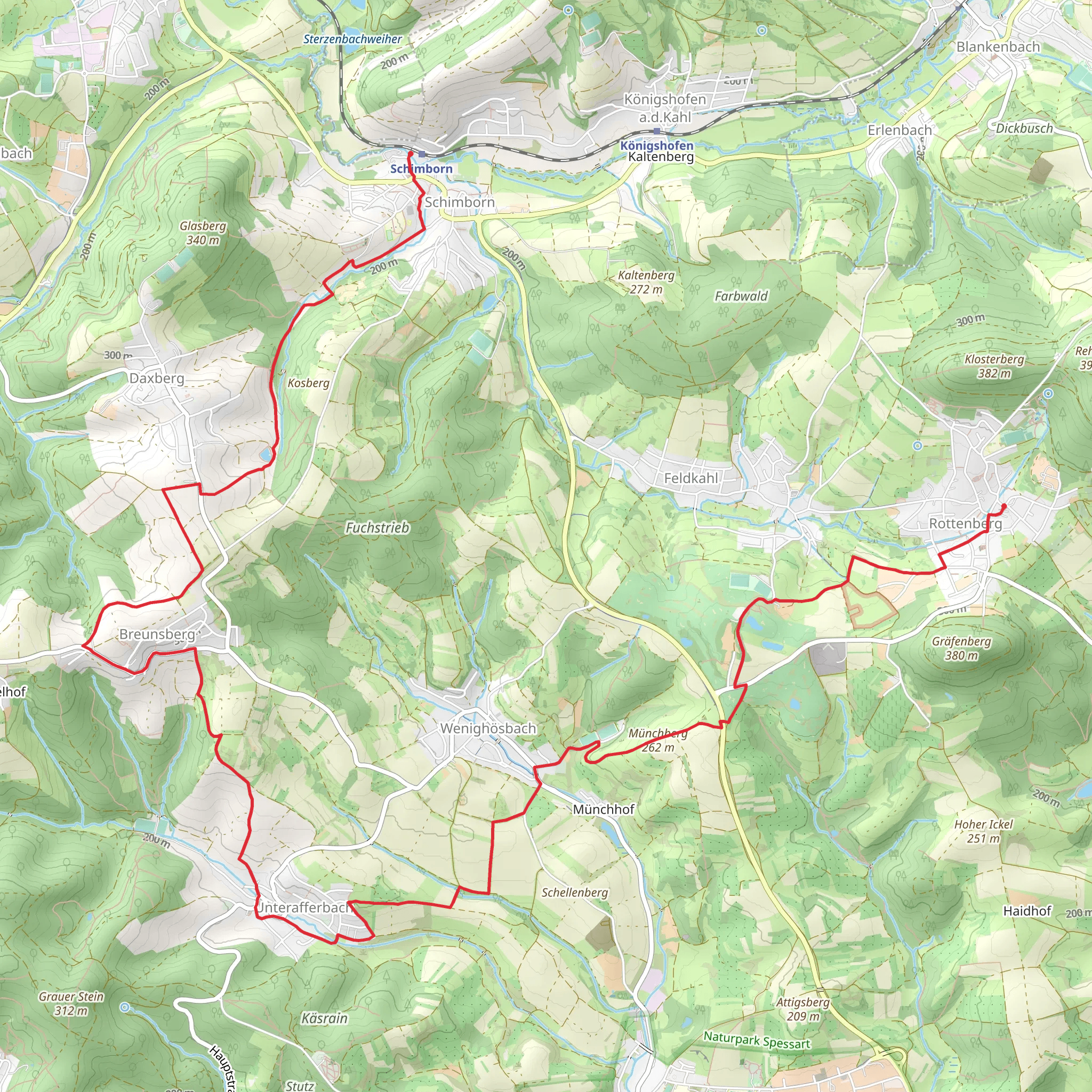
Starting near Aschaffenburg, Germany, the Rottenberg to Schimborn Walk spans approximately 14 kilometers (8.7 miles) with an elevation gain of around 200 meters (656 feet). This point-to-point trail is estimated to be of medium difficulty, making it suitable for moderately experienced hikers.### Getting There To reach the trailhead, you can either drive or use public transport. If driving, head towards Aschaffenburg and look for parking near Rottenberg. For those using public transport, take a train to Aschaffenburg Hauptbahnhof and then a local bus towards Rottenberg. The nearest significant landmark to the trailhead is the Rottenberg village center.### Trail Overview The trail begins in the quaint village of Rottenberg, known for its charming half-timbered houses and serene countryside. As you set off, you'll find yourself walking through lush forests and open fields, offering a mix of shaded and sunny sections. The initial part of the trail is relatively flat, making for a gentle warm-up.### Key Landmarks and Nature Around the 3-kilometer (1.9-mile) mark, you'll come across the picturesque Hahnenkamm, a small hill that offers panoramic views of the surrounding landscape. This is a great spot for a short break and some photography. Continuing on, the trail meanders through dense woodlands, where you might spot local wildlife such as deer, foxes, and a variety of bird species.### Historical Significance As you approach the halfway point, approximately 7 kilometers (4.3 miles) in, you'll pass near the ruins of an old medieval watchtower. This tower once served as a lookout point to protect the region from invaders. The area is steeped in history, and you can almost feel the echoes of the past as you walk by.### Elevation and Terrain The trail starts to gain elevation more noticeably after the halfway point, with a steady climb that adds up to the total 200 meters (656 feet) of elevation gain. The path here can be a bit rocky, so sturdy hiking boots are recommended. The ascent is gradual but consistent, making it a good workout without being overly strenuous.### Navigation For navigation, it's highly recommended to use the HiiKER app, which provides detailed maps and real-time updates. This will help you stay on track, especially in the more densely wooded sections where the trail can become less obvious.### Final Stretch As you near the end of the trail, the landscape opens up again, offering sweeping views of the Spessart hills. The final descent into Schimborn is gentle, allowing you to cool down as you approach the village. Schimborn itself is a charming destination, with a few local eateries where you can enjoy a well-deserved meal.### Wildlife and Flora Throughout the hike, keep an eye out for the diverse flora, including wildflowers in the spring and summer months. The forests are primarily composed of beech and oak trees, providing a rich habitat for various species.### Ending Point The trail concludes in the village of Schimborn, where you can either arrange for a pick-up or take a local bus back to Aschaffenburg. The nearest significant landmark to the endpoint is the Schimborn village church, a beautiful example of local architecture.This hike offers a perfect blend of natural beauty, historical intrigue, and moderate physical challenge, making it a rewarding experience for those who undertake it.
What to expect?
Activity types
Comments and Reviews
User comments, reviews and discussions about the Rottenberg to Schimborn Walk, Germany.
average rating out of 5
0 rating(s)

