Download
Preview
Add to list
More
10.9 km
~2 hrs 37 min
264 m
Loop
“Explore Germany's Wanderweg Remagen Circle: a 11 km trail blending nature, history, and stunning views.”
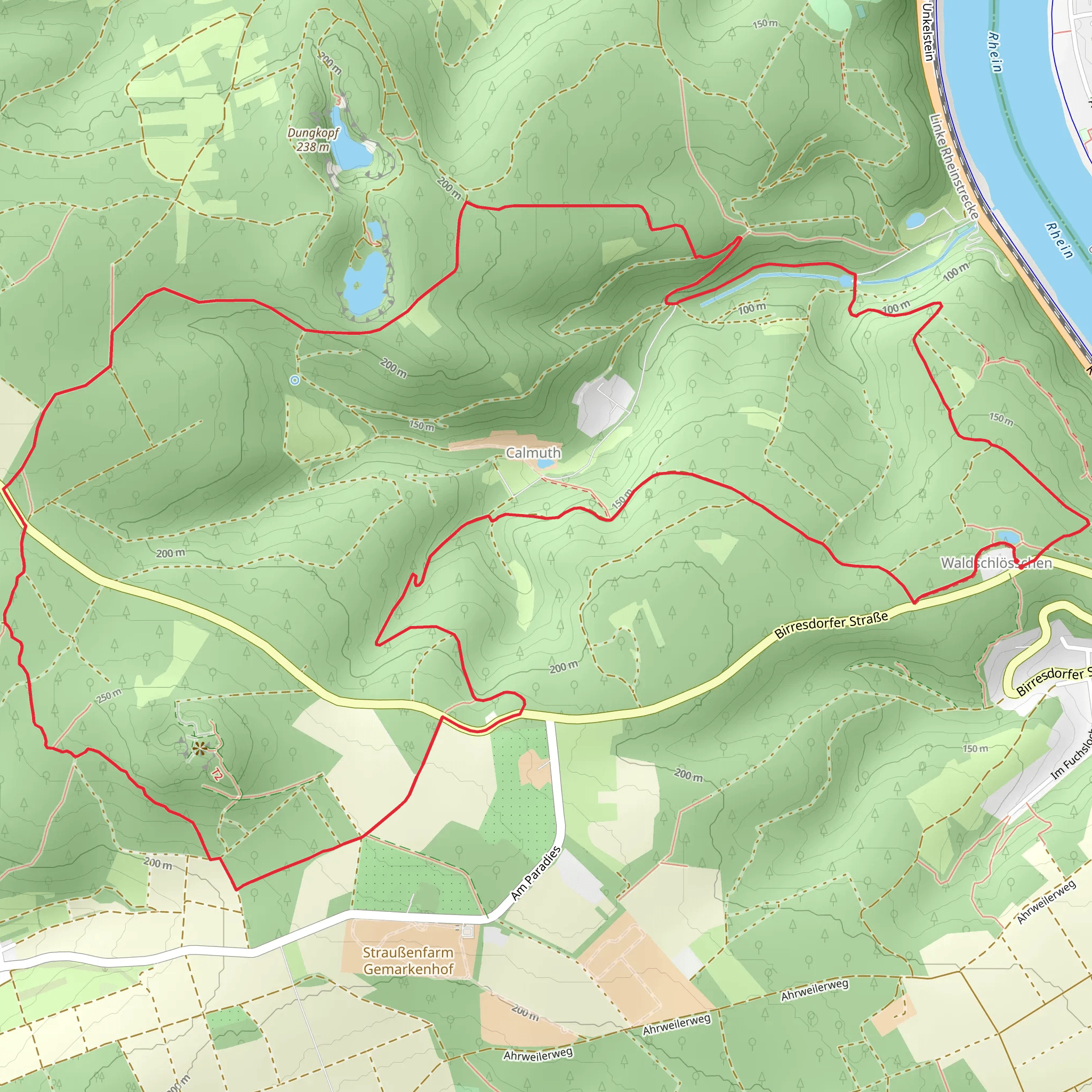
Starting near the charming town of Ahrweiler in Germany, the Wanderweg Remagen Circle is an 11 km (approximately 6.8 miles) loop trail with an elevation gain of around 200 meters (656 feet). This medium-difficulty trail offers a delightful mix of natural beauty, historical landmarks, and panoramic views, making it a rewarding experience for hikers.
Getting There To reach the trailhead, you can either drive or use public transport. If you're driving, set your GPS to Ahrweiler, Germany. There are several parking options available in the town. For those using public transport, Ahrweiler is well-connected by train. The nearest train station is Ahrweiler Station, from where you can walk to the trailhead.
Trail Overview The trail begins near Ahrweiler, a town known for its medieval architecture and vineyards. As you start your hike, you'll be greeted by the lush greenery of the surrounding forests. The initial part of the trail is relatively flat, making it a good warm-up for the more challenging sections ahead.
Historical Significance One of the highlights of this trail is its historical significance. As you hike, you'll come across remnants of World War II bunkers and fortifications. These serve as a poignant reminder of the region's turbulent past. The trail also passes near the famous Ludendorff Bridge, known for its role in the closing days of World War II. Although the bridge itself is no longer standing, the site is marked and offers a moment of reflection.
Nature and Wildlife The trail meanders through a variety of landscapes, from dense forests to open meadows. Keep an eye out for local wildlife, including deer, foxes, and a variety of bird species. The flora is equally diverse, with wildflowers adding splashes of color during the spring and summer months.
Key Landmarks - **Ahrweiler Town**: The starting point, known for its medieval walls and gates. - **Ludendorff Bridge Site**: Approximately 5 km (3.1 miles) into the hike, this historical site offers a glimpse into the past. - **Forest Sections**: Around 7 km (4.3 miles) in, you'll enter dense forest areas, providing a serene and shaded environment. - **Panoramic Viewpoints**: At various points along the trail, you'll find spots offering breathtaking views of the Ahr Valley and the surrounding hills.
Navigation and Safety Given the trail's moderate difficulty, it's advisable to use a reliable navigation tool like HiiKER to stay on track. The trail is well-marked, but having a digital map can be very helpful, especially in the forested sections where paths can be confusing.
Final Stretch As you near the end of the loop, the trail descends gently back towards Ahrweiler. This section offers a relaxing end to your hike, with the opportunity to explore the town's quaint streets and perhaps enjoy a meal at one of the local restaurants.
This trail offers a balanced mix of natural beauty, historical intrigue, and moderate physical challenge, making it a must-do for any hiking enthusiast visiting the region.
What to expect?
Activity types
Comments and Reviews
User comments, reviews and discussions about the Wanderweg Remagen Circle, Germany.
4.67
average rating out of 5
3 rating(s)

