Download
Preview
Add to list
More
52.5 km
~4 days
1463 m
Multi-Day
“Embark on an epic 33-mile journey through Georgia's rugged Cohutta Wilderness, brimming with natural splendor and historical echoes.”
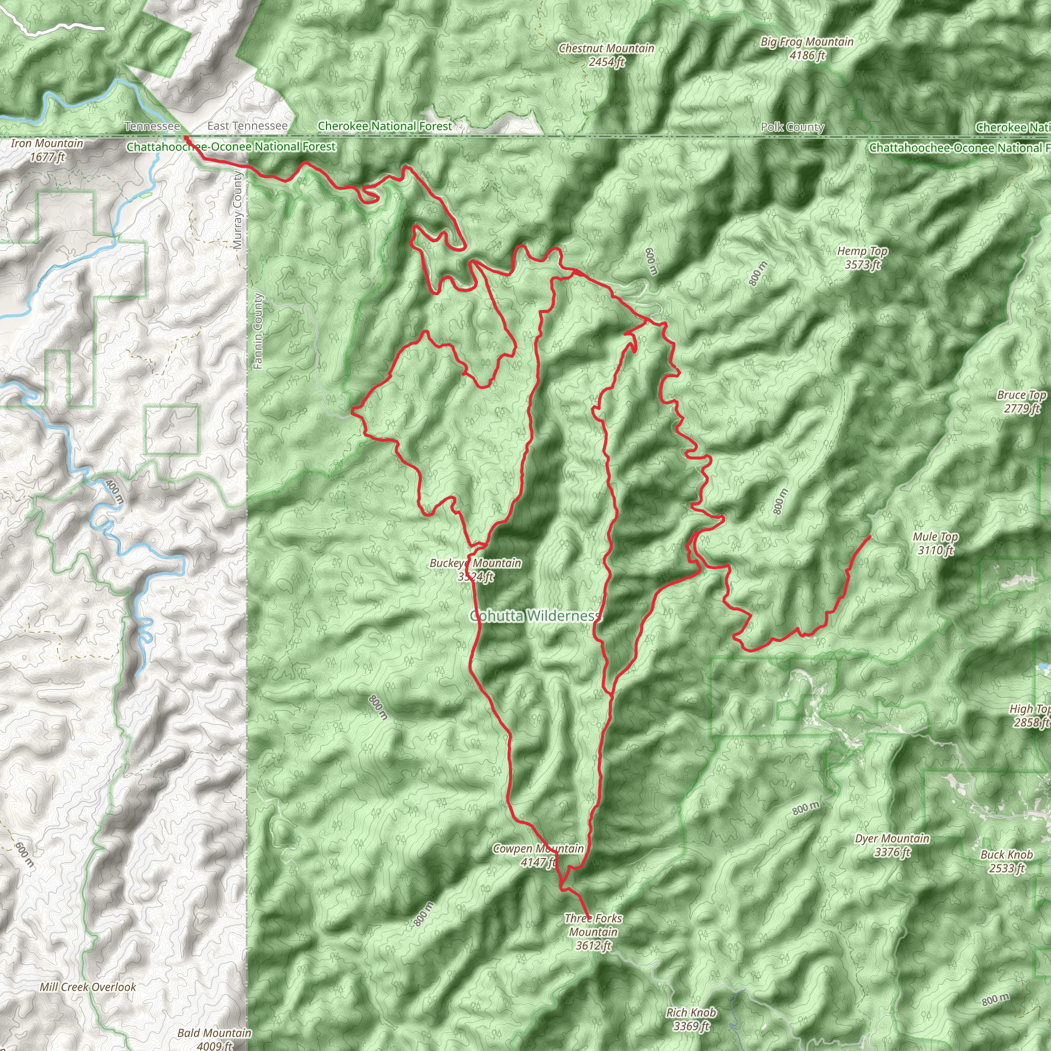
Embarking on the Jacks River to Cowpen Mountain trail, hikers will traverse a challenging yet rewarding loop that spans approximately 53 kilometers (about 33 miles) with an elevation gain of around 1400 meters (approximately 4600 feet). This trek is not for the faint-hearted and is considered difficult due to its rugged terrain and the need for good navigation skills. Hikers can expect to be immersed in the lush wilderness of the Cohutta Wilderness Area, located near Murray County, Georgia.
Getting to the Trailhead
The trailhead is accessible by car and is situated near the Conasauga River, which is a significant landmark in the region. Those driving should navigate towards the Three Forks Trailhead off Forest Service Road 64. There is no direct public transportation to the trailhead, so hikers will need to arrange private transport or drive themselves.
Navigating the Trail
Hikers should prepare to use HiiKER for navigation, as the trail can be complex with multiple river crossings and potentially confusing junctions. The trail begins with a descent into the Jacks River Valley, where the path meanders alongside the Jacks River. Hikers will encounter numerous river crossings that can vary in depth depending on recent rainfall, so waterproof gear and sturdy water shoes are recommended.
Landmarks and Natural Features
As adventurers progress, they will be greeted by the impressive Jacks River Falls, a popular landmark about 14 kilometers (9 miles) from the trailhead. This is an ideal spot for a rest or a refreshing swim in the warmer months. The trail continues to wind through dense forests of hemlock and rhododendron, with the river providing a constant soundtrack to the journey.
Wildlife and Flora
The area is rich in biodiversity, with chances to spot wildlife such as white-tailed deer, black bears, and a variety of bird species. The flora is equally diverse, with wildflowers blooming in spring and a tapestry of colors in the fall.
Historical Significance
The region holds historical significance, with the trail passing through areas that were once home to the Cherokee people before their forced removal on the Trail of Tears. Hikers walking these paths tread on land steeped in history and resilience.
Elevation and Terrain Challenges
The ascent to Cowpen Mountain is where hikers will face the majority of the elevation gain. This section of the trail is particularly strenuous, with steep inclines and potentially slippery conditions. The summit offers expansive views of the surrounding wilderness, a just reward for the climb.
Preparation and Safety
Due to the trail's difficulty, it is essential that hikers come well-prepared with adequate supplies, including water, food, and emergency gear. Weather conditions can change rapidly, and cell service is limited, so it is crucial to inform someone of your itinerary and expected return time.
Conclusion
The Jacks River to Cowpen Mountain trail offers an immersive experience in one of Georgia's most pristine wilderness areas. With its challenging terrain, stunning natural features, and rich history, it is a journey that will leave hikers with a sense of accomplishment and a deep appreciation for the natural world.
What to expect?
Activity types
Comments and Reviews
User comments, reviews and discussions about the Jacks River to Cowpen Mountain, Georgia.
4.7
average rating out of 5
10 rating(s)

