Download
3D Flyover
Add to list
More
123.4 km
~7 days
8141 m
Multi-Day
“Trek the GR 738 for a breathtaking, arduous journey through the historic, wildlife-rich French Alps.”
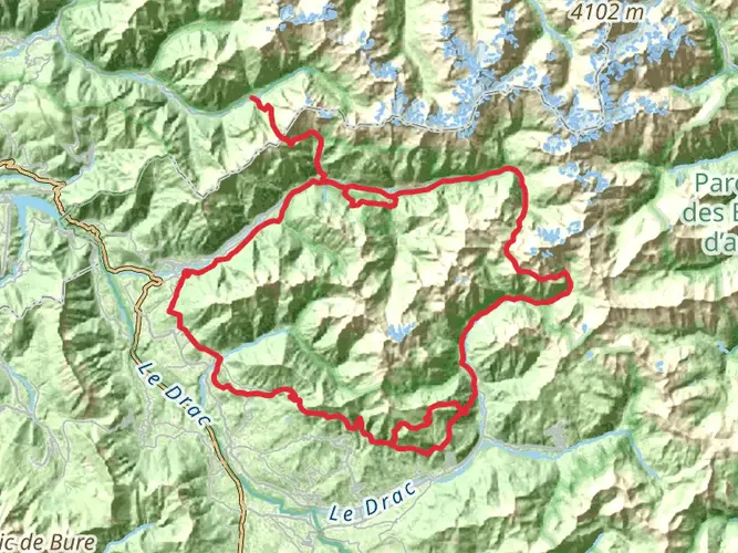
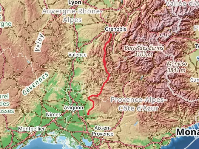
The GR 738 - Haute Traversée de Belledonne is a challenging and rewarding trek that spans approximately 123 kilometers (76 miles) with an elevation gain of around 8100 meters (26,575 feet). This point-to-point trail is nestled in the scenic French Alps and is known for its rugged terrain and stunning alpine vistas.
Starting near the town of Vizille, France, hikers can access the trailhead by public transport or car. From Grenoble, you can take a bus to Vizille, which is a common starting point for many adventurers. If driving, parking is available in the area, but it's advisable to check for the most current information on parking restrictions and fees.
Terrain and Difficulty
As you embark on this journey, prepare for a variety of terrain that includes rocky paths, steep inclines, and potentially snow-covered sections, depending on the season. The trail is rated as extra difficult due to its technical nature and the level of fitness required to complete it. Hikers should be well-prepared with proper gear, including sturdy hiking boots, trekking poles, and navigation tools. The HiiKER app is a reliable resource for trail maps and navigation, ensuring you stay on the right path.
Landmarks and Nature
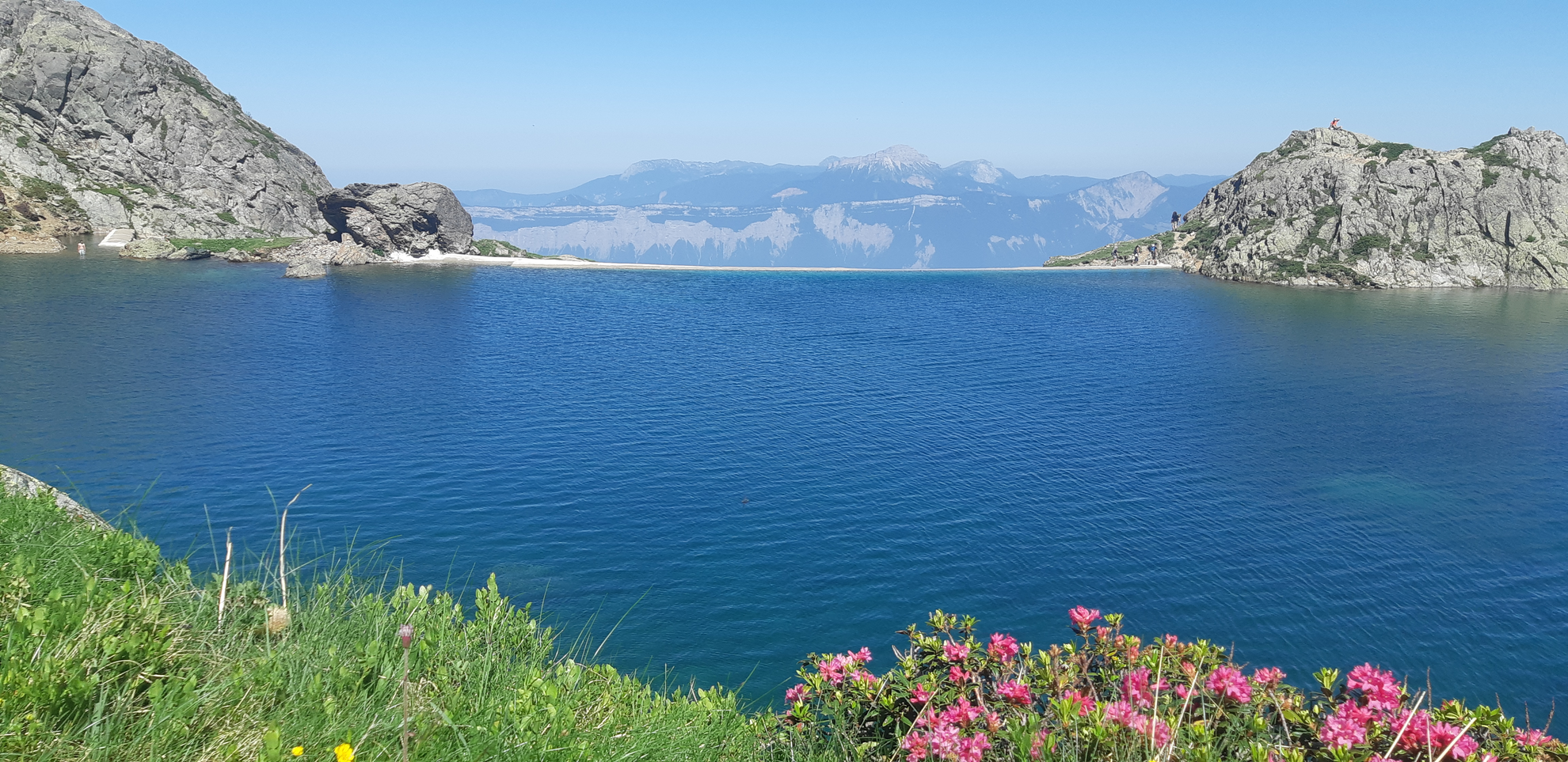
The trail will take you through the heart of the Belledonne mountain range, offering breathtaking views of pristine lakes, such as Lac Blanc and Lac de Crop, which are perfect spots for a rest and to take in the natural beauty. The route also includes several mountain passes, like the Col de la Vache and Col du Loup, where the panoramic views are unparalleled.
Wildlife in the area is abundant, with chances to spot chamois, marmots, and a variety of birds. The diverse flora along the trail changes with the elevation, ranging from lush forests to alpine meadows bursting with wildflowers in the summer months.
Historical Significance
The Belledonne range has a rich history, with its trails being used for centuries by locals for trade and travel between the valleys. The region was also a strategic location during World War II, and hikers may come across remnants from this period, such as old bunkers or fortifications.
Preparation and Planning
Given the trail's difficulty and remote sections, it's crucial to plan your hike carefully. Ensure you have enough food and water, as resupply points are limited. It's also wise to check the weather forecast and trail conditions before setting out, as the high altitude can lead to sudden weather changes.
Accommodation options along the trail include mountain huts and refuges, which offer basic amenities and a chance to meet fellow hikers. Booking in advance is recommended, especially during the peak summer months.
Access to the Trail
To reach the trailhead near Vizille, you can take a bus from Grenoble, which is well-connected by train to other major French cities. If arriving by car, you can navigate to the vicinity of Vizille, where you will find signage directing you to the starting point of the GR 738.
Embarking on the GR 738 - Haute Traversée de Belledonne is an adventure that promises to be both challenging and fulfilling. With its steep climbs, alpine scenery, and historical significance, this trail is a must-do for experienced hikers seeking to explore the beauty of the French Alps.

Comments and Reviews
User comments, reviews and discussions about the GR 738 - Haute Traversée de Belledonne, France.
4.86
average rating out of 5
7 rating(s)