Download
Preview
Add to list
More
85.2 km
~5 days
2652 m
Multi-Day
“Explore the historic and biodiverse Tour of Mont Aigoual, a scenic loop through France's Cévennes heartland.”
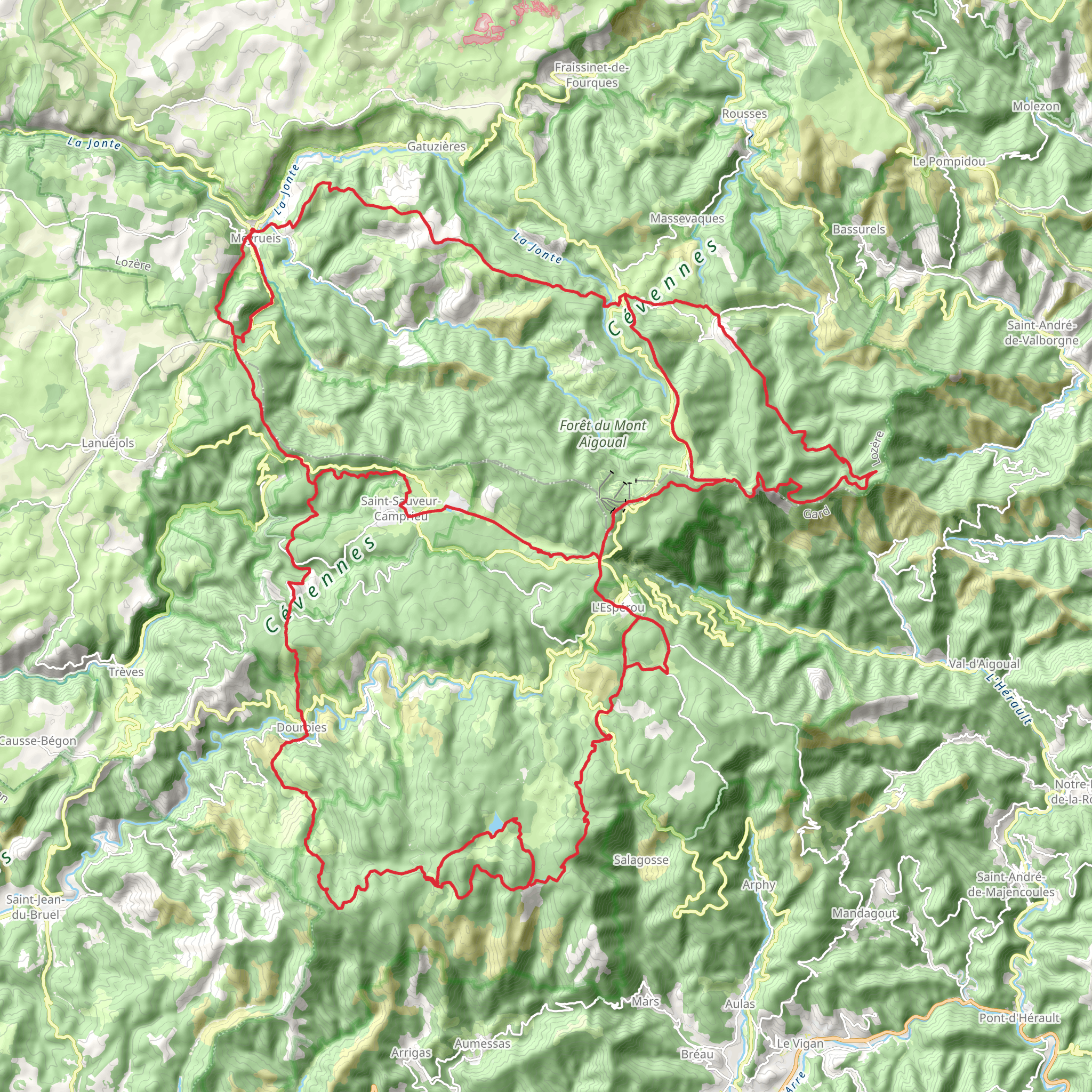
Embarking on the Tour of Mont Aigoual, hikers will traverse approximately 85 kilometers (about 53 miles) of varied terrain with an elevation gain of around 2600 meters (approximately 8530 feet). This loop trail, which begins near the quaint town of Meyrueis, France, offers a medium difficulty rating and is suitable for hikers with some experience.
Getting to the Trailhead To reach the starting point of the Tour of Mont Aigoual, hikers can drive to Meyrueis, which is accessible by regional roads. For those relying on public transport, buses from larger cities such as Nîmes or Montpellier may be available to nearby towns, from where a taxi or local shuttle can be taken to Meyrueis.
Navigating the Trail The trail can be navigated using the HiiKER app, which provides detailed maps and waypoints to ensure hikers stay on the correct path. It's advisable to download the trail map on HiiKER beforehand, as some sections of the trail may have limited cellular reception.
Trail Highlights and Landmarks The Tour of Mont Aigoual takes hikers through the heart of the Cévennes National Park, a UNESCO World Heritage site known for its rich biodiversity and historical significance. The trail offers panoramic views of the surrounding landscape, including the Causses and the Cévennes.
As hikers ascend, they will encounter a variety of landscapes, from dense forests to open grasslands and rocky outcrops. The trail passes through several small villages where hikers can experience local culture and cuisine.
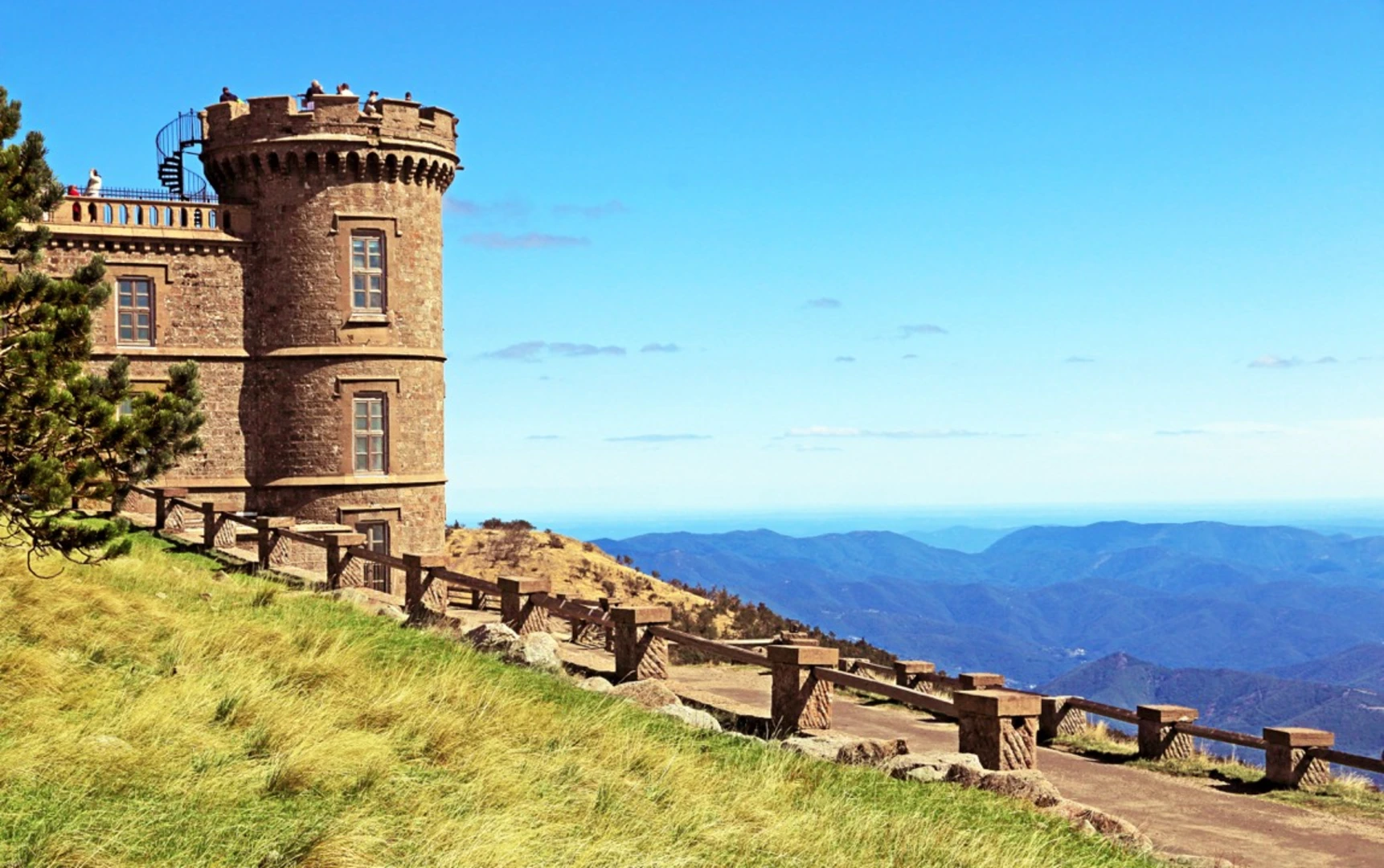
One of the significant landmarks on the trail is the Mont Aigoual Observatory, located at the summit. This meteorological observatory is one of the last remaining mountain weather stations in France and offers an educational experience about the region's climate.
Flora and Fauna The Cévennes National Park is home to a diverse range of flora and fauna. Hikers may spot species such as the Griffon vulture soaring above or the shy roe deer amongst the trees. The park's flora includes a variety of orchids, chestnut trees, and the rare Cévennes onion.
Historical Significance The region holds historical significance due to its role in the Camisard rebellion during the early 18th century. Hikers will find remnants of this history, such as old stone houses and terraced farmlands that tell the story of past inhabitants' struggles and resilience.
Preparation and Planning Before setting out, hikers should ensure they are well-prepared with appropriate gear, including sturdy hiking boots, weather-appropriate clothing, and sufficient water and food supplies. It's also important to check the weather forecast and plan for potential changes in mountain weather conditions.
Given the trail's length and elevation gain, it is recommended to plan for multiple days of hiking, with overnight stays in local gîtes or camping in designated areas. This allows for a more relaxed pace to fully enjoy the natural beauty and cultural experiences along the Tour of Mont Aigoual.
Comments and Reviews
User comments, reviews and discussions about the Tour of Mont Aigoual, France.
4.25
average rating out of 5
4 rating(s)

