Download
Preview
Add to list
More
154.3 km
~11 days
7924 m
Multi-Day
“Embark on the Ubaye Valley trail for an epic Alpine adventure rich in natural splendor and historical echoes.”
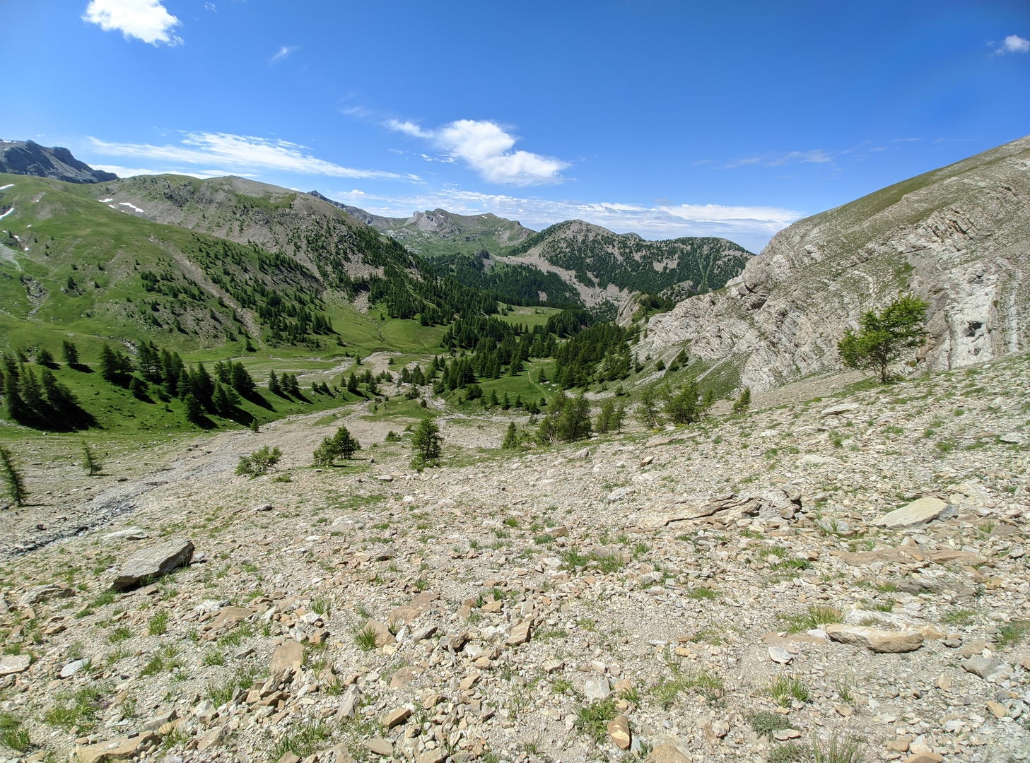
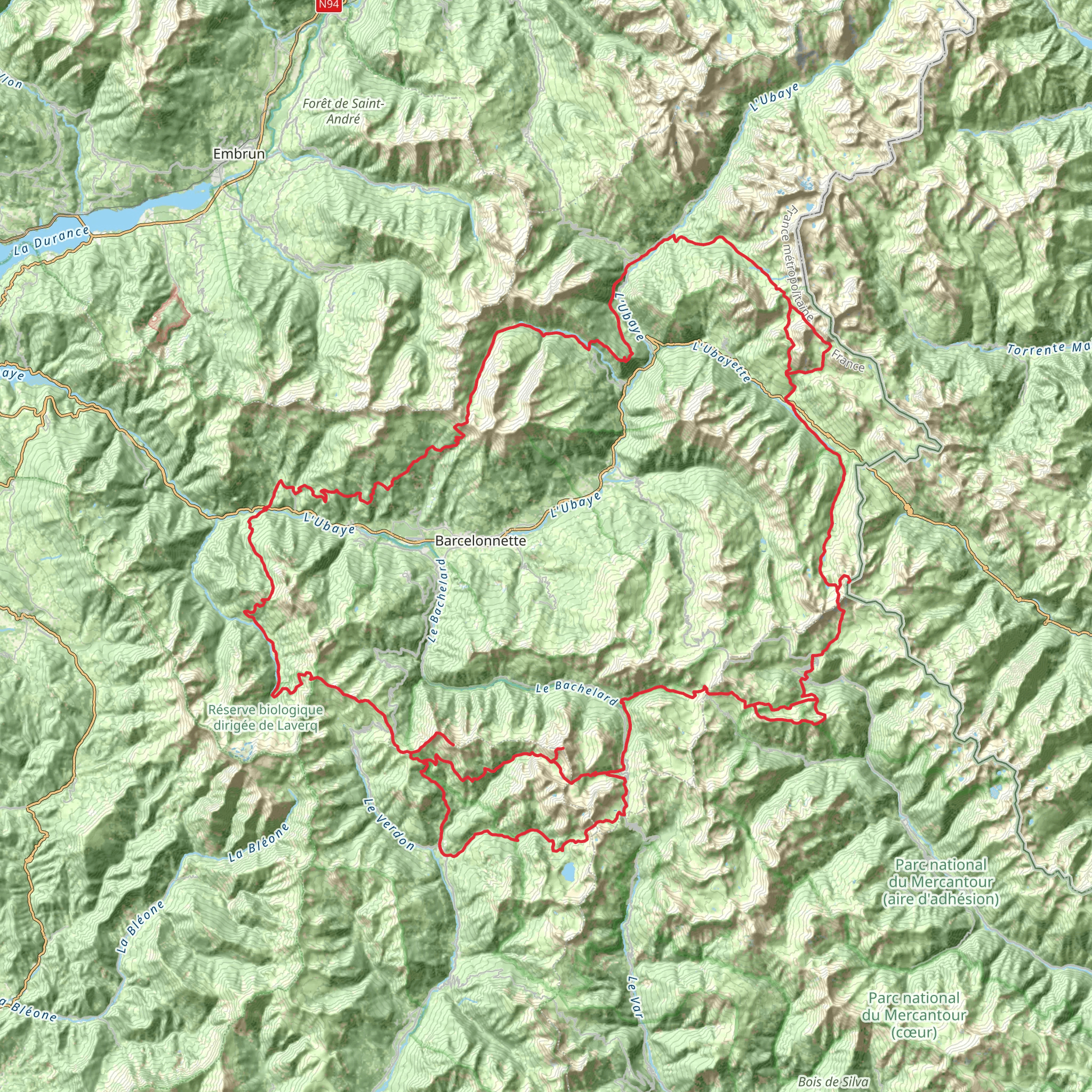
Embarking on the Ubaye Valley trail, you'll find yourself in the heart of the French Alps, surrounded by a landscape that combines rugged mountain terrain with serene alpine pastures. The trail spans approximately 154 kilometers (95.7 miles) and involves an elevation gain of around 7900 meters (25,919 feet), presenting a challenging yet rewarding experience for seasoned hikers.
Getting to the Trailhead
The adventure begins near Le Lauzet-Ubaye, a quaint village that serves as the gateway to your journey. If you're arriving by car, you can navigate to Le Lauzet-Ubaye, which is accessible via the D900 road, offering a scenic drive through the Ubaye Valley. For those relying on public transport, regional buses from larger towns such as Gap or Digne-les-Bains can drop you near the trailhead.
The Trail Experience
As you set out from the vicinity of Le Lauzet-Ubaye, the trail will lead you through a variety of terrains, from lush valleys to steep ascents. The initial phase of the hike introduces you to the lower valley, where the Ubaye River accompanies you, offering soothing sounds and sights.
Moving forward, you'll encounter the Col de Parpaillon, an old military road that reaches an altitude of 2,780 meters (9,121 feet). This historic path was once a strategic point for military transport and now stands as a testament to the region's past, providing panoramic views that are both humbling and exhilarating.
Flora and Fauna
The Ubaye Valley is a haven for wildlife enthusiasts. As you traverse different altitudes, you'll witness a diverse range of habitats. Keep an eye out for marmots whistling in the meadows, chamois navigating the rocky outcrops, and golden eagles soaring above. The trail also winds through forests of larch and pine, which give way to alpine flowers such as edelweiss and gentians in the higher reaches.
Landmarks and Points of Interest
One of the highlights of the trail is the Lac de Serre-Ponçon, a stunning artificial lake that's one of the largest in Western Europe. The lake is not only a visual spectacle but also a hub for water sports and relaxation.
As you approach the midpoint of the loop, the Mercantour National Park borders the trail to the south. This protected area offers a chance to immerse yourself in unspoiled nature, with the possibility of spotting rare wildlife such as the elusive wolf or the majestic ibex.
Navigation and Preparation
Given the trail's difficulty and length, it's crucial to be well-prepared with the right gear and sufficient provisions. Weather conditions in the Alps can change rapidly, so layered clothing and waterproof gear are essential. For navigation, HiiKER is an invaluable tool, providing detailed maps and waypoints to ensure you stay on the right path.
Historical Significance
The Ubaye Valley has been a crossroads of cultures and trade for centuries. Along the trail, you may stumble upon remnants of ancient forts and bunkers, particularly from the time of the Alpine Line—a series of fortifications built along the French Alps. These historical sites offer a glimpse into the strategic importance of the region during various conflicts.
Conclusion
In conclusion, the Ubaye Valley trail is a journey through both natural beauty and historical intrigue. It's a demanding trek that rewards the persistent hiker with breathtaking vistas, encounters with wildlife, and a deep connection to the Alpine heritage. Whether you're seeking solitude or an epic adventure, this trail promises an unforgettable experience in the French Alps.
Comments and Reviews
User comments, reviews and discussions about the Ubaye Valley, France.
4.5
average rating out of 5
8 rating(s)

