Download
Preview
Add to list
More
976.4 km
~49 days
8031 m
Multi-Day
“Embark on the Via Francigena for a scenic and historic 976-kilometer pilgrimage through France's heartlands to Italy's border.”
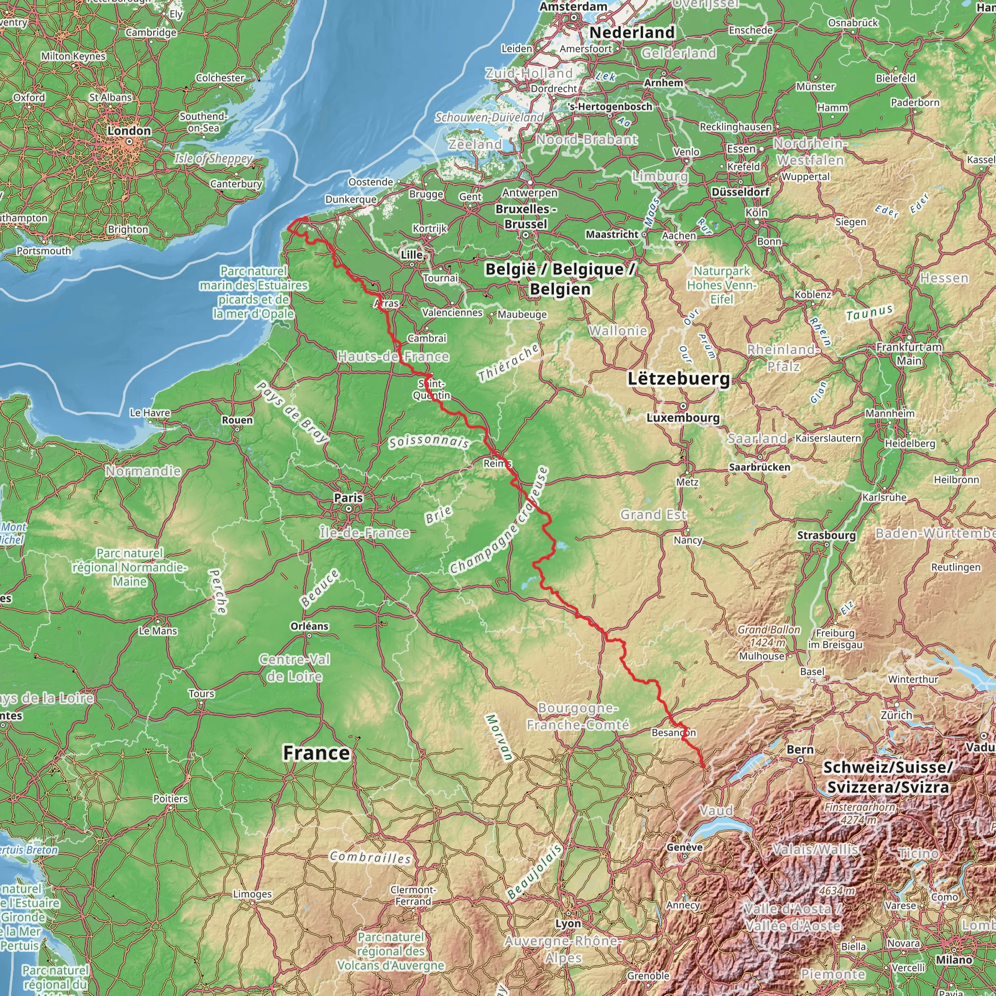
The Via Francigena in France is an ancient pilgrimage route that stretches approximately 976 kilometers (606 miles), with an elevation gain of around 8000 meters (26,247 feet). This historic trail begins near Calais, a port city in northern France, and is a point-to-point trek that takes you through some of the most picturesque regions of the country, ending at the Great St Bernard Pass on the border with Italy.
Getting to the Trailhead
To start your journey on the Via Francigena, you can reach Calais via the Eurostar train service or by ferry if you're coming from the UK. From Paris, you can take a train to Calais-Fréthun station. If you're driving, Calais is easily accessible via the A16 motorway. The trailhead is located near the Calais Town Hall, a significant landmark in the city.
Route Overview
As you embark on the Via Francigena, you'll traverse a variety of landscapes, including rolling hills, lush forests, and expansive agricultural fields. The trail is well-marked, but having the HiiKER app can be invaluable for navigation, ensuring you stay on the right path and can find nearby amenities.
Historical Significance
The Via Francigena is steeped in history, having been a major pilgrimage route to Rome since the early Middle Ages. Along the way, you'll encounter historical landmarks such as the Gothic-style Notre Dame Cathedral in Reims, a city which is approximately 293 kilometers (182 miles) from Calais. Reims is also renowned for its champagne production, so you may want to take a break and enjoy a tour of the vineyards.
Wildlife and Nature
The diverse ecosystems along the Via Francigena support a wide array of wildlife. You might spot deer, foxes, and various bird species, including birds of prey. The trail also takes you through the Champagne region, where the vineyard landscapes are a UNESCO World Heritage site.
Significant Landmarks and Towns
One of the most significant towns you'll pass through is Arras, about 108 kilometers (67 miles) from Calais. Arras is known for its beautiful Flemish-style architecture and the Wellington Quarry, a memorial of the World War I battle of Arras. Further along, at around 490 kilometers (304 miles) from Calais, you'll reach Besançon, a city with a rich history and a UNESCO-listed citadel designed by Vauban.
Terrain and Difficulty
The terrain varies from flat, easy sections to more challenging hilly areas, particularly as you approach the border with Italy. The difficulty rating is medium, but it's important to prepare for long distances and some steep climbs, especially in the latter part of the French section of the trail.
Preparation and Planning
When planning your hike, consider the time of year, as the weather can greatly affect your experience. Spring and autumn are ideal for milder temperatures. Ensure you have appropriate gear for the varied terrain and weather conditions, including good hiking boots, rain gear, and sun protection. It's also wise to book accommodations in advance, especially in the smaller towns where options may be limited.
Conclusion
The Via Francigena offers a unique blend of natural beauty, historical exploration, and cultural immersion. Whether you're a seasoned hiker or a history enthusiast, this trail provides an unforgettable experience through the heart of France.
Comments and Reviews
User comments, reviews and discussions about the Via Francigena - France, France.
4.8
average rating out of 5
5 rating(s)

