Download
Preview
Add to list
More
1915.8 km
~103 days
28745 m
Multi-Day
“Embark on the GR 36, a historical and scenic trek from Normandy's shores to the Pyrenean peaks.”
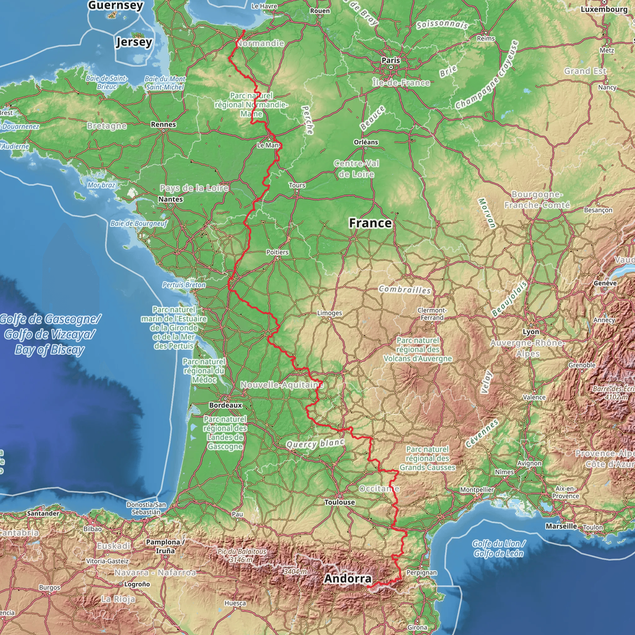
The GR 36 is a long-distance hiking path that stretches approximately 1916 kilometers (1190 miles) with an elevation gain of around 28700 meters (94200 feet), offering a medium difficulty level for seasoned hikers. This extensive trail begins near Caen, a city in the Normandy region of France, and traverses the country southward to Bourg-Madame, near the Spanish border.
Getting to the Trailhead
To reach the starting point of the GR 36 near Caen, hikers can fly into the Caen-Carpiquet Airport or travel by train to the Caen railway station from various locations in France. From the city center, local buses or taxis can take you to the trailhead. For those driving, parking is available in the vicinity of the starting point.
Trail Overview
The GR 36 offers a diverse hiking experience, passing through the lush Normandy countryside, the Loire Valley, the Massif Central, and the Pyrenees. The trail is well-marked with the characteristic red and white stripes, and hikers can use the HiiKER app for detailed navigation and planning.
Normandy to the Loire Valley
Starting near Caen, the trail meanders through the historic Normandy region, where hikers can witness the remnants of World War II and the famous D-Day landing beaches. The route continues southward, passing through picturesque villages and apple orchards, characteristic of this region.
Massif Central
As the GR 36 reaches the Massif Central, the terrain becomes more challenging with significant elevation gains. This volcanic region offers breathtaking landscapes and the opportunity to explore unique geological formations. Hikers will traverse through the Parc Naturel Régional des Volcans d'Auvergne, home to a rich variety of flora and fauna.
The Pyrenees and the Approach to Bourg-Madame
The final stretch of the GR 36 takes hikers into the Pyrenees, a rugged mountain range forming a natural border between France and Spain. This section is both physically demanding and visually rewarding, with panoramic views of the mountainous landscape. The trail concludes in the quaint town of Bourg-Madame, where hikers can reflect on their journey through some of France's most stunning and varied terrains.
Wildlife and Nature
Throughout the hike, nature enthusiasts will be delighted by the diversity of wildlife, including birds of prey, deer, and possibly even wild boar. The changing landscapes from north to south provide a habitat for a wide range of species.
Historical Significance
The GR 36 not only offers natural beauty but also a journey through France's rich history. From the Norman castles and medieval towns to the ancient volcanic landscapes of the Massif Central, hikers will walk through centuries of history.
Preparation and Planning
Given the length and varied terrain of the GR 36, hikers should prepare adequately. It's essential to carry appropriate gear for both warm and cold weather conditions, as the trail covers several climatic zones. Water sources are generally available, but carrying a water filter is advisable. Accommodations range from campsites to guesthouses, and it's recommended to book in advance during peak seasons.
For detailed planning, including waypoints, accommodations, and water sources, hikers should refer to the HiiKER app, which provides comprehensive trail information and offline maps for the GR 36.
Comments and Reviews
User comments, reviews and discussions about the GR 36, France.
4.6
average rating out of 5
5 rating(s)

