North Hill, Table Hill, Sugarloaf Hill, Perseverance Hill and British Camp Reservoir
Download
Preview
Add to list
More
13.1 km
~3 hrs 49 min
722 m
Point-to-Point
“Explore Worcestershire's scenic 13 km trail, featuring diverse terrain, historical sites, and panoramic views.”
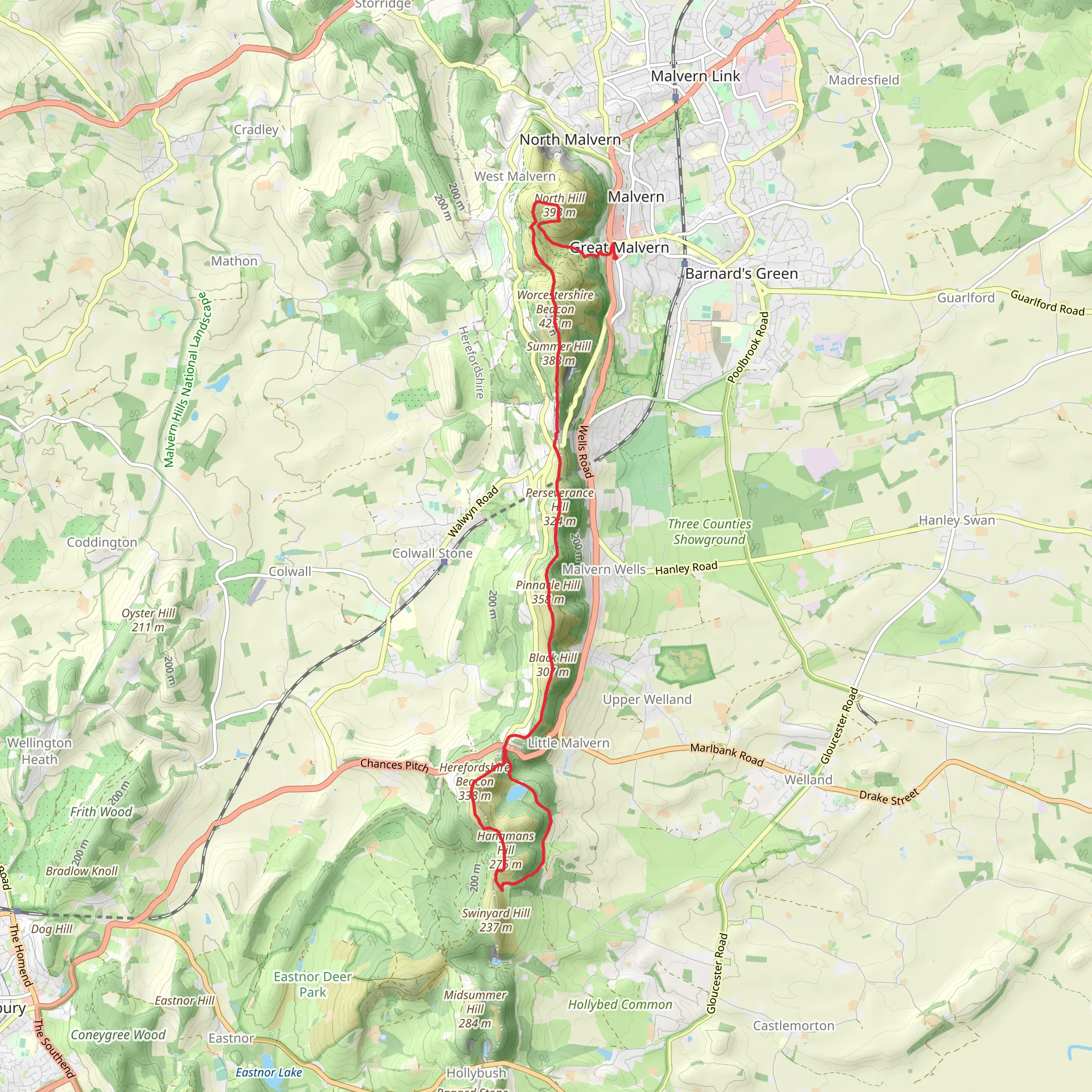
Starting near Worcestershire, England, this 13 km (approximately 8 miles) point-to-point trail offers a medium difficulty hike with an elevation gain of around 700 meters (2,300 feet). The trailhead is accessible by car or public transport, with the nearest significant landmark being the town of Great Malvern. From Great Malvern, you can take a local bus or taxi to the trailhead.
North Hill The journey begins with a climb up North Hill, which stands at 397 meters (1,302 feet). This initial ascent is steep but rewarding, offering panoramic views of the surrounding countryside. The terrain is a mix of grassy paths and rocky sections, so sturdy footwear is recommended. As you ascend, keep an eye out for wildflowers and local bird species such as skylarks and kestrels.
Table Hill After descending North Hill, you'll approach Table Hill, which is slightly lower at 373 meters (1,224 feet). The path here is less steep but still requires careful footing. The summit of Table Hill provides a great spot for a short break, with views extending towards the Malvern Hills and the Severn Valley. The area is rich in history, with ancient earthworks and remnants of old settlements visible along the way.
Sugarloaf Hill Next, you'll tackle Sugarloaf Hill, which rises to 368 meters (1,207 feet). The trail here is well-marked but can be narrow in places. Sugarloaf Hill is known for its unique geological formations, including exposed rock faces and quartz veins. The flora changes slightly, with more heather and gorse bushes dotting the landscape. This section is particularly beautiful in late summer when the heather is in full bloom.
Perseverance Hill Continuing on, Perseverance Hill stands at 326 meters (1,070 feet). The ascent is gradual, making it a bit easier on the legs. This part of the trail is less frequented, offering a more secluded experience. The hill is named for the perseverance required to reach its summit, but the effort is well worth it for the serene environment and the chance to spot deer and other wildlife.
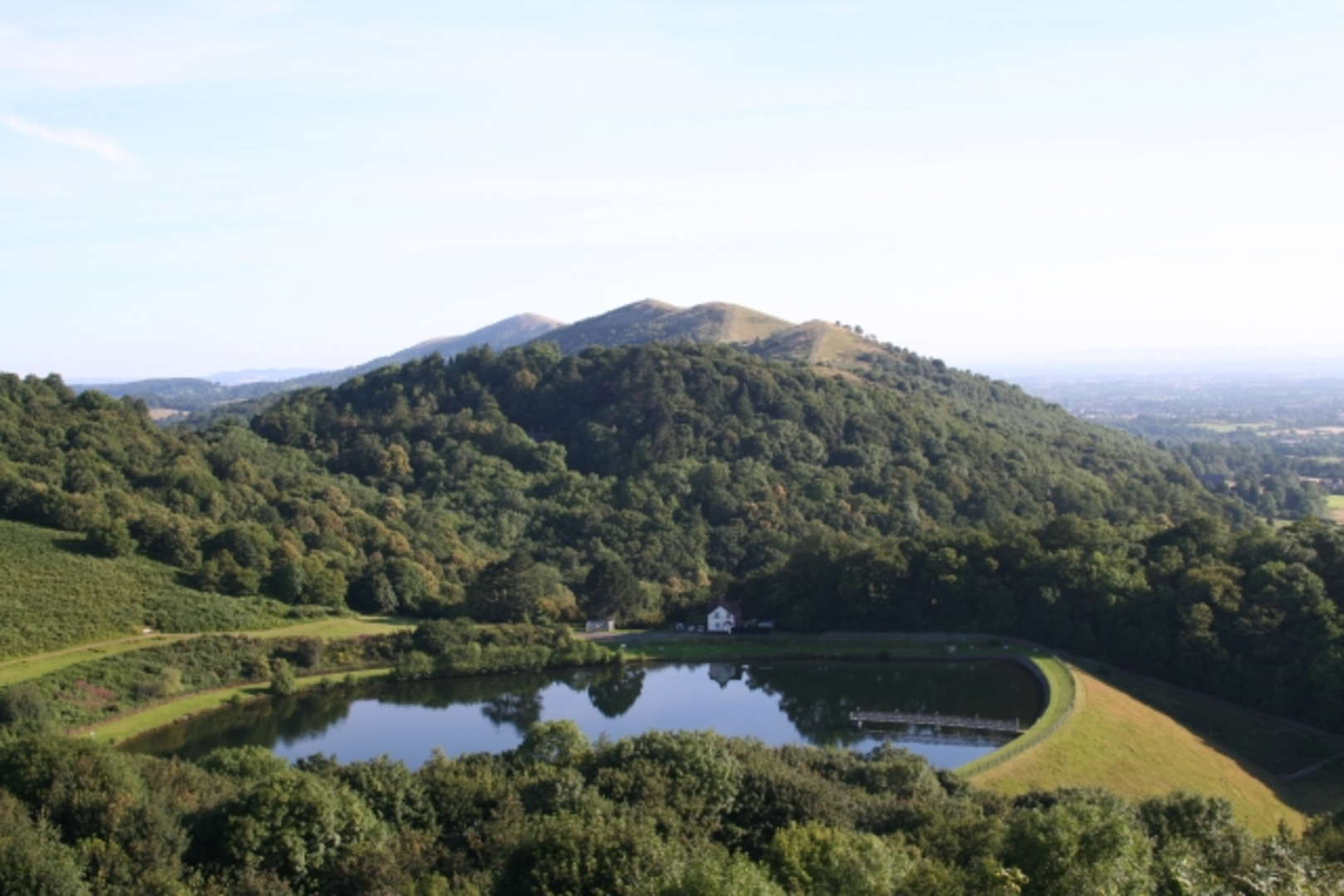
British Camp Reservoir The final leg of the hike takes you to the British Camp Reservoir. This area is steeped in history, with the nearby British Camp, an Iron Age hill fort, providing a fascinating glimpse into the past. The reservoir itself is a peaceful spot, perfect for a moment of reflection before concluding your hike. The descent towards the reservoir is gentle, allowing you to cool down and enjoy the tranquil surroundings.
Navigation and Safety For navigation, it's highly recommended to use the HiiKER app, which provides detailed maps and real-time updates. The trail is generally well-marked, but having a reliable navigation tool can help you stay on track, especially in areas where the path may be less obvious.
Getting There To reach the trailhead, you can drive to Great Malvern, where parking is available. Alternatively, take a train to Great Malvern Station and then a local bus or taxi to the starting point. The trailhead is well-signposted, making it easy to find.
This hike offers a blend of natural beauty, historical significance, and moderate physical challenge, making it a rewarding experience for those prepared to tackle its varied terrain.
What to expect?
Activity types
Comments and Reviews
User comments, reviews and discussions about the North Hill, Table Hill, Sugarloaf Hill, Perseverance Hill and British Camp Reservoir, England.
4.25
average rating out of 5
4 rating(s)
