Download
Preview
Add to list
More
21.5 km
~4 hrs 38 min
206 m
Point-to-Point
“The Alvechurch to Wootton Wawen Walk offers 21 km of scenic, historical, and moderately challenging countryside adventure.”
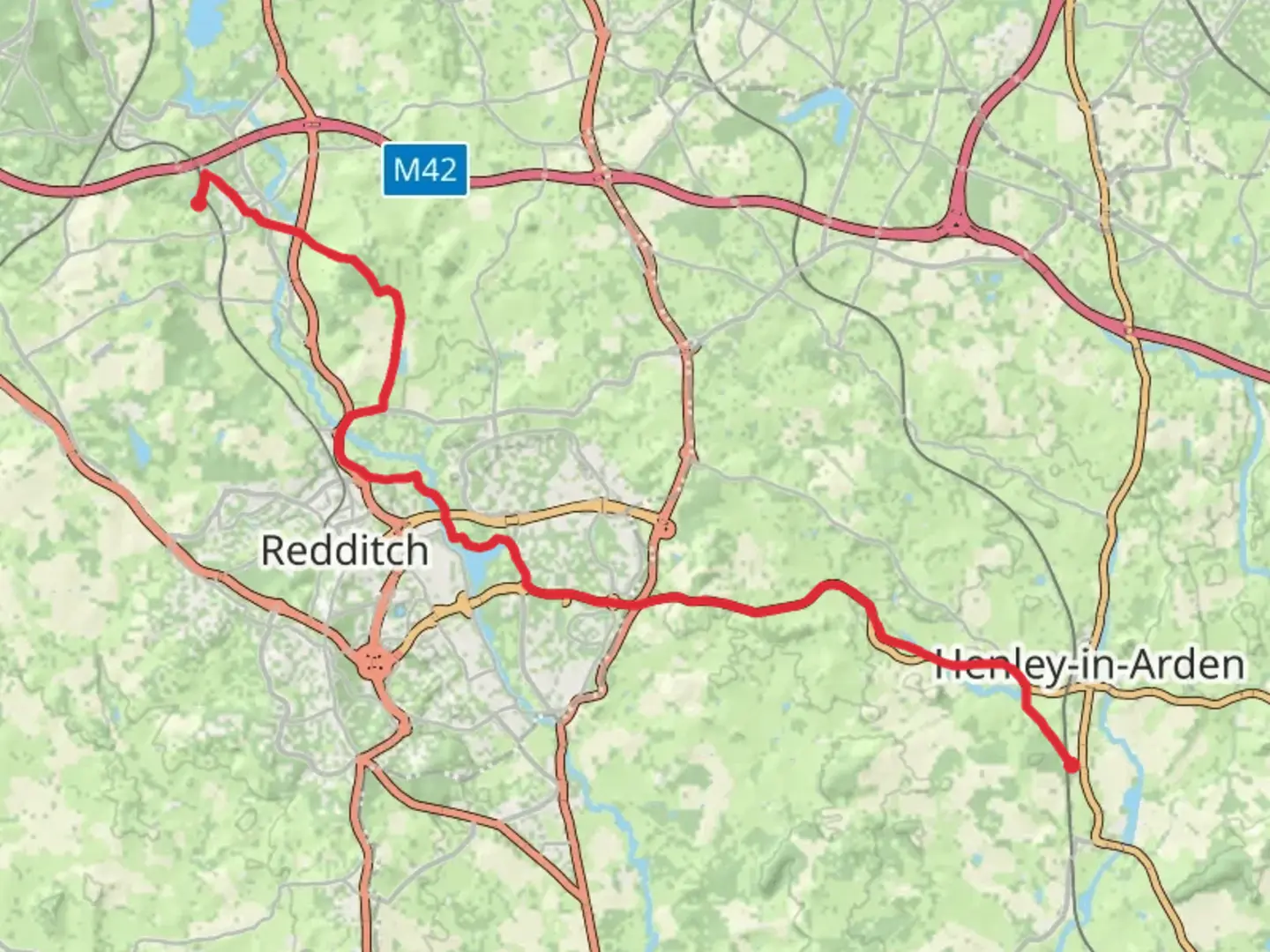
Starting near Worcestershire, England, the Alvechurch to Wootton Wawen Walk spans approximately 21 km (13 miles) with an elevation gain of around 200 meters (656 feet). This point-to-point trail is estimated to be of medium difficulty, making it suitable for moderately experienced hikers.
Getting There To reach the trailhead, you can take a train to Alvechurch Station, which is well-connected via the West Midlands Railway. If you're driving, parking is available near the station or in the village of Alvechurch itself. The trail concludes in Wootton Wawen, where you can catch a train back from Wootton Wawen Station, also serviced by the West Midlands Railway.
Trail Overview The trail begins in the charming village of Alvechurch, known for its picturesque canals and historic buildings. As you set off, you'll traverse through a mix of rural landscapes, including open fields, woodlands, and quaint villages. The initial part of the trail is relatively flat, making for a gentle start.
Key Landmarks and Sections - **Alvechurch to Rowney Green (0-5 km / 0-3 miles):** The first section takes you through the village of Rowney Green. Here, you can enjoy views of the rolling countryside and perhaps spot some local wildlife such as deer and various bird species. The elevation gain is minimal in this section, making it a pleasant walk.
- Rowney Green to Weatheroak Hill (5-10 km / 3-6 miles): As you continue, the trail gradually ascends towards Weatheroak Hill. This area is known for its panoramic views of the surrounding countryside. The climb is steady but manageable, offering a rewarding vista at the top.
- Weatheroak Hill to Henley-in-Arden (10-15 km / 6-9 miles): Descending from Weatheroak Hill, you'll pass through a series of small woodlands and open fields before reaching the historic market town of Henley-in-Arden. This town is rich in history, featuring a mile-long High Street lined with medieval and Tudor buildings. It's an excellent spot for a rest and some refreshments.
- Henley-in-Arden to Wootton Wawen (15-21 km / 9-13 miles): The final stretch takes you through more pastoral landscapes and along the Stratford-upon-Avon Canal. The canal towpath offers a flat and scenic route, making for an easy finish to your hike. Wootton Wawen is notable for its Saxon church, St. Peter's, which dates back to the 8th century.
Navigation and Safety For navigation, it's highly recommended to use the HiiKER app, which provides detailed maps and real-time updates. The trail is generally well-marked, but having a reliable navigation tool will ensure you stay on track.
Flora and Fauna Throughout the hike, you'll encounter a variety of flora, including ancient oak trees, wildflowers, and hedgerows. Wildlife is abundant, with opportunities to see rabbits, foxes, and a variety of bird species, including kestrels and woodpeckers.
Historical Significance The region is steeped in history, from the medieval architecture of Henley-in-Arden to the ancient Saxon roots of Wootton Wawen. The Stratford-upon-Avon Canal itself is a historical landmark, having been constructed in the early 19th century to facilitate trade and transport.
This trail offers a blend of natural beauty, historical intrigue, and moderate physical challenge, making it a rewarding experience for those looking to explore the English countryside.
What to expect?
Activity types
Comments and Reviews
User comments, reviews and discussions about the Alvechurch to Wootton Wawen Walk, England.
4.57
average rating out of 5
7 rating(s)
